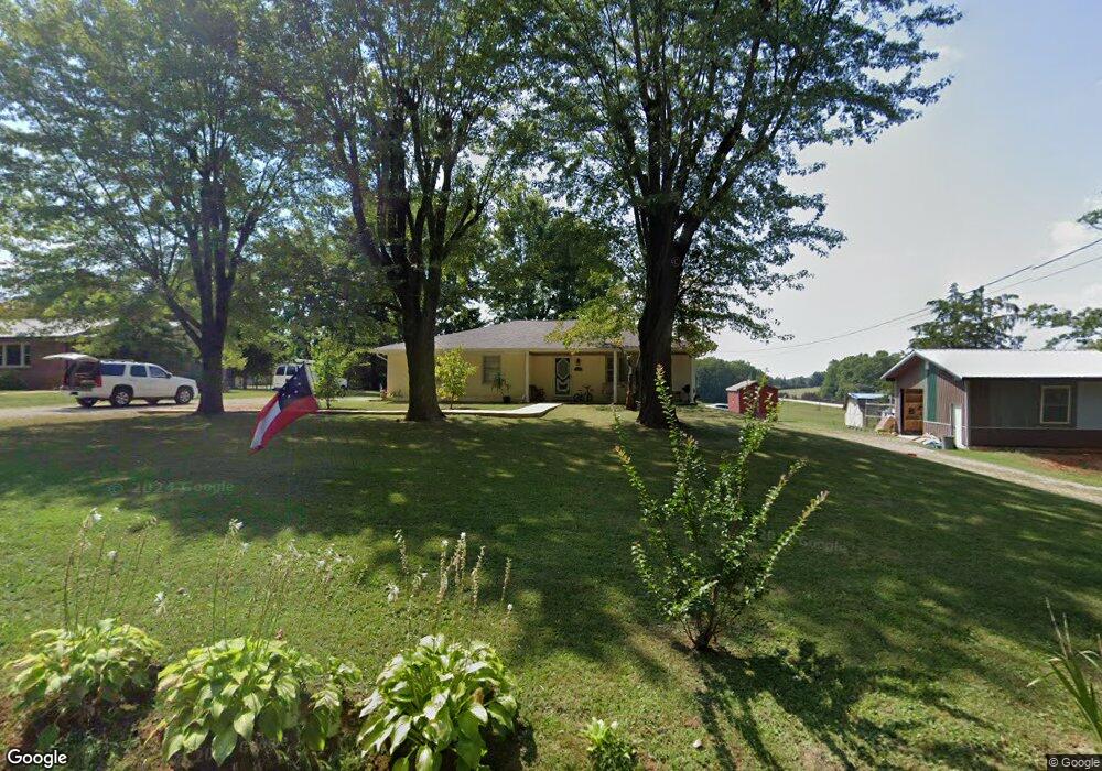
156 Frank Anderson Rd Sparta, TN 38583
Estimated Value: $215,946 - $272,000
3
Beds
2
Baths
1,728
Sq Ft
$139/Sq Ft
Est. Value
About This Home
This home is located at 156 Frank Anderson Rd, Sparta, TN 38583 and is currently estimated at $240,487, approximately $139 per square foot. 156 Frank Anderson Rd is a home located in White County with nearby schools including Cassville Elementary School, White County Middle School, and White County High School.
Ownership History
Date
Name
Owned For
Owner Type
Purchase Details
Closed on
Jun 28, 2011
Sold by
Cantrell Mary Catherine
Bought by
Keener Joseph and Keener Crystal D
Current Estimated Value
Home Financials for this Owner
Home Financials are based on the most recent Mortgage that was taken out on this home.
Original Mortgage
$73,098
Outstanding Balance
$50,313
Interest Rate
4.75%
Mortgage Type
FHA
Estimated Equity
$190,174
Purchase Details
Closed on
Jan 27, 2009
Sold by
White Edna Earl
Bought by
Cantrell Catherine
Create a Home Valuation Report for This Property
The Home Valuation Report is an in-depth analysis detailing your home's value as well as a comparison with similar homes in the area
Home Values in the Area
Average Home Value in this Area
Purchase History
| Date | Buyer | Sale Price | Title Company |
|---|---|---|---|
| Keener Joseph | $75,000 | -- | |
| Cantrell Catherine | -- | -- |
Source: Public Records
Mortgage History
| Date | Status | Borrower | Loan Amount |
|---|---|---|---|
| Open | Keener Joseph | $73,098 |
Source: Public Records
Tax History Compared to Growth
Tax History
| Year | Tax Paid | Tax Assessment Tax Assessment Total Assessment is a certain percentage of the fair market value that is determined by local assessors to be the total taxable value of land and additions on the property. | Land | Improvement |
|---|---|---|---|---|
| 2025 | $635 | $58,075 | $0 | $0 |
| 2024 | $635 | $30,975 | $3,250 | $27,725 |
| 2023 | $635 | $30,975 | $3,250 | $27,725 |
| 2022 | $635 | $30,975 | $3,250 | $27,725 |
| 2021 | $635 | $30,975 | $3,250 | $27,725 |
| 2020 | $635 | $30,975 | $3,250 | $27,725 |
| 2019 | $411 | $20,025 | $2,750 | $17,275 |
| 2018 | $411 | $20,025 | $2,750 | $17,275 |
| 2017 | $411 | $20,025 | $2,750 | $17,275 |
| 2016 | $411 | $20,025 | $2,750 | $17,275 |
| 2015 | $370 | $20,025 | $2,750 | $17,275 |
| 2014 | -- | $20,025 | $2,750 | $17,275 |
| 2013 | -- | $20,925 | $2,750 | $18,175 |
Source: Public Records
Map
Nearby Homes
- 180 Frank Anderson Rd
- 536 Frank Anderson Rd
- 8.5 Acre Frank Anderson Rd
- 0 Frank Anderson Rd
- 8.5 Acres Frank Anderson Rd
- 268 Fairview Cir
- lot 16 Old Kentucky Rd
- Lot 17 Old Kentucky Rd
- 912 Frank Anderson Rd
- 8565 Old Kentucky Rd
- 1054 Frank Anderson Rd
- 8444 Old Kentucky Rd
- 288 Westwood Dr
- 436 Westwood Dr
- 121 Hutchings College Rd
- 6311 Old Smithville Hwy S
- 0 Old Kentucky Rd
- LOT 3 Old Kentucky Rd
- 6444 Old Smithville Hwy S
- 481 Ballard Ln
- 124 Frank Anderson Rd
- 4525 Smithville Hwy
- 210 Gunnels Rd
- 4349 Smithville Hwy
- 302 Frank Anderson Rd
- 5115 Old Smithville Hwy N
- 5115 Old Smithville Hwy N
- 5189 Old Smithville Hwy N
- 5169 N Old Smithville Hwy
- 5055 Old Smithville Hwy N
- 399 Frank Anderson Rd
- 4165 Smithville Hwy
- 459 Frank Anderson Rd
- 4944 Old Smithville Hwy N
- 511 Frank Anderson Rd
- 00 Corinth Rd
- 556 Frank Anderson Rd
- 571 Frank Anderson Rd
- 237 Guhse Rd
- 290 Corinth Rd