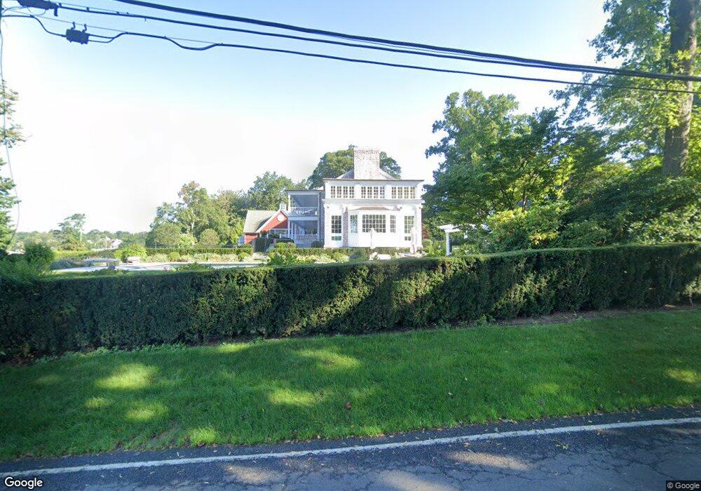
156 Pear Tree Point Rd Darien, CT 06820
Estimated Value: $4,858,000 - $6,783,263
3
Beds
6
Baths
4,578
Sq Ft
$1,289/Sq Ft
Est. Value
About This Home
This home is located at 156 Pear Tree Point Rd, Darien, CT 06820 and is currently estimated at $5,903,316, approximately $1,289 per square foot. 156 Pear Tree Point Rd is a home located in Fairfield County with nearby schools including Tokeneke Elementary School, Middlesex Middle School, and Darien High School.
Ownership History
Date
Name
Owned For
Owner Type
Purchase Details
Closed on
Sep 8, 2006
Sold by
Mccarthy Dennis T and Wood-Mccarthy Deborah
Bought by
Durkin David A and Durkin Mardi L
Current Estimated Value
Home Financials for this Owner
Home Financials are based on the most recent Mortgage that was taken out on this home.
Original Mortgage
$2,800,000
Interest Rate
6.59%
Create a Home Valuation Report for This Property
The Home Valuation Report is an in-depth analysis detailing your home's value as well as a comparison with similar homes in the area
Home Values in the Area
Average Home Value in this Area
Purchase History
| Date | Buyer | Sale Price | Title Company |
|---|---|---|---|
| Durkin David A | $3,800,000 | -- |
Source: Public Records
Mortgage History
| Date | Status | Borrower | Loan Amount |
|---|---|---|---|
| Open | Durkin David A | $2,800,000 | |
| Closed | Durkin David A | $100,000 | |
| Closed | Durkin David A | $2,800,000 |
Source: Public Records
Tax History
| Year | Tax Paid | Tax Assessment Tax Assessment Total Assessment is a certain percentage of the fair market value that is determined by local assessors to be the total taxable value of land and additions on the property. | Land | Improvement |
|---|---|---|---|---|
| 2025 | $62,965 | $4,067,490 | $2,095,240 | $1,972,250 |
| 2024 | $59,751 | $4,067,490 | $2,095,240 | $1,972,250 |
| 2023 | $62,424 | $3,544,800 | $1,846,600 | $1,698,200 |
| 2022 | $61,077 | $3,544,800 | $1,846,600 | $1,698,200 |
| 2021 | $216 | $3,544,800 | $1,846,600 | $1,698,200 |
| 2020 | $222 | $3,544,800 | $1,846,600 | $1,698,200 |
| 2019 | $58,383 | $3,544,800 | $1,846,600 | $1,698,200 |
| 2018 | $236 | $3,074,610 | $1,495,760 | $1,578,850 |
| 2017 | $5,497 | $3,074,610 | $1,495,760 | $1,578,850 |
| 2016 | $48,487 | $3,074,610 | $1,495,760 | $1,578,850 |
| 2015 | $47,195 | $3,074,610 | $1,495,760 | $1,578,850 |
| 2014 | $45,859 | $3,055,220 | $1,495,760 | $1,559,460 |
Source: Public Records
Map
Nearby Homes
- 18 Pasture Ln
- 23 Beach Dr
- 3 Salt Box Ln E
- 33 Dora St
- 950 Cove Rd Unit B6
- 86 Wallacks Dr
- 254 Seaside Ave Unit A
- 85 Avery St
- 55 Avery St
- 32 Relihan Rd
- 209 Seaside Ave Unit 2
- 105 Houston Terrace
- 74 Palmer Ave
- 104 Sylvan Knoll Rd
- 114 Sylvan Knoll Rd
- 163 Sylvan Knoll Rd
- 697 Cove Rd Unit 1B
- 697 Cove Rd Unit 2A
- 171 Sylvan Knoll Rd
- 274 Sylvan Knoll Rd
- 150 Pear Tree Point Rd
- 166 Pear Tree Point Rd
- 155 Pear Tree Point Rd
- 159 Pear Tree Point Rd
- 171 Pear Tree Point Rd
- 170 Pear Tree Point Rd
- 17 Crane Rd
- 136 Pear Tree Point Rd
- 180 Pear Tree Point Rd
- 163 Pear Tree Point Rd
- 15 Crane Rd
- 18 Crane Rd
- 158 Long Neck Point Rd
- 124 Pear Tree Point Rd
- 140 Long Neck Point Rd
- 14 Crane Rd
- 9 Crane Rd
- 130 Long Neck Point Rd
- 160 Long Neck Point Rd
- 172 Long Neck Point Rd
Your Personal Tour Guide
Ask me questions while you tour the home.