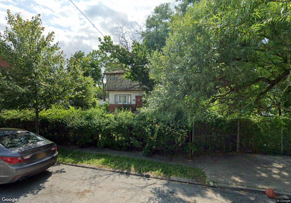
156 Roosevelt Ave Staten Island, NY 10314
Willowbrook NeighborhoodEstimated Value: $759,000 - $860,000
--
Bed
4
Baths
1,664
Sq Ft
$485/Sq Ft
Est. Value
About This Home
This home is located at 156 Roosevelt Ave, Staten Island, NY 10314 and is currently estimated at $806,860, approximately $484 per square foot. 156 Roosevelt Ave is a home located in Richmond County with nearby schools including P.S. 54 Charles W Leng, Is 72 Rocco Laurie, and Susan E Wagner High School.
Ownership History
Date
Name
Owned For
Owner Type
Purchase Details
Closed on
Mar 29, 2017
Sold by
Maccarone Marie and Maccaroni Marie
Bought by
Mancino Mark
Current Estimated Value
Home Financials for this Owner
Home Financials are based on the most recent Mortgage that was taken out on this home.
Original Mortgage
$343,660
Outstanding Balance
$287,220
Interest Rate
4.37%
Mortgage Type
FHA
Estimated Equity
$519,640
Create a Home Valuation Report for This Property
The Home Valuation Report is an in-depth analysis detailing your home's value as well as a comparison with similar homes in the area
Home Values in the Area
Average Home Value in this Area
Purchase History
| Date | Buyer | Sale Price | Title Company |
|---|---|---|---|
| Mancino Mark | $350,000 | None Available |
Source: Public Records
Mortgage History
| Date | Status | Borrower | Loan Amount |
|---|---|---|---|
| Open | Mancino Mark | $343,660 |
Source: Public Records
Tax History Compared to Growth
Tax History
| Year | Tax Paid | Tax Assessment Tax Assessment Total Assessment is a certain percentage of the fair market value that is determined by local assessors to be the total taxable value of land and additions on the property. | Land | Improvement |
|---|---|---|---|---|
| 2025 | $6,562 | $53,880 | $8,394 | $45,486 |
| 2024 | $1,562 | $47,100 | $9,530 | $37,570 |
| 2023 | $1,259 | $30,821 | $9,037 | $21,784 |
| 2022 | $5,805 | $43,860 | $13,740 | $30,120 |
| 2021 | $5,773 | $36,300 | $13,740 | $22,560 |
| 2020 | $5,807 | $31,320 | $13,740 | $17,580 |
| 2019 | $5,695 | $33,960 | $13,740 | $20,220 |
| 2018 | $5,236 | $25,684 | $13,552 | $12,132 |
| 2017 | $4,640 | $24,231 | $12,845 | $11,386 |
| 2016 | $3,970 | $22,860 | $13,740 | $9,120 |
| 2015 | $3,923 | $24,894 | $10,981 | $13,913 |
| 2014 | $3,923 | $23,486 | $10,360 | $13,126 |
Source: Public Records
Map
Nearby Homes
- 148 Roosevelt Ave
- 546 Buchanan Ave Unit B
- 566 Buchanan Ave Unit B
- 5 Birchard Ave
- 371 Bradley Ave
- 114 Sunset Ave
- 33 Bradley Ct Unit A
- 50 Bradley Ct Unit 52
- 17 Bradley Ct Unit A
- 236 Queen St
- 15 Soren St
- 153 Graves St
- 240 Harold St
- 51 Livingston Ave
- 0 Roosevelt Ave
- 243 Wellbrook Ave
- 619 Ingram Ave
- 198 Warwick Ave
- 380 Gansevoort Blvd
- 165 Warwick Ave
- 146 Roosevelt Ave
- 144 Roosevelt Ave
- 142 Roosevelt Ave
- 533 Buchanan Ave
- 140 Roosevelt Ave
- 160 Roosevelt Ave
- 535 Buchanan Ave
- 525 Buchanan Ave
- 537 Buchanan Ave
- 138 Roosevelt Ave
- 162 Roosevelt Ave
- 541 Buchanan Ave
- 136 Roosevelt Ave
- 519 Buchanan Ave
- 151 Roosevelt Ave
- 164 Roosevelt Ave
- 134 Roosevelt Ave
- 145 Roosevelt Ave
- 159 Roosevelt Ave
- 143 Roosevelt Ave