
Seller's Agent in 2025
Kimberly Rosado
Keller Williams Allentown
(484) 357-9284
18 in this area
375 Total Sales
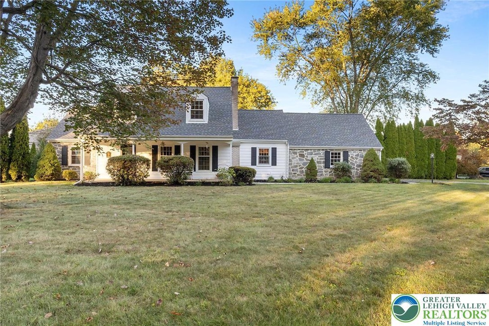
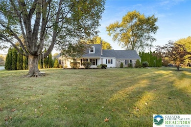
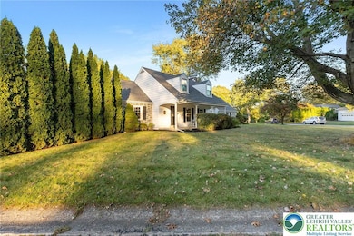
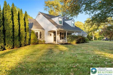
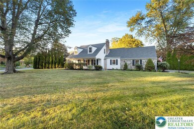
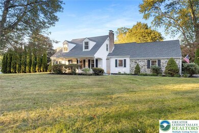
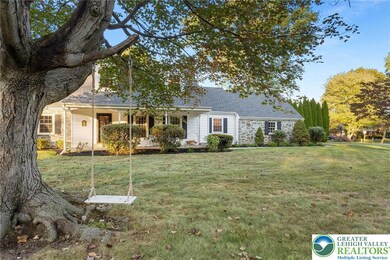
Please submit best and final offer offers by Monday 10/13 at 5pm. Welcome to this picture-perfect Cape Cod in the highly desired Stafore Estates, ideally situated on a prominent corner lot! From the moment you arrive, the charm of the covered front porch invites you to step inside and feel right at home. Gleaming hardwood floors run throughout the home, adding warmth & character to every room. A cozy peekaboo wood-burning fireplace provides the perfect focal point for relaxing evenings or gatherings with loved ones! This home seamlessly combines the timeless character of Cape Cod with the convenience of ranch-style living. The spacious primary suite is located on the first floor, offering a comfortable retreat with easy access to the main living areas. The thoughtfully designed floor plan features a total of 4 bedrooms and 2.5 baths, providing plenty of room for family & guests! The kitchen is bright & welcoming with/ stainless steel appliances, ample cabinetry, & a delightful breakfast nook where you can enjoy your morning coffee. Upstairs, you’ll find three additional bedrooms that offer flexibility, a home office, or a guest space! With a 2-car garage, a big back yard, & a convenient location... This is truly the home that has it ALL!! With its stunning curb appeal, sought-after location, and balance of character and practicality, this home is a true gem.
Last Agent to Sell the Property
Keller Williams Allentown License #RS316767 Listed on: 10/03/2025
| Date | Type | Sale Price | Title Company |
|---|---|---|---|
| Deed | $524,000 | First United Land Transfer | |
| Warranty Deed | $300,000 | -- |
| Date | Status | Loan Amount | Loan Type |
|---|---|---|---|
| Open | $456,000 | New Conventional | |
| Previous Owner | $340,000 | New Conventional |
| Date | Event | Price | List to Sale | Price per Sq Ft |
|---|---|---|---|---|
| 11/14/2025 11/14/25 | Sold | $524,000 | +8.0% | $226 / Sq Ft |
| 10/14/2025 10/14/25 | Pending | -- | -- | -- |
| 10/08/2025 10/08/25 | For Sale | $485,000 | -- | $209 / Sq Ft |
| Year | Tax Paid | Tax Assessment Tax Assessment Total Assessment is a certain percentage of the fair market value that is determined by local assessors to be the total taxable value of land and additions on the property. | Land | Improvement |
|---|---|---|---|---|
| 2025 | $833 | $77,100 | $21,500 | $55,600 |
| 2024 | $5,621 | $77,100 | $21,500 | $55,600 |
| 2023 | $5,640 | $77,100 | $21,500 | $55,600 |
| 2022 | $5,587 | $77,100 | $21,500 | $55,600 |
| 2021 | $5,541 | $77,100 | $21,500 | $55,600 |
| 2020 | $5,548 | $77,100 | $21,500 | $55,600 |
| 2019 | $5,526 | $77,100 | $21,500 | $55,600 |
| 2018 | $5,416 | $77,100 | $21,500 | $55,600 |
| 2017 | $5,378 | $77,100 | $21,500 | $55,600 |
| 2016 | -- | $77,100 | $21,500 | $55,600 |
| 2015 | -- | $77,100 | $21,500 | $55,600 |
| 2014 | -- | $77,100 | $21,500 | $55,600 |
Seller's Agent in 2025
Kimberly Rosado
Keller Williams Allentown
(484) 357-9284
18 in this area
375 Total Sales
F
Buyer's Agent in 2025
Fred Longernecker
Keller Williams Northampton
(610) 360-4002
4 in this area
30 Total Sales
Source: Greater Lehigh Valley REALTORS®
MLS Number: 765234
APN: M6SW1 2 1 0214
Disclaimer: Certain information contained herein is derived from information provided by parties other than Homes.com. All information provided is deemed reliable, but is not guaranteed to be accurate and should be independently verified.
![]() IDX information is provided exclusively for personal, non-commercial use, and may not be used for any purpose other than to identify prospective properties consumers may be interested in purchasing.
IDX information is provided exclusively for personal, non-commercial use, and may not be used for any purpose other than to identify prospective properties consumers may be interested in purchasing.
Information is deemed reliable but not guaranteed.