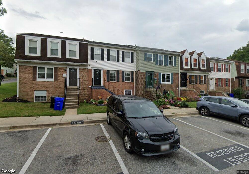
15604 Plaid Dr Laurel, MD 20707
Estimated Value: $335,000 - $367,000
Studio
4
Baths
1,320
Sq Ft
$265/Sq Ft
Est. Value
About This Home
This home is located at 15604 Plaid Dr, Laurel, MD 20707 and is currently estimated at $349,497, approximately $264 per square foot. 15604 Plaid Dr is a home located in Prince George's County with nearby schools including Scotchtown Hills Elementary School, Dwight D. Eisenhower Middle School, and Laurel High School.
Ownership History
Date
Name
Owned For
Owner Type
Purchase Details
Closed on
Feb 14, 2005
Sold by
Lepore James E
Bought by
Lepore James E
Current Estimated Value
Home Financials for this Owner
Home Financials are based on the most recent Mortgage that was taken out on this home.
Original Mortgage
$137,200
Outstanding Balance
$69,461
Interest Rate
5.69%
Mortgage Type
New Conventional
Estimated Equity
$280,036
Purchase Details
Closed on
Aug 3, 1983
Sold by
Plaid & Scotch Inc
Bought by
Lepore James E and Jo Ann Hyatt
Create a Home Valuation Report for This Property
The Home Valuation Report is an in-depth analysis detailing your home's value as well as a comparison with similar homes in the area
Home Values in the Area
Average Home Value in this Area
Purchase History
| Date | Buyer | Sale Price | Title Company |
|---|---|---|---|
| Lepore James E | -- | -- | |
| Lepore James E | $71,300 | -- |
Source: Public Records
Mortgage History
| Date | Status | Borrower | Loan Amount |
|---|---|---|---|
| Open | Lepore James E | $137,200 |
Source: Public Records
Tax History
| Year | Tax Paid | Tax Assessment Tax Assessment Total Assessment is a certain percentage of the fair market value that is determined by local assessors to be the total taxable value of land and additions on the property. | Land | Improvement |
|---|---|---|---|---|
| 2025 | $5,684 | $323,300 | $90,000 | $233,300 |
| 2024 | $5,684 | $306,000 | -- | -- |
| 2023 | $5,333 | $288,700 | $0 | $0 |
| 2022 | $4,475 | $271,400 | $75,000 | $196,400 |
| 2021 | $4,624 | $256,733 | $0 | $0 |
| 2020 | $8,820 | $242,067 | $0 | $0 |
| 2019 | $4,154 | $227,400 | $75,000 | $152,400 |
| 2018 | $3,890 | $212,467 | $0 | $0 |
| 2017 | $4,179 | $197,533 | $0 | $0 |
| 2016 | -- | $182,600 | $0 | $0 |
| 2015 | $2,959 | $176,367 | $0 | $0 |
| 2014 | $2,959 | $170,133 | $0 | $0 |
Source: Public Records
Map
Nearby Homes
- 6918 Scotch Dr
- 7004 Fitzpatrick Dr
- 7019 Fitzpatrick Dr
- 7019 Redmiles Rd
- 15708 Dorset Rd Unit 203
- 15708 Dorset Rd Unit 202
- 7018 Redmiles Rd
- 15706 Dorset Rd Unit 102
- 15603 Dorset Rd Unit 101
- 16140 Kenny Rd
- 7616 Woodbine Dr
- 15743 Millbrook Ln
- 15046 Cherrywood Dr
- 7106 Donston Dr
- 15020 Cherrywood Dr
- 7651 E Arbory Ct
- 7646 S Arbory Ln
- 14717 Exbury Ln
- 6406 Sandy St
- 7631 S Arbory Ln