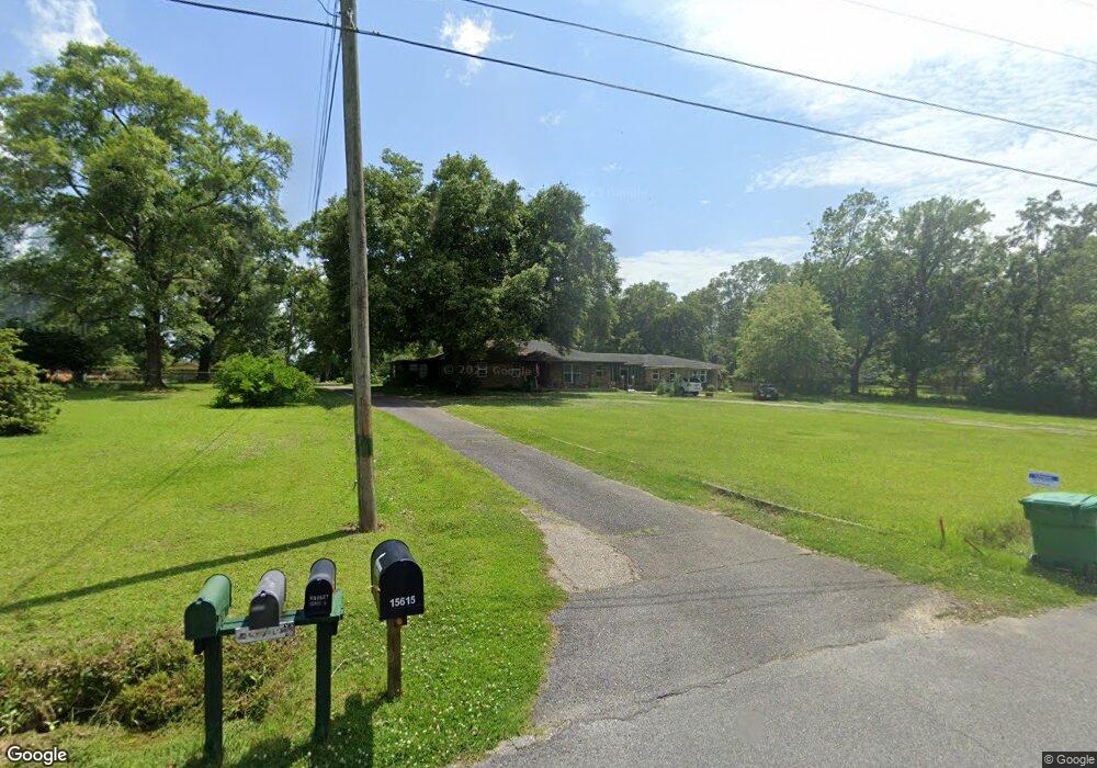
15609 Stanley Rd Unit A Vancleave, MS 39565
Estimated Value: $240,000 - $347,000
3
Beds
3
Baths
1,650
Sq Ft
$173/Sq Ft
Est. Value
About This Home
This home is located at 15609 Stanley Rd Unit A, Vancleave, MS 39565 and is currently estimated at $284,843, approximately $172 per square foot. 15609 Stanley Rd Unit A is a home located in Jackson County with nearby schools including St Martin East Elementary School, St Martin North Elementary School, and St Martin Upper Elementary School.
Ownership History
Date
Name
Owned For
Owner Type
Purchase Details
Closed on
Mar 12, 2021
Sold by
Bailey Christopher R
Bought by
Uram George A and Uram Elaine C
Current Estimated Value
Home Financials for this Owner
Home Financials are based on the most recent Mortgage that was taken out on this home.
Original Mortgage
$157,472
Outstanding Balance
$141,234
Interest Rate
2.73%
Mortgage Type
VA
Estimated Equity
$143,609
Purchase Details
Closed on
Dec 12, 2017
Sold by
Baker Alvin M and Baker Anna M
Bought by
Bailey Christopher R
Home Financials for this Owner
Home Financials are based on the most recent Mortgage that was taken out on this home.
Original Mortgage
$93,450
Interest Rate
3.95%
Mortgage Type
New Conventional
Create a Home Valuation Report for This Property
The Home Valuation Report is an in-depth analysis detailing your home's value as well as a comparison with similar homes in the area
Home Values in the Area
Average Home Value in this Area
Purchase History
| Date | Buyer | Sale Price | Title Company |
|---|---|---|---|
| Uram George A | -- | None Available | |
| Bailey Christopher R | $27,000 | None Available |
Source: Public Records
Mortgage History
| Date | Status | Borrower | Loan Amount |
|---|---|---|---|
| Open | Uram George A | $157,472 | |
| Previous Owner | Bailey Christopher R | $93,450 |
Source: Public Records
Tax History Compared to Growth
Tax History
| Year | Tax Paid | Tax Assessment Tax Assessment Total Assessment is a certain percentage of the fair market value that is determined by local assessors to be the total taxable value of land and additions on the property. | Land | Improvement |
|---|---|---|---|---|
| 2024 | $2,096 | $19,959 | $2,573 | $17,386 |
| 2023 | $2,096 | $18,540 | $2,339 | $16,201 |
| 2022 | $1,863 | $18,540 | $2,339 | $16,201 |
| 2021 | $3,295 | $28,262 | $3,509 | $24,753 |
| 2020 | $2,731 | $22,606 | $2,699 | $19,907 |
| 2019 | $2,701 | $22,606 | $2,699 | $19,907 |
| 2018 | $2,754 | $22,606 | $2,699 | $19,907 |
| 2017 | $2,800 | $22,606 | $2,699 | $19,907 |
| 2016 | $2,689 | $22,606 | $2,699 | $19,907 |
| 2015 | $2,430 | $135,460 | $14,710 | $120,750 |
| 2014 | $2,387 | $20,320 | $2,207 | $18,113 |
| 2013 | $2,368 | $20,851 | $2,207 | $18,644 |
Source: Public Records
Map
Nearby Homes
- 15655 Krohn Rd
- 3419 Stephen Earl Dr
- 0 Wescovich Rd
- 0 Rivers Pointe Dr Unit 4114604
- 0 Rivers Pointe Rd Unit 4114609
- 3554 Rivers Point Rd
- 0 Joe Batt Rd
- 14342 Oak View Cir
- 14920 Pine Blvd
- 15469 Dobson Rd
- 0 Dobson Rd Unit 4114623
- 15021 Dobson Rd
- 15320 Old Highway 15
- 15712 Poydras Cir
- 4155 Tux River Cir
- 13809 Briarwood Dr
- 0 Larue Rd Unit 4090289
- 0 Dantzler Rd
- 15566 Mississippi 15
- 17321 Avondale Cir Unit 1
- 15609 Stanley Rd
- 15613 Stanley Rd
- 15607 Stanley Rd
- 15615 Stanley Rd
- 15601 Stanley Rd
- 15701 Stanley Rd
- 15701 Stanley Rd
- 15600 Stanley Rd
- 15704 Cruthirds Rd
- 15515 Stanley Rd
- 15608 Stanley Rd
- 15512 Stanley Rd
- 0 Stanley Rd
- 15511 Stanley Rd
- 15801 Allie Byrd Rd
- 15809 Allie Byrd Rd
- 15504 Stanley Rd
- 15500 Cruthirds Rd
- 15500 Stanley Rd
- 15626 Cruthirds Rd
