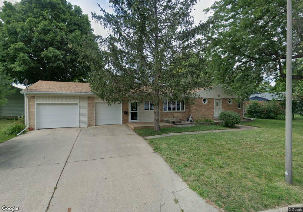
1561 Maplecrest Dr Estherville, IA 51334
Estimated Value: $207,050 - $270,000
2
Beds
2
Baths
1,601
Sq Ft
$145/Sq Ft
Est. Value
About This Home
This home is located at 1561 Maplecrest Dr, Estherville, IA 51334 and is currently estimated at $232,263, approximately $145 per square foot. 1561 Maplecrest Dr is a home located in Emmet County with nearby schools including Estherville Lincoln Central Middle School, Estherville Lincoln Central High School, and Estherville Community Christian School.
Ownership History
Date
Name
Owned For
Owner Type
Purchase Details
Closed on
May 13, 2016
Sold by
Perea Alex E and Perea Janet E
Bought by
Olson Norris X and Olson Donna G
Current Estimated Value
Home Financials for this Owner
Home Financials are based on the most recent Mortgage that was taken out on this home.
Original Mortgage
$50,000
Outstanding Balance
$30,846
Interest Rate
3.59%
Mortgage Type
New Conventional
Estimated Equity
$201,417
Purchase Details
Closed on
Aug 19, 2005
Sold by
Rushing Trish
Bought by
Perea Alex E and Perea Janet E
Purchase Details
Closed on
May 23, 2005
Sold by
Jenison John R and Jenison Katherine M
Bought by
Grsw Real Estate Trust
Create a Home Valuation Report for This Property
The Home Valuation Report is an in-depth analysis detailing your home's value as well as a comparison with similar homes in the area
Home Values in the Area
Average Home Value in this Area
Purchase History
| Date | Buyer | Sale Price | Title Company |
|---|---|---|---|
| Olson Norris X | $159,000 | None Available | |
| Perea Alex E | $108,500 | None Available | |
| Grsw Real Estate Trust | $108,500 | None Available |
Source: Public Records
Mortgage History
| Date | Status | Borrower | Loan Amount |
|---|---|---|---|
| Open | Olson Norris X | $50,000 |
Source: Public Records
Tax History Compared to Growth
Tax History
| Year | Tax Paid | Tax Assessment Tax Assessment Total Assessment is a certain percentage of the fair market value that is determined by local assessors to be the total taxable value of land and additions on the property. | Land | Improvement |
|---|---|---|---|---|
| 2025 | $3,042 | $213,600 | $27,600 | $186,000 |
| 2024 | $3,042 | $192,000 | $27,600 | $164,400 |
| 2023 | $3,326 | $192,000 | $27,600 | $164,400 |
| 2022 | $3,212 | $157,800 | $27,600 | $130,200 |
| 2021 | $3,212 | $157,800 | $27,600 | $130,200 |
| 2020 | $3,056 | $145,000 | $25,100 | $119,900 |
| 2019 | $3,424 | $157,300 | $0 | $0 |
| 2018 | $3,408 | $157,300 | $0 | $0 |
| 2017 | $3,408 | $119,300 | $0 | $0 |
| 2016 | $2,550 | $119,300 | $0 | $0 |
| 2015 | $2,550 | $113,600 | $0 | $0 |
| 2014 | $2,428 | $113,600 | $0 | $0 |
Source: Public Records
Map
Nearby Homes
- 1555 Maplecrest Dr
- 1547 Maplecrest Dr
- 1568 Maplecrest Dr
- 1580 Maplecrest Dr
- 1627 Maplecrest Dr
- 1539 Maplecrest Dr
- 1554 Maplecrest Dr
- 1548 Maplecrest Dr
- 1633 Maplecrest Dr
- 1602 Maplecrest Dr
- 1560 Maplecrest Dr
- 1542 Maplecrest Dr
- 1536 Maplecrest Dr
- 1608 Maplecrest Dr
- 1639 Maplecrest Dr
- 5 Maple Heights Dr
- 9 Maple Heights Dr
- 1564 Maplecrest Dr
- 1620 Maplecrest Dr
- 1628 Maplecrest Dr