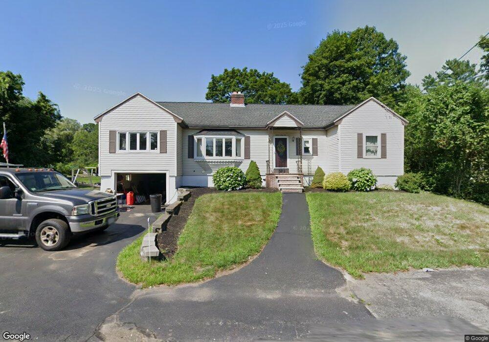
1562 Bridge St Dracut, MA 01826
Estimated Value: $535,088 - $596,000
3
Beds
1
Bath
1,580
Sq Ft
$356/Sq Ft
Est. Value
About This Home
This home is located at 1562 Bridge St, Dracut, MA 01826 and is currently estimated at $562,272, approximately $355 per square foot. 1562 Bridge St is a home located in Middlesex County with nearby schools including Greenmont Avenue School, Richardson Middle School, and Dracut Senior High School.
Ownership History
Date
Name
Owned For
Owner Type
Purchase Details
Closed on
Oct 21, 2009
Sold by
L John
Bought by
Berman Melissa G
Current Estimated Value
Purchase Details
Closed on
Dec 15, 2000
Sold by
Berman Melissa G
Bought by
Hudon Gregory C and Taylor Kery Ann
Home Financials for this Owner
Home Financials are based on the most recent Mortgage that was taken out on this home.
Original Mortgage
$173,825
Interest Rate
7.7%
Mortgage Type
Purchase Money Mortgage
Create a Home Valuation Report for This Property
The Home Valuation Report is an in-depth analysis detailing your home's value as well as a comparison with similar homes in the area
Home Values in the Area
Average Home Value in this Area
Purchase History
| Date | Buyer | Sale Price | Title Company |
|---|---|---|---|
| Berman Melissa G | -- | -- | |
| Hudon Gregory C | $200,000 | -- |
Source: Public Records
Mortgage History
| Date | Status | Borrower | Loan Amount |
|---|---|---|---|
| Previous Owner | Hudon Gregory C | $183,500 | |
| Previous Owner | Hudon Gregory C | $184,500 | |
| Previous Owner | Hudon Gregory C | $173,825 |
Source: Public Records
Tax History
| Year | Tax Paid | Tax Assessment Tax Assessment Total Assessment is a certain percentage of the fair market value that is determined by local assessors to be the total taxable value of land and additions on the property. | Land | Improvement |
|---|---|---|---|---|
| 2025 | $5,005 | $494,600 | $180,400 | $314,200 |
| 2024 | $5,001 | $478,600 | $171,800 | $306,800 |
| 2023 | $4,780 | $412,800 | $149,300 | $263,500 |
| 2022 | $4,917 | $400,100 | $135,700 | $264,400 |
| 2021 | $5,585 | $364,600 | $123,300 | $241,300 |
| 2020 | $5,412 | $339,300 | $119,600 | $219,700 |
| 2019 | $4,397 | $319,800 | $113,900 | $205,900 |
| 2018 | $4,047 | $286,200 | $113,900 | $172,300 |
| 2017 | $3,883 | $286,200 | $113,900 | $172,300 |
| 2016 | $3,706 | $249,700 | $109,500 | $140,200 |
| 2015 | $3,568 | $239,000 | $109,500 | $129,500 |
| 2014 | $3,308 | $228,300 | $109,500 | $118,800 |
Source: Public Records
Map
Nearby Homes
- 1573 Bridge St
- 1563 Bridge St
- 26 Frank St
- 23 Frank St Unit 2
- 54 Montaup Ave
- 1391 Bridge St
- 69 Arlington St
- 287 Fox Ave
- 551 Hildreth St Unit 10
- 40 Arlington Ave
- 19 Esther Way Unit Lot 10
- 175 Willard St Unit 9
- 315 Broadway Rd Unit 1
- 315 Broadway Rd Unit 7
- 417 Hildreth St Unit 30
- 700 Robbins Ave Unit 6
- 367 Hildreth St Unit 14
- 10 Lanseigne St
- 345 Hildreth St Unit 14
- 668 Robbins Ave Unit 1
- 1576 Bridge St
- 1570 Bridge St
- 1556 Bridge St
- 1543 Bridge St
- 1543 Bridge St Unit 1543
- 1544 Bridge St
- 16 Fox Ave Unit 38
- 1540 Bridge St
- 1540 Bridge St Unit 2
- 1535 Bridge St
- Lots 35/39 Harlem St
- 13 Fox Ave Unit 13
- 1393&1415 Lakeview Ave
- L145-20 Regency Dr
- uni#78 100-MerriMacK Ave Unit 78,4
- Lot 7 Westview Farm Estates
- 15 Fox Ave Unit 8
- 1590 Bridge St
- 28 Fox Ave
- 21 Fox Ave Unit 11
Your Personal Tour Guide
Ask me questions while you tour the home.