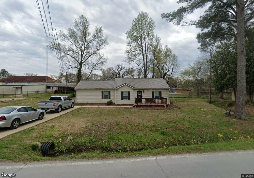
1562 Maple Rd Nettleton, MS 38858
Estimated Value: $134,742 - $163,000
Studio
--
Bath
1,753
Sq Ft
$87/Sq Ft
Est. Value
About This Home
This home is located at 1562 Maple Rd, Nettleton, MS 38858 and is currently estimated at $152,436, approximately $86 per square foot. 1562 Maple Rd is a home with nearby schools including Nettleton Primary School, Nettleton Junior High School, and Nettleton Upper Elementary School.
Ownership History
Date
Name
Owned For
Owner Type
Purchase Details
Closed on
Jul 31, 2014
Sold by
Pate William and Pate Keith
Bought by
Rucker Bernard
Current Estimated Value
Home Financials for this Owner
Home Financials are based on the most recent Mortgage that was taken out on this home.
Original Mortgage
$107,142
Outstanding Balance
$81,617
Interest Rate
4.24%
Mortgage Type
Purchase Money Mortgage
Estimated Equity
$70,819
Purchase Details
Closed on
Aug 13, 2013
Sold by
Wise A Rhett
Bought by
Pate William B and Pate Keith
Home Financials for this Owner
Home Financials are based on the most recent Mortgage that was taken out on this home.
Original Mortgage
$15,260
Interest Rate
4.31%
Create a Home Valuation Report for This Property
The Home Valuation Report is an in-depth analysis detailing your home's value as well as a comparison with similar homes in the area
Purchase History
| Date | Buyer | Sale Price | Title Company |
|---|---|---|---|
| Rucker Bernard | -- | -- | |
| Pate William B | -- | -- |
Source: Public Records
Mortgage History
| Date | Status | Borrower | Loan Amount |
|---|---|---|---|
| Open | Rucker Bernard | $107,142 | |
| Previous Owner | Pate William B | $15,260 |
Source: Public Records
Tax History
| Year | Tax Paid | Tax Assessment Tax Assessment Total Assessment is a certain percentage of the fair market value that is determined by local assessors to be the total taxable value of land and additions on the property. | Land | Improvement |
|---|---|---|---|---|
| 2025 | $1,038 | $7,849 | $0 | $0 |
| 2024 | $1,038 | $7,849 | $0 | $0 |
| 2023 | $742 | $5,701 | $0 | $0 |
| 2022 | $742 | $5,701 | $0 | $0 |
| 2021 | $738 | $5,701 | $0 | $0 |
| 2020 | $725 | $5,701 | $0 | $0 |
| 2019 | $456 | $5,284 | $0 | $0 |
| 2018 | $456 | $5,284 | $0 | $0 |
| 2017 | $456 | $5,284 | $0 | $0 |
| 2016 | $456 | $5,284 | $0 | $0 |
| 2015 | -- | $4,986 | $0 | $0 |
| 2014 | -- | $7,479 | $0 | $0 |
Source: Public Records
Map
Nearby Homes
- 131 W Main St
- 152 Myrtle Ave
- 0 Hwy 145
- 0 Will Robbins
- 0 Coggin Ave
- 0 Metts Rd
- 987 Road 1277
- 30152 Metts Rd
- 1083 Road 1205
- 0 Lake Estates Dr Unit 26-90
- 323 Old Highway 45
- 22 Barnett St
- 459 Road 1199
- 6346 Noah Curtis + - 1 Acre
- 6346 Noah Curtis St
- 130 Grubbs Ave
- (10 acres) Hwy 45 Alt Pine Grove (Cr 506) Rd
- 0 Noah Curtis St
- Lot 2 Prospect Rd
- 141 Old Highway 45
Your Personal Tour Guide
Ask me questions while you tour the home.