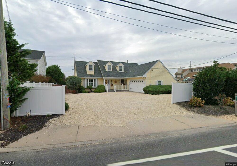
1562 Ocean Ave Mantoloking, NJ 08738
Estimated Value: $1,729,790 - $2,908,000
5
Beds
2
Baths
2,367
Sq Ft
$945/Sq Ft
Est. Value
About This Home
This home is located at 1562 Ocean Ave, Mantoloking, NJ 08738 and is currently estimated at $2,235,698, approximately $944 per square foot. 1562 Ocean Ave is a home located in Ocean County with nearby schools including Emma Havens Young Elementary School, Lake Riviera Middle School, and Brick Township High School.
Ownership History
Date
Name
Owned For
Owner Type
Purchase Details
Closed on
Apr 19, 2004
Sold by
Intile Joseph M and Intile Rose Marie
Bought by
Tomaszeski Paul M and Tomaszeski Nancy E
Current Estimated Value
Home Financials for this Owner
Home Financials are based on the most recent Mortgage that was taken out on this home.
Original Mortgage
$639,200
Outstanding Balance
$295,334
Interest Rate
5.4%
Mortgage Type
Purchase Money Mortgage
Estimated Equity
$1,940,364
Create a Home Valuation Report for This Property
The Home Valuation Report is an in-depth analysis detailing your home's value as well as a comparison with similar homes in the area
Home Values in the Area
Average Home Value in this Area
Purchase History
| Date | Buyer | Sale Price | Title Company |
|---|---|---|---|
| Tomaszeski Paul M | $799,000 | Chicago Title Insurance Co |
Source: Public Records
Mortgage History
| Date | Status | Borrower | Loan Amount |
|---|---|---|---|
| Open | Tomaszeski Paul M | $639,200 |
Source: Public Records
Tax History Compared to Growth
Tax History
| Year | Tax Paid | Tax Assessment Tax Assessment Total Assessment is a certain percentage of the fair market value that is determined by local assessors to be the total taxable value of land and additions on the property. | Land | Improvement |
|---|---|---|---|---|
| 2025 | $7,434 | $866,400 | $451,600 | $414,800 |
| 2024 | $7,070 | $866,400 | $451,600 | $414,800 |
| 2023 | $6,065 | $866,400 | $451,600 | $414,800 |
| 2022 | $6,065 | $866,400 | $451,600 | $414,800 |
| 2021 | $6,099 | $866,400 | $451,600 | $414,800 |
| 2020 | $6,169 | $866,400 | $451,600 | $414,800 |
| 2019 | $6,082 | $866,400 | $451,600 | $414,800 |
| 2018 | $5,995 | $866,400 | $451,600 | $414,800 |
| 2017 | $6,039 | $866,400 | $451,600 | $414,800 |
| 2016 | $5,707 | $822,400 | $451,600 | $370,800 |
| 2015 | $4,998 | $731,700 | $451,600 | $280,100 |
| 2014 | $4,588 | $731,700 | $451,600 | $280,100 |
Source: Public Records
Map
Nearby Homes
- 1519 Runyon Ln
- 122 Squan Beach Dr
- 150 Sunset Ln
- 233 Curtis Point Dr
- 275 Curtis Point Dr
- 304 Schooner Ln
- 1318 Ocean Ave
- 308 Cove Dr
- 1207 Ocean Ave
- 1201 Ocean Ave
- 366 Highway 35 N
- 1097 Barnegat Ln
- 438 Highway 35 N Unit 1304
- 12 Shell Rd
- 1063 Ocean Ave
- 1027 Ocean Ave
- 515 New Jersey 35
- 64 W Granada Dr
- 45 W Granada Dr
- 305 Alameda Dr
- 101 Highway 35 S
- 1558 Ocean Ave
- 1550 Ocean Ave
- 1581 Ocean Ave
- 1561 Ocean Ave
- 115 Curtis Point Dr
- 100 Highway 35 N
- 1557 Ocean Ave
- 109 Curtis Point Dr
- 1556 Runyon Ln
- 1551 Ocean Ave
- 90 Curtis Point Dr
- 90 Curtis Point Dr
- 1548 Runyon Ln
- 1552 Runyon Ln
- 100 Curtis Point Dr
- 1544 Ocean Ave
- 1547 Ocean Ave
- 112 Highway 35 N
- 113 Curtis Point Dr