

15639 Grove Rd SE Port Washington, OH 43837
Estimated payment $1,710/month
Highlights
- 15.31 Acre Lot
- 2 Car Detached Garage
- 1-Story Property
- No HOA
- Space Heater
About This Home
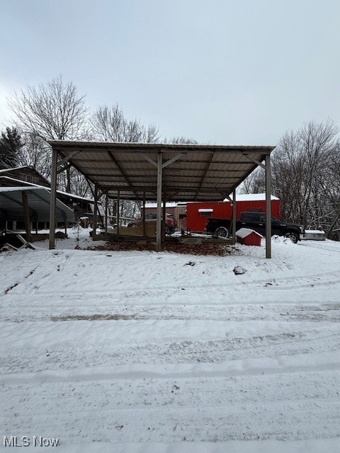
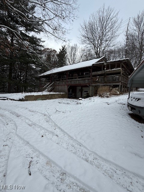
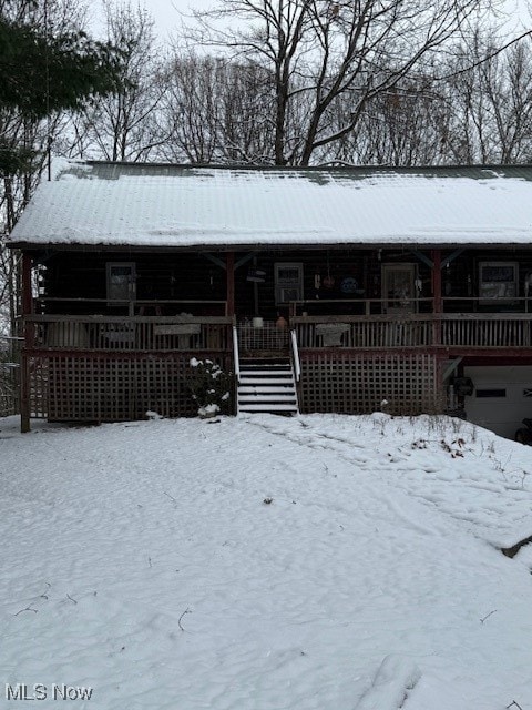
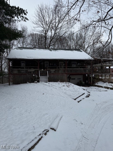
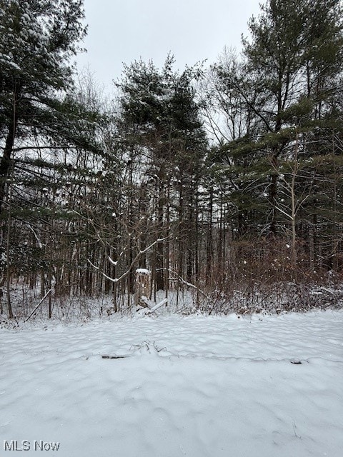
Amish built real log rough cut cabin with 2 bedrooms and a loft that could be a 3rd bedroom. The kitchen, living room and ding room is all open concept. Located Indian Valley schools the cabin is tucked away in the woods. Also a barn, shop and a carport all on 15 acres with 50% minerals passing to the buyers. The sellers are crediting $10,000 towards a new water well to be drilled. Must be 20% down payment. Home needs some work please view all pictures.
Listing Agent
RE/MAX Crossroads Properties Brokerage Email: ronhickmansells@gmail.com, 330-204-1025 License #397385 Listed on: 12/12/2025

Home Details
Home Type
- Single Family
Est. Annual Taxes
- $1,639
Year Built
- Built in 1985
Lot Details
- 15.31 Acre Lot
Parking
- 2 Car Detached Garage
- 2 Carport Spaces
Home Design
- Block Foundation
- Metal Roof
- Log Siding
Interior Spaces
- 1,344 Sq Ft Home
- 1-Story Property
- Partial Basement
Bedrooms and Bathrooms
- 3 Bedrooms | 2 Main Level Bedrooms
- 1 Full Bathroom
Utilities
- No Cooling
- Space Heater
- Heating System Uses Propane
- Heating System Uses Wood
- Radiant Heating System
- Water Not Available
Community Details
- No Home Owners Association
Listing and Financial Details
- Assessor Parcel Number 4600107001
Map
Home Values in the Area
Average Home Value in this Area
Tax History
| Year | Tax Paid | Tax Assessment Tax Assessment Total Assessment is a certain percentage of the fair market value that is determined by local assessors to be the total taxable value of land and additions on the property. | Land | Improvement |
|---|---|---|---|---|
| 2024 | $1,641 | $69,370 | $21,400 | $47,970 |
| 2023 | $1,641 | $198,210 | $61,150 | $137,060 |
| 2022 | $1,554 | $69,374 | $21,403 | $47,971 |
| 2021 | $1,488 | $63,634 | $21,000 | $42,634 |
| 2020 | $1,509 | $63,634 | $21,000 | $42,634 |
| 2019 | $1,520 | $63,634 | $21,000 | $42,634 |
| 2018 | $1,294 | $53,190 | $17,520 | $35,670 |
| 2017 | $1,302 | $53,190 | $17,520 | $35,670 |
| 2016 | $1,309 | $53,190 | $17,520 | $35,670 |
| 2014 | $1,189 | $46,380 | $13,910 | $32,470 |
| 2013 | $1,149 | $46,380 | $13,910 | $32,470 |
Property History
| Date | Event | Price | List to Sale | Price per Sq Ft |
|---|---|---|---|---|
| 12/12/2025 12/12/25 | For Sale | $299,000 | -- | $222 / Sq Ft |
Purchase History
| Date | Type | Sale Price | Title Company |
|---|---|---|---|
| Executors Deed | $198,000 | Connolly Hillyer & Welch Title | |
| Interfamily Deed Transfer | -- | -- | |
| Deed | -- | -- | |
| Warranty Deed | -- | -- | |
| Warranty Deed | $20,700 | -- |
Source: MLS Now
MLS Number: 5177138
APN: 4600107001
Disclaimer: Certain information contained herein is derived from information provided by parties other than Homes.com. All information provided is deemed reliable, but is not guaranteed to be accurate and should be independently verified.
![]() IDX information is provided exclusively for personal, non-commercial use, and may not be used for any purpose other than to identify prospective properties consumers may be interested in purchasing. Information is deemed reliable but not guaranteed.
IDX information is provided exclusively for personal, non-commercial use, and may not be used for any purpose other than to identify prospective properties consumers may be interested in purchasing. Information is deemed reliable but not guaranteed.
- 3653 Turkey Flat Rd SE
- 5991 Sandy Ridge Rd SE
- 18063 Sligo Rd
- 4308 Flat Rd SE
- 0 Broadhead Rd Unit 179 & 180 5154762
- 76165 Vandalia Ln
- 75959 Vandalia Ln Unit 544
- 75959 Vandalia Ln Unit 32-33-34
- 0000 Green Rd
- 639 Echo Rd SW
- 16691 Dog Rd
- 0 Twy Highway 116
- 73353 Birmingham Rd
- 9375 Ridge Rd SE
- 28838 Norris Rd
- 11375 Seminary Rd
- 0 Lock 17 Rd SE
- 0 Lock 17 Rd SE
- 0 Lock 17 Rd SE
- 10720 State Route 258 SE
- 100 Oxford Ln
- 233 Chestnut St
- 219 Grant St Unit 219.5 Grant St
- 2729 Barnhill Rd SE
- 2717 Barnhill Rd SE
- 6 Sunrise Dr Unit B
- 158 N Broadway St Unit Upper
- 251 Fair Ave NW
- 312 Minnich Ave NE
- 531 N 18th St
- 1527 Foster Ave Unit 9
- 1206 Foster Ave
- 1013 Prospect Ave NW
- 640 Lakeside Dr Unit 11
- 620 Lakeside Dr Unit 6
- 823 Beatty Ave
- 500 S 8th St
- 101 Brookside Dr
- 202 Meek Ave
- 1232 Schneiders Crossing Rd NW Unit 1232A