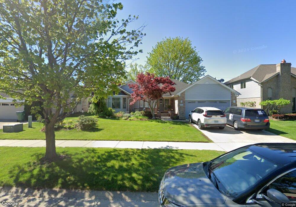
15648 Mountainside Dr Macomb, MI 48042
Estimated Value: $372,000 - $440,624
3
Beds
3
Baths
1,915
Sq Ft
$211/Sq Ft
Est. Value
About This Home
This home is located at 15648 Mountainside Dr, Macomb, MI 48042 and is currently estimated at $404,906, approximately $211 per square foot. 15648 Mountainside Dr is a home located in Macomb County with nearby schools including Beck Centennial Elementary School, Shelby Junior High School, and Eisenhower High School.
Ownership History
Date
Name
Owned For
Owner Type
Purchase Details
Closed on
Aug 3, 2022
Sold by
Serra Philip A
Bought by
Dedaj Luxhe and Dedaj Antoneta
Current Estimated Value
Home Financials for this Owner
Home Financials are based on the most recent Mortgage that was taken out on this home.
Original Mortgage
$334,650
Outstanding Balance
$319,401
Interest Rate
5.3%
Mortgage Type
New Conventional
Estimated Equity
$85,505
Purchase Details
Closed on
May 30, 2018
Sold by
Serra Melanie A
Bought by
Serra Philip A
Create a Home Valuation Report for This Property
The Home Valuation Report is an in-depth analysis detailing your home's value as well as a comparison with similar homes in the area
Home Values in the Area
Average Home Value in this Area
Purchase History
We collect this data history from publicly available records. To have your information removed, we recommend requesting removal directly through your county’s website.
| Date | Buyer | Sale Price | Title Company |
|---|---|---|---|
| Dedaj Luxhe | $345,000 | None Listed On Document | |
| Serra Philip A | -- | None Available |
Source: Public Records
Mortgage History
We collect this data history from publicly available records. To have your information removed, we recommend requesting removal directly through your county’s website.
| Date | Status | Borrower | Loan Amount |
|---|---|---|---|
| Open | Dedaj Luxhe | $334,650 |
Source: Public Records
Tax History
| Year | Tax Paid | Tax Assessment Tax Assessment Total Assessment is a certain percentage of the fair market value that is determined by local assessors to be the total taxable value of land and additions on the property. | Land | Improvement |
|---|---|---|---|---|
| 2025 | $3,438 | $210,100 | $0 | $0 |
| 2024 | $4,814 | $201,900 | $0 | $0 |
| 2023 | $3,169 | $175,000 | $0 | $0 |
| 2022 | $3,006 | $147,700 | $0 | $0 |
| 2021 | $2,928 | $142,100 | $0 | $0 |
| 2020 | $1,916 | $137,600 | $0 | $0 |
| 2019 | $2,685 | $129,200 | $0 | $0 |
| 2018 | $2,646 | $122,900 | $0 | $0 |
| 2017 | $2,611 | $115,410 | $32,000 | $83,410 |
| 2016 | $2,456 | $115,370 | $0 | $0 |
| 2015 | $2,426 | $109,090 | $0 | $0 |
| 2014 | $2,426 | $98,480 | $21,000 | $77,480 |
| 2011 | $740 | $93,870 | $18,000 | $75,870 |
Source: Public Records
Map
Nearby Homes
- 52425 Bryan Michael Dr
- 52317 Sawmill Creek Dr
- 51214 Industrial Dr
- 52186 Jacqueline Ct
- 52237 Mitchell Ln Unit 11
- 52598 Bordeaux Way
- 16768 Pearlcreek Ct Unit 39
- 14855 Brompton Ct
- 53118 Celtic Dr
- 53260 Villa Rosa Dr
- 53106 Celtic Dr Unit 31
- 16890 Sandstone Cir Unit 32
- 14382 Knightsbridge Dr
- 15342 Amberfield Dr
- 53698 Cranston Dr
- 15756 Lamont Dr
- 16497 Evelyn Dr
- 17197 Averhill Blvd Unit 86
- 53721 Beck Ct
- 16532 Moore Park Rd
- 15620 Mountainside Dr
- 15676 Mountainside Dr
- 15704 Mountainside Dr
- 15592 Mountainside Dr
- 15643 Mountainside Dr
- 15615 Mountainside Dr
- 15671 Mountainside Dr
- 15564 Mountainside Dr
- 15732 Mountainside Dr
- 15587 Mountainside Dr
- 15699 Mountainside Dr
- 15559 Mountainside Dr
- 15760 Mountainside Dr
- 52015 Antler Dr
- 15536 Mountainside Dr
- 52396 Ten Point Dr
- 52380 Ten Point Dr
- 52414 Ten Point Dr
- 15747 Leone Dr
- 52358 Ten Point Dr
Your Personal Tour Guide
Ask me questions while you tour the home.