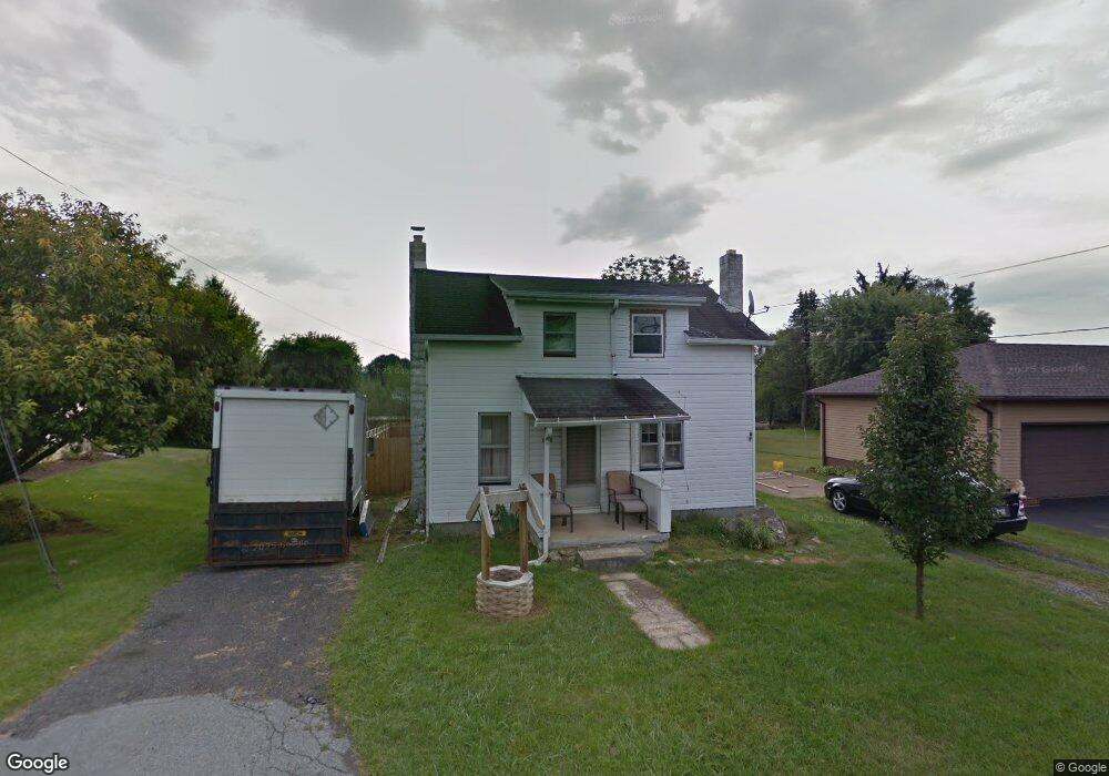
1565 S Krocks Rd Allentown, PA 18106
Lower Macungie Township East NeighborhoodEstimated Value: $249,000 - $295,000
3
Beds
1
Bath
1,536
Sq Ft
$178/Sq Ft
Est. Value
About This Home
This home is located at 1565 S Krocks Rd, Allentown, PA 18106 and is currently estimated at $272,961, approximately $177 per square foot. 1565 S Krocks Rd is a home located in Lehigh County with nearby schools including Willow Lane Elementary School, Lower Macungie Middle School, and Emmaus High School.
Ownership History
Date
Name
Owned For
Owner Type
Purchase Details
Closed on
Sep 21, 2009
Sold by
Schaufler Bernice C
Bought by
Brown Barry W
Current Estimated Value
Home Financials for this Owner
Home Financials are based on the most recent Mortgage that was taken out on this home.
Original Mortgage
$137,464
Outstanding Balance
$89,581
Interest Rate
5.12%
Mortgage Type
FHA
Estimated Equity
$183,380
Purchase Details
Closed on
Oct 12, 1978
Bought by
Schaufler Bernice C
Create a Home Valuation Report for This Property
The Home Valuation Report is an in-depth analysis detailing your home's value as well as a comparison with similar homes in the area
Home Values in the Area
Average Home Value in this Area
Purchase History
| Date | Buyer | Sale Price | Title Company |
|---|---|---|---|
| Brown Barry W | $140,000 | -- | |
| Schaufler Bernice C | $300 | -- |
Source: Public Records
Mortgage History
| Date | Status | Borrower | Loan Amount |
|---|---|---|---|
| Open | Brown Barry W | $137,464 |
Source: Public Records
Tax History Compared to Growth
Tax History
| Year | Tax Paid | Tax Assessment Tax Assessment Total Assessment is a certain percentage of the fair market value that is determined by local assessors to be the total taxable value of land and additions on the property. | Land | Improvement |
|---|---|---|---|---|
| 2025 | $2,775 | $108,700 | $33,200 | $75,500 |
| 2024 | $2,685 | $108,700 | $33,200 | $75,500 |
| 2023 | $2,631 | $108,700 | $33,200 | $75,500 |
| 2022 | $2,569 | $108,700 | $75,500 | $33,200 |
| 2021 | $2,514 | $108,700 | $33,200 | $75,500 |
| 2020 | $2,490 | $108,700 | $33,200 | $75,500 |
| 2019 | $2,448 | $108,700 | $33,200 | $75,500 |
| 2018 | $2,416 | $108,700 | $33,200 | $75,500 |
| 2017 | $2,374 | $108,700 | $33,200 | $75,500 |
| 2016 | -- | $108,700 | $33,200 | $75,500 |
| 2015 | -- | $108,700 | $33,200 | $75,500 |
| 2014 | -- | $108,700 | $33,200 | $75,500 |
Source: Public Records
Map
Nearby Homes
- 6007 Timberknoll Dr
- 6179 Fairway Ln
- 5736 Greens Dr
- 5673 Wedge Ln
- 2056 Autumn Ridge Rd
- 1991 Autumn Ridge Rd
- 5280 Townsquare Dr
- 1675 Hamlet Dr
- 5619 Stonecroft Ln
- 5524 Stonecroft Ln
- 6022 Eli Cir
- 6522 Trafalgar Dr
- 5300 Hanover Dr
- 1037 Village Round Unit L
- 997 Village Round Unit K
- 997K Village Round Unit 104K
- 5133 Meadow Ln
- 1385 Brookside Rd
- 2154 Gorton Rd
- 6645 Stein Way Unit 6639-6661
- 1575 S Krocks Rd
- 1551 S Krocks Rd
- 1578 Par Causeway
- 1585 S Krocks Rd
- 1592 Par Causeway
- 1562 Par Causeway
- 1535 Birdie St
- 1536 S Krocks Rd
- 1603 S Krocks Rd
- 1546 Birdie St
- 1602 Par Causeway
- 1520 S Krocks Rd
- 1575 Par Causeway
- 1599 Par Causeway
- 1515 S Krocks Rd
- 1656 Allen Cir
- 1555 Par Causeway
- 1614 Par Causeway
- 1502 S Krocks Rd
- 1623 S Krocks Rd