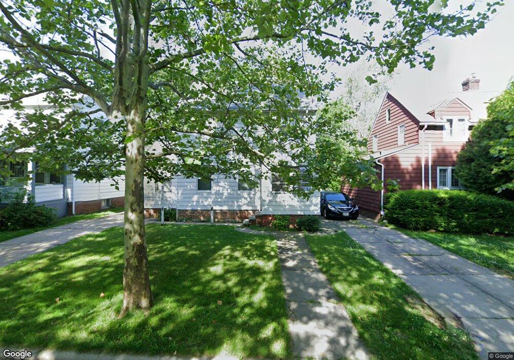
1566 E 219th St Euclid, OH 44117
Estimated Value: $113,418 - $155,000
3
Beds
2
Baths
1,312
Sq Ft
$102/Sq Ft
Est. Value
About This Home
This home is located at 1566 E 219th St, Euclid, OH 44117 and is currently estimated at $133,855, approximately $102 per square foot. 1566 E 219th St is a home located in Cuyahoga County with nearby schools including Bluestone Elementary School, Euclid Middle School, and Euclid High School.
Ownership History
Date
Name
Owned For
Owner Type
Purchase Details
Closed on
Dec 8, 2025
Sold by
Hasan Robert and Hasan Yvette G
Bought by
Hasan Family Trust and Hasan
Current Estimated Value
Purchase Details
Closed on
Jul 28, 1995
Sold by
Stack Charle M
Bought by
Hasan Robert
Home Financials for this Owner
Home Financials are based on the most recent Mortgage that was taken out on this home.
Original Mortgage
$58,250
Interest Rate
7.59%
Mortgage Type
FHA
Purchase Details
Closed on
Aug 29, 1991
Sold by
Stack Alberta R
Bought by
Stack Charles M
Purchase Details
Closed on
Jan 10, 1989
Sold by
Stack Maurice
Bought by
Stack Alberta R
Purchase Details
Closed on
Apr 1, 1985
Sold by
Stack Alberta R and Stack Maurice C
Bought by
Stack Maurice
Purchase Details
Closed on
Jan 1, 1975
Bought by
Stack Alberta R and Stack Maurice C
Create a Home Valuation Report for This Property
The Home Valuation Report is an in-depth analysis detailing your home's value as well as a comparison with similar homes in the area
Home Values in the Area
Average Home Value in this Area
Purchase History
| Date | Buyer | Sale Price | Title Company |
|---|---|---|---|
| Hasan Family Trust | -- | None Listed On Document | |
| Hasan Robert | $58,000 | -- | |
| Stack Charles M | $45,000 | -- | |
| Stack Alberta R | -- | -- | |
| Stack Maurice | -- | -- | |
| Stack Alberta R | -- | -- |
Source: Public Records
Mortgage History
| Date | Status | Borrower | Loan Amount |
|---|---|---|---|
| Previous Owner | Hasan Robert | $58,250 |
Source: Public Records
Tax History
| Year | Tax Paid | Tax Assessment Tax Assessment Total Assessment is a certain percentage of the fair market value that is determined by local assessors to be the total taxable value of land and additions on the property. | Land | Improvement |
|---|---|---|---|---|
| 2024 | $2,383 | $34,160 | $6,230 | $27,930 |
| 2023 | $1,925 | $21,710 | $4,800 | $16,910 |
| 2022 | $1,882 | $21,700 | $4,800 | $16,910 |
| 2021 | $2,088 | $21,700 | $4,800 | $16,910 |
| 2020 | $1,761 | $16,450 | $3,640 | $12,810 |
| 2019 | $1,579 | $47,000 | $10,400 | $36,600 |
| 2018 | $1,572 | $16,450 | $3,640 | $12,810 |
| 2017 | $1,674 | $14,460 | $3,010 | $11,450 |
| 2016 | $1,678 | $14,460 | $3,010 | $11,450 |
| 2015 | $1,783 | $14,460 | $3,010 | $11,450 |
| 2014 | $1,783 | $17,020 | $3,540 | $13,480 |
Source: Public Records
Map
Nearby Homes
- 1554 E 221st St
- 21950 Euclid Ave
- 1545 E 214th St
- 1754 E 236th St
- 1524 E 204th St
- 1765 E 238th St
- 1734 Glenridge Rd
- 24105 Chardon Rd
- 19210 Firwood Rd
- 22601 Harms Rd
- 1721 Grand Blvd
- 22791 Harms Rd
- 902 E 207th St
- 1620 E 243rd St
- 931 E 214th St
- 1290 E 188th St
- 24 Washington Square
- 824 E 207th St
- 25031 Glenbrook Blvd
- 21070 N Vine Ave
- 1570 E 219th St
- 1562 E 219th St
- 1574 E 219th St
- 1550 E 219th St
- 1559 E 219th St
- 1551 E 219th St
- 1545 E 219th St
- 1565 E 219th St
- 1541 E 219th St
- 1571 E 219th St
- 1520 E 219th St
- 21877 Euclid Ave
- 1525 E 219th St
- 1514 E 219th St
- 1560 E 221st St
- 1574 E 221st St
- 1580 E 221st St
- 1550 E 221st St
- 1521 E 219th St
- 1510 E 219th St
Your Personal Tour Guide
Ask me questions while you tour the home.