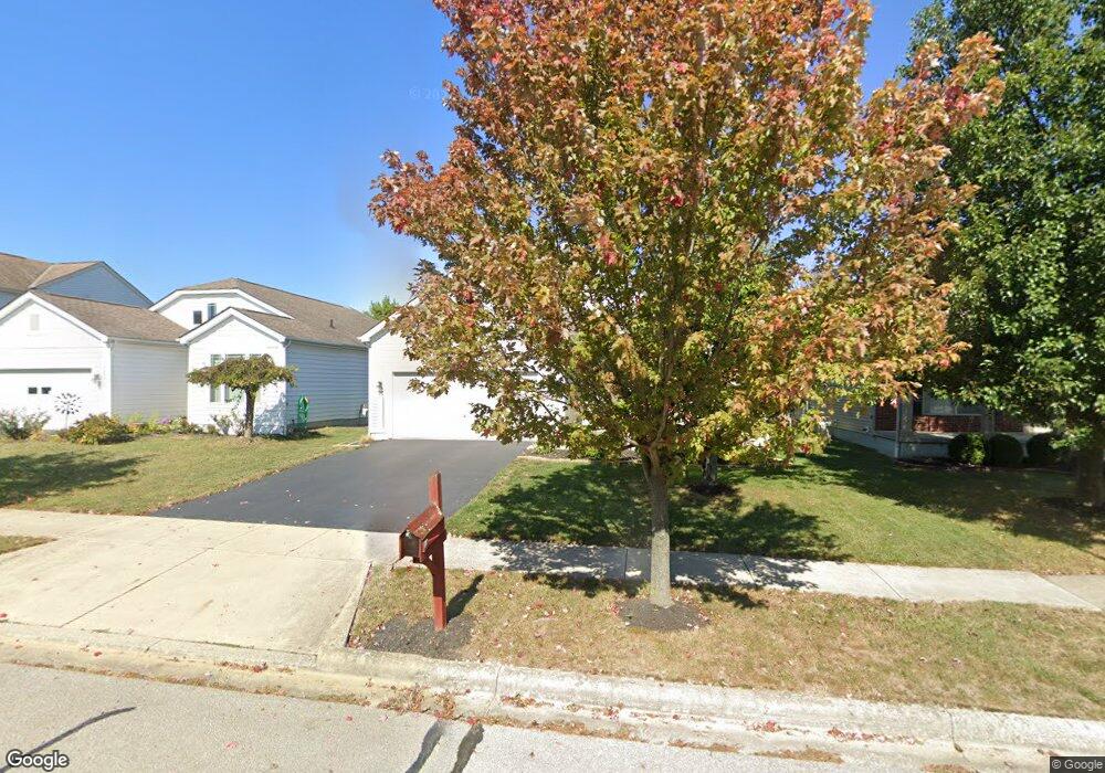
1566 Grove Hill Dr Columbus, OH 43240
Polaris North NeighborhoodEstimated Value: $403,619 - $426,000
3
Beds
2
Baths
1,494
Sq Ft
$277/Sq Ft
Est. Value
About This Home
This home is located at 1566 Grove Hill Dr, Columbus, OH 43240 and is currently estimated at $413,155, approximately $276 per square foot. 1566 Grove Hill Dr is a home located in Delaware County with nearby schools including Freedom Trail Elementary School, Olentangy Orange Middle School, and Orange High School.
Ownership History
Date
Name
Owned For
Owner Type
Purchase Details
Closed on
Jan 30, 2004
Sold by
M/I Homes Of Central Ohio Llc
Bought by
Anderson Rory M
Current Estimated Value
Home Financials for this Owner
Home Financials are based on the most recent Mortgage that was taken out on this home.
Original Mortgage
$175,000
Outstanding Balance
$67,220
Interest Rate
3.25%
Mortgage Type
Purchase Money Mortgage
Estimated Equity
$345,935
Create a Home Valuation Report for This Property
The Home Valuation Report is an in-depth analysis detailing your home's value as well as a comparison with similar homes in the area
Home Values in the Area
Average Home Value in this Area
Purchase History
| Date | Buyer | Sale Price | Title Company |
|---|---|---|---|
| Anderson Rory M | $207,000 | Transohio Residential Title |
Source: Public Records
Mortgage History
| Date | Status | Borrower | Loan Amount |
|---|---|---|---|
| Open | Anderson Rory M | $175,000 |
Source: Public Records
Tax History Compared to Growth
Tax History
| Year | Tax Paid | Tax Assessment Tax Assessment Total Assessment is a certain percentage of the fair market value that is determined by local assessors to be the total taxable value of land and additions on the property. | Land | Improvement |
|---|---|---|---|---|
| 2024 | $5,603 | $115,190 | $25,380 | $89,810 |
| 2023 | $5,627 | $115,190 | $25,380 | $89,810 |
| 2022 | $5,061 | $82,500 | $17,330 | $65,170 |
| 2021 | $5,090 | $82,500 | $17,330 | $65,170 |
| 2020 | $5,118 | $82,500 | $17,330 | $65,170 |
| 2019 | $4,122 | $70,070 | $15,750 | $54,320 |
| 2018 | $4,141 | $70,070 | $15,750 | $54,320 |
| 2017 | $3,920 | $66,610 | $14,000 | $52,610 |
| 2016 | $4,176 | $66,610 | $14,000 | $52,610 |
| 2015 | $3,747 | $66,610 | $14,000 | $52,610 |
| 2014 | $3,804 | $66,610 | $14,000 | $52,610 |
| 2013 | $3,799 | $65,070 | $14,000 | $51,070 |
Source: Public Records
Map
Nearby Homes
- 1627 Bristol Commons Place
- 2715 Tucker Trail
- 3138 E Powell Rd
- 9146 Gramford St Unit 9146
- 2251 Tucker Trail
- 9168 Tahoma St
- 3313 Glen Oaks Ct
- 8322 Aurora Ct
- 1746 E Powell Rd
- 7631 Pleasant Colony Ct
- 975 Adara Dr Unit 6975
- 2216 Reeves Ave
- 3679 Birkland Cir
- 2165 Ben Brush Place
- 2363 Pleasant Colony Dr
- 1923 Myrtle St
- 7697 Bale Kenyon Rd
- 8910 Sedona Ct
- 8293 Mira St Unit 175
- 2383 Bold Venture Dr
- 1572 Grove Hill Dr
- 1560 Grove Hill Dr
- 1554 Grove Hill Dr
- 1578 Grove Hill Dr
- 1584 Grove Hill Dr
- 1548 Grove Hill Dr
- 9209 Cambrian Commons Dr
- 9210 Cambrian Commons Dr
- 1590 Grove Hill Dr
- 1542 Grove Hill Dr
- 8475 Greentree Dr
- 9203 Cambrian Commons Dr
- 8465 Green Tree Dr
- 9204 Cambrian Commons Dr
- 1596 Grove Hill Dr
- 1536 Grove Hill Dr
- 1547 Grove Hill Dr
- 9197 Cambrian Commons Dr
- 9211 Colonial Commons Dr
- 1541 Grove Hill Dr