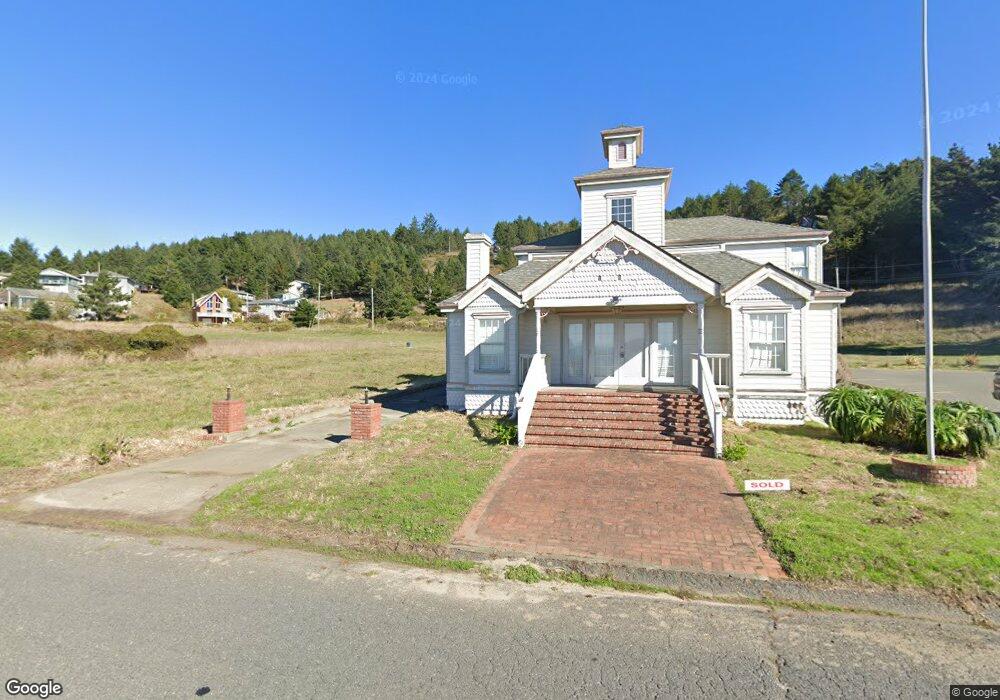
1566 Upper Pacific Dr Shelter Cove, CA 95589
Shelter Cove NeighborhoodEstimated Value: $238,270
--
Bed
--
Bath
--
Sq Ft
10,019
Sq Ft Lot
About This Home
This home is located at 1566 Upper Pacific Dr, Shelter Cove, CA 95589 and is currently estimated at $238,270. 1566 Upper Pacific Dr is a home located in Humboldt County.
Ownership History
Date
Name
Owned For
Owner Type
Purchase Details
Closed on
Apr 4, 2006
Sold by
Rolff George
Bought by
Rolff Melinda D
Current Estimated Value
Home Financials for this Owner
Home Financials are based on the most recent Mortgage that was taken out on this home.
Original Mortgage
$100,000
Outstanding Balance
$56,934
Interest Rate
6.2%
Mortgage Type
Seller Take Back
Estimated Equity
$181,336
Purchase Details
Closed on
Oct 14, 2004
Sold by
Hanaoka Daniel T and Hanaoka Gladys H
Bought by
Quinn Virginia Helen
Create a Home Valuation Report for This Property
The Home Valuation Report is an in-depth analysis detailing your home's value as well as a comparison with similar homes in the area
Home Values in the Area
Average Home Value in this Area
Purchase History
| Date | Buyer | Sale Price | Title Company |
|---|---|---|---|
| Rolff Melinda D | -- | Fidelity Natl Title Co Of Ca | |
| Rolff Melinda D | $160,000 | Fidelity Natl Title Co Of Ca | |
| Quinn Virginia Helen | $95,000 | Fidelity National Title Co |
Source: Public Records
Mortgage History
| Date | Status | Borrower | Loan Amount |
|---|---|---|---|
| Open | Rolff Melinda D | $100,000 |
Source: Public Records
Tax History Compared to Growth
Tax History
| Year | Tax Paid | Tax Assessment Tax Assessment Total Assessment is a certain percentage of the fair market value that is determined by local assessors to be the total taxable value of land and additions on the property. | Land | Improvement |
|---|---|---|---|---|
| 2025 | $908 | $55,000 | $55,000 | -- |
| 2024 | $908 | $55,000 | $55,000 | -- |
| 2023 | $923 | $55,000 | $55,000 | $0 |
| 2022 | $925 | $55,000 | $55,000 | $0 |
| 2021 | $913 | $55,000 | $55,000 | $0 |
| 2020 | $923 | $55,000 | $55,000 | $0 |
| 2019 | $1,300 | $90,000 | $90,000 | $0 |
| 2018 | $1,302 | $90,000 | $90,000 | $0 |
| 2017 | $1,228 | $90,000 | $90,000 | $0 |
| 2016 | $1,241 | $90,000 | $90,000 | $0 |
| 2015 | $1,251 | $90,000 | $90,000 | $0 |
| 2014 | $1,310 | $90,000 | $90,000 | $0 |
Source: Public Records
Map
Nearby Homes
- 142 Oceanview Rd
- 15 Seal Ct
- 6 Coral Point
- 81 Fawn Dr
- 82 Fawn Dr
- 86 Steelhead Ct
- 36 Bambi Dr
- 16 Bambi Dr
- 93 Neptune Rd
- 23 Steelhead Ct
- 126 Neptune Dr
- 5 Antler Ct
- 794 & 806 Lower Pacific Dr
- 9046 Shelter Cove Rd
- 1325&1335 Upper Pacific Dr
- 42 Vista Rd
- 112 Seafoam Rd
- 14 High Ct
- 8989 Shelter Cove Rd
- 60 Spruce Rd
- 1518 Upper Pacific
- 17 View Cir
- 1638 Upper Pacific Dr
- 1661 Upper Pacific Dr
- 48 Ocean View Rd
- 65 Ocean View Rd
- 60 Ocean View Rd
- 252 MacHi Rd
- 246 MacHi Rd
- 461 MacHi Rd
- 492 MacHi Rd
- 238 MacHi Rd
- 1594 Upper Pacific Dr
- 52 Ocean View Rd
- 245 MacHi Rd
- 245 MacHi Rd
- 230 MacHi Rd
- 1580 Upper Pacific Dr
- 216 MacHi Rd