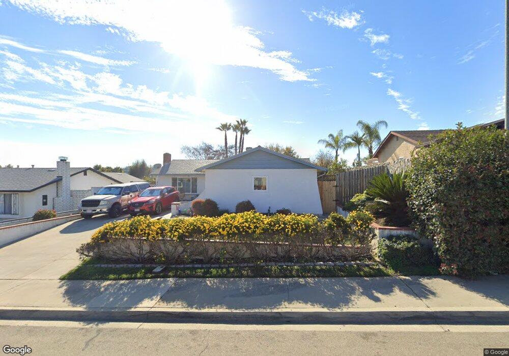
1567 Bitterroot Ct San Marcos, CA 92069
Estimated Value: $718,931 - $808,000
3
Beds
2
Baths
1,074
Sq Ft
$713/Sq Ft
Est. Value
About This Home
This home is located at 1567 Bitterroot Ct, San Marcos, CA 92069 and is currently estimated at $765,233, approximately $712 per square foot. 1567 Bitterroot Ct is a home located in San Diego County with nearby schools including Richland Elementary School, Woodland Park Middle School, and Mission Hills High School.
Ownership History
Date
Name
Owned For
Owner Type
Purchase Details
Closed on
Oct 3, 2016
Sold by
Gerv Mark Anthony
Bought by
Cerv Mark Anthony
Current Estimated Value
Home Financials for this Owner
Home Financials are based on the most recent Mortgage that was taken out on this home.
Original Mortgage
$194,000
Outstanding Balance
$142,839
Interest Rate
3.43%
Mortgage Type
New Conventional
Estimated Equity
$622,394
Purchase Details
Closed on
Jan 14, 2015
Sold by
Cerv Mark
Bought by
Cerv Mark Anthony
Purchase Details
Closed on
Mar 9, 2012
Sold by
Cerv Marsi L
Bought by
Cerv Mark
Home Financials for this Owner
Home Financials are based on the most recent Mortgage that was taken out on this home.
Original Mortgage
$216,000
Interest Rate
3.83%
Mortgage Type
New Conventional
Purchase Details
Closed on
Jul 18, 2002
Sold by
Cerv Mark
Bought by
Cerv Mark
Home Financials for this Owner
Home Financials are based on the most recent Mortgage that was taken out on this home.
Original Mortgage
$190,000
Interest Rate
6.7%
Purchase Details
Closed on
Apr 29, 2002
Sold by
Cerv Angela
Bought by
Cerv Mark
Purchase Details
Closed on
Jan 31, 2000
Sold by
United Commerce Company
Bought by
Cerv Mark and Cerv Angela
Home Financials for this Owner
Home Financials are based on the most recent Mortgage that was taken out on this home.
Original Mortgage
$163,780
Interest Rate
8.14%
Purchase Details
Closed on
Jan 6, 2000
Sold by
Dagang Noelito C and Dagang Aurea S
Bought by
United Commerce Company
Home Financials for this Owner
Home Financials are based on the most recent Mortgage that was taken out on this home.
Original Mortgage
$163,780
Interest Rate
8.14%
Purchase Details
Closed on
Oct 26, 1994
Sold by
Hatcher Edith L
Bought by
Dagang Noelito C and Dagang Aurea S
Home Financials for this Owner
Home Financials are based on the most recent Mortgage that was taken out on this home.
Original Mortgage
$132,498
Interest Rate
9.25%
Mortgage Type
VA
Create a Home Valuation Report for This Property
The Home Valuation Report is an in-depth analysis detailing your home's value as well as a comparison with similar homes in the area
Home Values in the Area
Average Home Value in this Area
Purchase History
| Date | Buyer | Sale Price | Title Company |
|---|---|---|---|
| Cerv Mark Anthony | -- | Western Resources Title | |
| Cerv Mark Anthony | -- | Western Resources Title | |
| Cerv Mark Anthony | -- | Western Resources Title | |
| Cerv Mark Anthony | -- | None Available | |
| Cerv Mark | -- | Lsi Title Company | |
| Cerv Mark | -- | Chicago Title Co | |
| Cerv Mark | -- | -- | |
| Cerv Mark | $172,500 | Commonwealth Land Title Co | |
| United Commerce Company | $140,100 | -- | |
| Dagang Noelito C | $130,000 | Fidelity National Title |
Source: Public Records
Mortgage History
| Date | Status | Borrower | Loan Amount |
|---|---|---|---|
| Open | Cerv Mark Anthony | $194,000 | |
| Previous Owner | Cerv Mark | $216,000 | |
| Previous Owner | Cerv Mark | $190,000 | |
| Previous Owner | Cerv Mark | $163,780 | |
| Previous Owner | Dagang Noelito C | $132,498 |
Source: Public Records
Tax History
| Year | Tax Paid | Tax Assessment Tax Assessment Total Assessment is a certain percentage of the fair market value that is determined by local assessors to be the total taxable value of land and additions on the property. | Land | Improvement |
|---|---|---|---|---|
| 2025 | $2,825 | $264,948 | $99,892 | $165,056 |
| 2024 | $2,825 | $259,754 | $97,934 | $161,820 |
| 2023 | $2,770 | $254,662 | $96,014 | $158,648 |
| 2022 | $2,731 | $249,670 | $94,132 | $155,538 |
| 2021 | $2,685 | $244,776 | $92,287 | $152,489 |
| 2020 | $2,659 | $242,267 | $91,341 | $150,926 |
| 2019 | $2,628 | $237,517 | $89,550 | $147,967 |
| 2018 | $2,543 | $232,861 | $87,795 | $145,066 |
| 2017 | $133 | $228,296 | $86,074 | $142,222 |
| 2016 | $2,452 | $223,821 | $84,387 | $139,434 |
| 2015 | $2,415 | $220,460 | $83,120 | $137,340 |
| 2014 | $2,359 | $216,142 | $81,492 | $134,650 |
Source: Public Records
Map
Nearby Homes
- 1544 Indian Summer Rd
- 1719 Kiwi Glen
- 1708 Woodbridge Rd
- 1501 Rock Springs Rd
- 1708 Harold Rd
- 1401 W El Norte Pkwy Unit SPC 25
- 1401 W El Norte Pkwy Unit SPC 309
- 1401 W El Norte Pkwy Unit SPC 73
- 1401 W El Norte Pkwy Unit 282
- 1761 Pinehurst Ave
- 2025 W El Norte Pkwy
- 1401 El Norte Pkwy Unit 57
- 1401 El Norte Pkwy Unit 34
- 1401 El Norte Pkwy Unit SPC 174
- 1401 El Norte Pkwy Unit SPC 326
- 1401 El Norte Pkwy
- 1401 El Norte Pkwy Unit 64
- 1401 El Norte Pkwy Unit 267
- 1894 Sunbury St
- 1915 Rees Rd
- 1575 Bitterroot Ct
- 1559 Bitterroot Ct
- 1570 Indian Summer Ct
- 1562 Indian Summer Ct
- 1583 Bitterroot Ct
- 1551 Bitterroot Ct
- 767 Indian Summer Place
- 1572 Bitterroot Ct
- 1554 Indian Summer Ct
- 1580 Bitterroot Ct
- 1564 Bitterroot Ct
- 1591 Bitterroot Ct
- 1543 Bitterroot Ct
- 776 Bennett Ave
- 1588 Bitterroot Ct
- 1556 Bitterroot Ct
- 1546 Indian Summer Ct
- 763 Indian Summer Place
- 772 Bennett Ave
- 1548 Bitterroot Ct
Your Personal Tour Guide
Ask me questions while you tour the home.