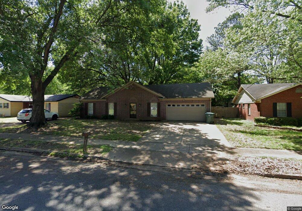
1567 Dimwood St Memphis, TN 38134
Cordova NeighborhoodEstimated Value: $199,000 - $207,000
3
Beds
2
Baths
1,446
Sq Ft
$140/Sq Ft
Est. Value
About This Home
This home is located at 1567 Dimwood St, Memphis, TN 38134 and is currently estimated at $202,935, approximately $140 per square foot. 1567 Dimwood St is a home located in Shelby County with nearby schools including Dexter Elementary School, White Station Middle, and White Station High.
Ownership History
Date
Name
Owned For
Owner Type
Purchase Details
Closed on
Jan 7, 2011
Sold by
Griggs Timothy A
Bought by
The Secretary Of Housing & Urban Develop
Current Estimated Value
Purchase Details
Closed on
Dec 5, 1997
Sold by
Dahmer Barton L and Dahmer Sharon K
Bought by
Griggs Timothy A
Home Financials for this Owner
Home Financials are based on the most recent Mortgage that was taken out on this home.
Original Mortgage
$73,800
Interest Rate
7.19%
Create a Home Valuation Report for This Property
The Home Valuation Report is an in-depth analysis detailing your home's value as well as a comparison with similar homes in the area
Home Values in the Area
Average Home Value in this Area
Purchase History
| Date | Buyer | Sale Price | Title Company |
|---|---|---|---|
| The Secretary Of Housing & Urban Develop | $82,798 | None Available | |
| Griggs Timothy A | $82,000 | -- |
Source: Public Records
Mortgage History
| Date | Status | Borrower | Loan Amount |
|---|---|---|---|
| Previous Owner | Griggs Timothy A | $73,800 | |
| Closed | Griggs Timothy A | $4,100 |
Source: Public Records
Tax History Compared to Growth
Tax History
| Year | Tax Paid | Tax Assessment Tax Assessment Total Assessment is a certain percentage of the fair market value that is determined by local assessors to be the total taxable value of land and additions on the property. | Land | Improvement |
|---|---|---|---|---|
| 2025 | $1,331 | $54,800 | $5,750 | $49,050 |
| 2024 | $1,331 | $39,250 | $4,250 | $35,000 |
| 2023 | $2,391 | $39,250 | $4,250 | $35,000 |
| 2022 | $2,391 | $39,250 | $4,250 | $35,000 |
| 2021 | $2,419 | $39,250 | $4,250 | $35,000 |
| 2020 | $1,797 | $24,800 | $4,250 | $20,550 |
| 2019 | $1,797 | $24,800 | $4,250 | $20,550 |
| 2018 | $1,797 | $24,800 | $4,250 | $20,550 |
| 2017 | $1,019 | $24,800 | $4,250 | $20,550 |
| 2016 | $1,039 | $23,775 | $0 | $0 |
| 2014 | $1,039 | $23,775 | $0 | $0 |
Source: Public Records
Map
Nearby Homes
- 1472 Kinilwood St
- 1339 Mullins Station Rd
- 1289 Heathcliff Dr
- 1461 Phillips Rd
- 6690 Whitten Pine Dr
- 6840 Lagrange Pines Rd
- 6774 Whitten Pine Dr
- 6838 Lagrange Cir N
- 0 Mullins Station Rd
- 6916 Lagrange Pines Rd
- 6321 Ashton Rd
- 6830 Garmin Ln
- 0 Summer Ave Unit 10195870
- 0 Summer Ave Unit 10200827
- 0 Summer Ave Unit 10195869
- 6925 Raleigh Lagrange Rd
- 7020 Wynne Ridge Rd N
- 6880 Wrigley Dr
- 6521 Wimble Rd
- 6523 Wimble Rd
- 1577 Dimwood St
- 1559 Dimwood St
- 1566 Lightwood Cove
- 1570 Lightwood Cove
- 1583 Dimwood St
- 6392 Limewood Ave
- 1568 Dimwood St
- 1560 Lightwood Cove
- 1560 Dimwood St
- 6384 Limewood Ave
- 1554 Dimwood St
- 6387 Brightwood Dr
- 1584 Dimwood St
- 6371 Brightwood Dr
- 6378 Limewood Ave
- 1580 Lightwood Cove
- 1565 Lightwood Cove
- 1569 Pepperwood St
- 1546 Dimwood St
- 6403 Brightwood Dr