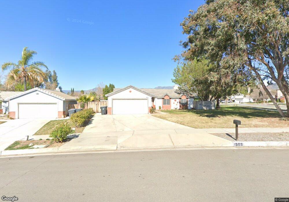
1569 Cambridge Ave Redlands, CA 92374
North Redlands NeighborhoodEstimated Value: $542,974 - $615,000
3
Beds
2
Baths
1,431
Sq Ft
$416/Sq Ft
Est. Value
About This Home
This home is located at 1569 Cambridge Ave, Redlands, CA 92374 and is currently estimated at $595,494, approximately $416 per square foot. 1569 Cambridge Ave is a home located in San Bernardino County with nearby schools including Crafton Elementary School, Clement Middle School, and Redlands East Valley High School.
Ownership History
Date
Name
Owned For
Owner Type
Purchase Details
Closed on
Sep 2, 1998
Sold by
Yowell Susan B
Bought by
Yowell Susan Bean
Current Estimated Value
Home Financials for this Owner
Home Financials are based on the most recent Mortgage that was taken out on this home.
Original Mortgage
$106,900
Interest Rate
6.88%
Purchase Details
Closed on
Oct 1, 1996
Sold by
Yowell Jack L
Bought by
Yowell Susan Bean
Create a Home Valuation Report for This Property
The Home Valuation Report is an in-depth analysis detailing your home's value as well as a comparison with similar homes in the area
Home Values in the Area
Average Home Value in this Area
Purchase History
| Date | Buyer | Sale Price | Title Company |
|---|---|---|---|
| Yowell Susan Bean | -- | Chicago Title Co | |
| Yowell Susan Bean | -- | -- |
Source: Public Records
Mortgage History
| Date | Status | Borrower | Loan Amount |
|---|---|---|---|
| Closed | Yowell Susan Bean | $106,900 |
Source: Public Records
Tax History
| Year | Tax Paid | Tax Assessment Tax Assessment Total Assessment is a certain percentage of the fair market value that is determined by local assessors to be the total taxable value of land and additions on the property. | Land | Improvement |
|---|---|---|---|---|
| 2025 | $2,414 | $198,874 | $38,281 | $160,593 |
| 2024 | $2,254 | $194,974 | $37,530 | $157,444 |
| 2023 | $2,250 | $191,151 | $36,794 | $154,357 |
| 2022 | $2,216 | $187,403 | $36,073 | $151,330 |
| 2021 | $2,254 | $183,729 | $35,366 | $148,363 |
| 2020 | $2,220 | $181,845 | $35,003 | $146,842 |
| 2019 | $2,157 | $178,280 | $34,317 | $143,963 |
| 2018 | $2,102 | $174,784 | $33,644 | $141,140 |
| 2017 | $2,083 | $171,357 | $32,984 | $138,373 |
| 2016 | $2,058 | $167,997 | $32,337 | $135,660 |
| 2015 | $2,042 | $165,473 | $31,851 | $133,622 |
| 2014 | $2,003 | $162,232 | $31,227 | $131,005 |
Source: Public Records
Map
Nearby Homes
- 1617 Waterford Ave
- 0 E Colton Ave
- 1721 E Colton Ave Unit 33
- 1721 E Colton Ave Unit 106
- 1160 Via Ravenna
- 616 N Lincoln St
- 626 N Dearborn St Unit 150
- 626 N Dearborn St Unit 7
- 626 N Dearborn St
- 1528 Laramie Ave
- 936 Judson St
- 1580 Lisa Ln
- 1575 Christopher Ln
- 450 Judson St Unit 94
- 1326 Campus Ave
- 1427 Laramie Ave
- 1592 Christopher Ln
- 455 Judson St Unit 9
- 56 Dearborn Cir
- 217 Judson St
- 1565 Cambridge Ave
- 1568 Clock St
- 1568 Clock Ave
- 1572 Clock St
- 1564 Clock St
- 1561 Cambridge Ave
- 1566 Cambridge Ave
- 1560 Clock St
- 1562 Cambridge Ave
- 906 N Dearborn St
- 918 N Dearborn St
- 1557 Cambridge Ave
- 910 N Dearborn St
- 922 N Dearborn St
- 1558 Clock St
- 1569 Clock St
- 901 N Dearborn St
- 1603 Waterford Ave
- 1573 Clock St
- 926 N Dearborn St
Your Personal Tour Guide
Ask me questions while you tour the home.