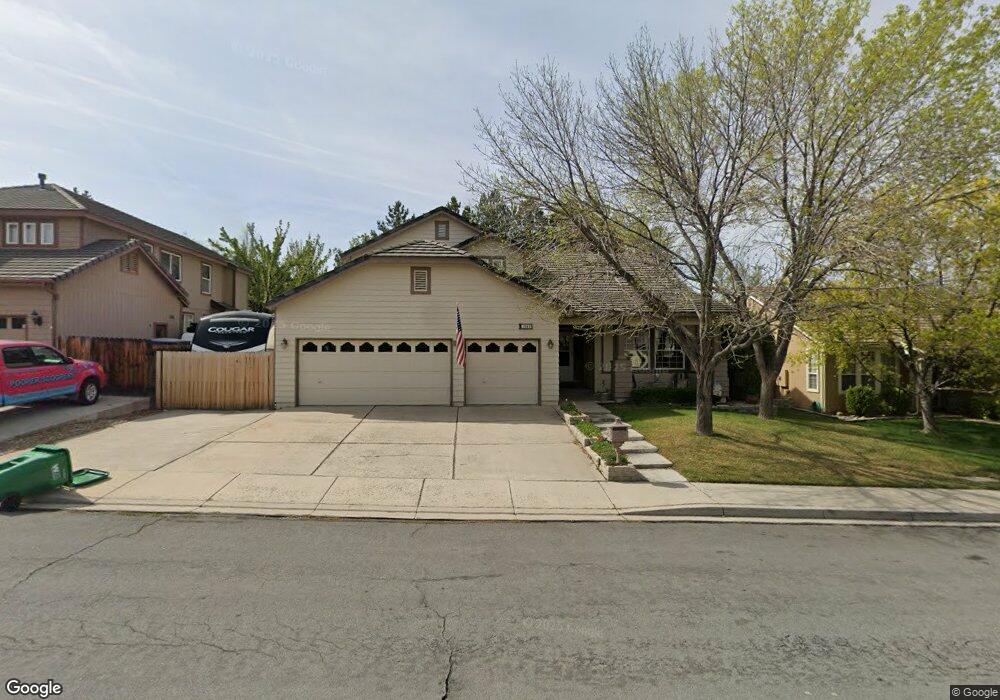
1569 Disc Dr Sparks, NV 89436
Los Altos Parkway NeighborhoodEstimated Value: $604,000 - $643,000
4
Beds
3
Baths
2,495
Sq Ft
$249/Sq Ft
Est. Value
About This Home
This home is located at 1569 Disc Dr, Sparks, NV 89436 and is currently estimated at $621,602, approximately $249 per square foot. 1569 Disc Dr is a home located in Washoe County with nearby schools including Bud Beasley Elementary School, Lou Mendive Middle School, and Edward C Reed High School.
Ownership History
Date
Name
Owned For
Owner Type
Purchase Details
Closed on
Oct 28, 1994
Sold by
Potter Hugh L and Potter Shirley A
Bought by
Potter Hugh L and Potter Shirley A
Current Estimated Value
Purchase Details
Closed on
Oct 14, 1994
Sold by
Jones Michael D and Jones Gale L
Bought by
Potter Hugh L and Potter Shirley A
Purchase Details
Closed on
May 27, 1994
Sold by
Centex Real Estate Corp
Bought by
Jones Michael D and Jones Gale L
Home Financials for this Owner
Home Financials are based on the most recent Mortgage that was taken out on this home.
Original Mortgage
$178,362
Interest Rate
8.3%
Mortgage Type
VA
Create a Home Valuation Report for This Property
The Home Valuation Report is an in-depth analysis detailing your home's value as well as a comparison with similar homes in the area
Home Values in the Area
Average Home Value in this Area
Purchase History
| Date | Buyer | Sale Price | Title Company |
|---|---|---|---|
| Potter Hugh L | -- | -- | |
| Potter Hugh L | $189,500 | Western Title Company Inc | |
| Jones Michael D | $178,500 | First Centennial Title Co |
Source: Public Records
Mortgage History
| Date | Status | Borrower | Loan Amount |
|---|---|---|---|
| Previous Owner | Jones Michael D | $178,362 |
Source: Public Records
Tax History
| Year | Tax Paid | Tax Assessment Tax Assessment Total Assessment is a certain percentage of the fair market value that is determined by local assessors to be the total taxable value of land and additions on the property. | Land | Improvement |
|---|---|---|---|---|
| 2026 | $2,520 | $123,377 | $42,560 | $80,817 |
| 2024 | $3,187 | $121,516 | $40,075 | $81,441 |
| 2023 | $3,036 | $114,535 | $38,710 | $75,825 |
| 2022 | $2,952 | $96,360 | $32,830 | $63,530 |
| 2021 | $2,760 | $87,305 | $23,835 | $63,470 |
| 2020 | $2,729 | $87,634 | $23,800 | $63,834 |
| 2019 | $2,649 | $85,680 | $24,360 | $61,320 |
| 2018 | $2,672 | $77,999 | $17,780 | $60,219 |
| 2017 | $2,594 | $76,982 | $16,450 | $60,532 |
| 2016 | $2,529 | $76,444 | $14,525 | $61,919 |
| 2015 | $2,525 | $75,476 | $12,880 | $62,596 |
| 2014 | $2,451 | $71,412 | $10,885 | $60,527 |
| 2013 | -- | $64,763 | $8,925 | $55,838 |
Source: Public Records
Map
Nearby Homes
- 4800 Frankie Way
- 4896 Treetop Rd
- 1472 Giannotti Dr
- 1522 Satellite Dr
- 1381 Laser Ct
- 1215 Ebling Dr
- 4430 Dancing Moon Ct
- 1388 Lambrays Ln
- 5216 Santa Barbara Ave
- 4455 Desert Highlands Dr
- 1716 Canyon Terrace Dr
- 1901 Canyon Ridge Dr
- 1616 Canyon Terrace Dr
- 5070 Rhine Wine Dr
- 4995 Wine Cellar Dr
- 4301 Pinnacle Vista Ct Unit 1
- 1295 Glendora Ln
- 1080 Cartago Ct
- 3988 Ella Jayne Ct Unit Lot 6
- 5385 Santa Anita Dr
- 1559 Disc Dr
- 1579 Disc Dr
- 1560 Squirreltail Dr
- 1570 Squirreltail Dr
- 1589 Disc Dr
- 1549 Disc Dr
- 1548 Squirreltail Dr
- 1580 Squirreltail Dr
- 1560 Disc Dr Unit 2
- 1570 Disc Dr
- 1580 Disc Dr
- 1539 Disc Dr
- 1540 Squirreltail Dr Unit 2
- 1597 Disc Dr
- 1590 Disc Dr
- 1550 Disc Dr Unit 2
- 1590 Squirreltail Dr
- 1532 Squirreltail Dr
- 1529 Disc Dr
- 1540 Disc Dr
Your Personal Tour Guide
Ask me questions while you tour the home.