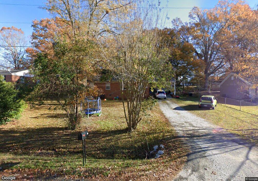
1569 Oakwood Ave Lancaster, SC 29720
Estimated Value: $148,082 - $205,000
--
Bed
2
Baths
1,232
Sq Ft
$147/Sq Ft
Est. Value
About This Home
This home is located at 1569 Oakwood Ave, Lancaster, SC 29720 and is currently estimated at $181,021, approximately $146 per square foot. 1569 Oakwood Ave is a home located in Lancaster County with nearby schools including Erwin Elementary School, South Middle School, and Lancaster High School.
Ownership History
Date
Name
Owned For
Owner Type
Purchase Details
Closed on
Jul 15, 2005
Sold by
Mcduffle Thomas H and Humphries Susan M
Bought by
Moore Kristopher and Moore Krista
Current Estimated Value
Home Financials for this Owner
Home Financials are based on the most recent Mortgage that was taken out on this home.
Original Mortgage
$15,980
Interest Rate
5.59%
Mortgage Type
Balloon
Purchase Details
Closed on
Jul 6, 2005
Sold by
Mcduffie Thomas H and Humphries Susan M
Bought by
Mcduffie Thomas H and Humphries Susan M
Home Financials for this Owner
Home Financials are based on the most recent Mortgage that was taken out on this home.
Original Mortgage
$15,980
Interest Rate
5.59%
Mortgage Type
Balloon
Create a Home Valuation Report for This Property
The Home Valuation Report is an in-depth analysis detailing your home's value as well as a comparison with similar homes in the area
Home Values in the Area
Average Home Value in this Area
Purchase History
| Date | Buyer | Sale Price | Title Company |
|---|---|---|---|
| Moore Kristopher | $79,900 | -- | |
| Mcduffie Thomas H | -- | -- |
Source: Public Records
Mortgage History
| Date | Status | Borrower | Loan Amount |
|---|---|---|---|
| Closed | Moore Kristopher | $15,980 | |
| Open | Moore Kristopher | $63,920 |
Source: Public Records
Tax History Compared to Growth
Tax History
| Year | Tax Paid | Tax Assessment Tax Assessment Total Assessment is a certain percentage of the fair market value that is determined by local assessors to be the total taxable value of land and additions on the property. | Land | Improvement |
|---|---|---|---|---|
| 2024 | $414 | $2,700 | $428 | $2,272 |
| 2023 | $413 | $2,700 | $428 | $2,272 |
| 2022 | $411 | $2,700 | $428 | $2,272 |
| 2021 | $403 | $2,700 | $428 | $2,272 |
| 2020 | $386 | $2,516 | $428 | $2,088 |
| 2019 | $852 | $2,516 | $428 | $2,088 |
| 2018 | $820 | $2,516 | $428 | $2,088 |
| 2017 | $378 | $0 | $0 | $0 |
| 2016 | $368 | $0 | $0 | $0 |
| 2015 | $311 | $0 | $0 | $0 |
| 2014 | $311 | $0 | $0 | $0 |
| 2013 | $311 | $0 | $0 | $0 |
Source: Public Records
Map
Nearby Homes
- 1428 Boxwood Ave
- 1530 Danlee Dr
- 1631 Oakdale Dr
- 1447 Carmel Rd
- 1795 Grace Ave
- 1401 Carmel Rd
- 1658 Oakdale Dr
- 1324 Mason St
- 1250 Hampton Grace Ave
- 1397 Grace Ave
- 1797 Drywood Cir
- 1746 Grace Ave Unit 1
- 1801 Grace Ave
- 1500 Victoria St Unit 4
- 1509 Victoria St Unit 13
- 1503 Victoria St
- 1501 Victoria St Unit 11
- 1817 Grace Ave
- 5.45 acres Memorial Park Rd
- 3.04 acres Memorial Park Rd
- 1579 Oakwood Ave
- 1559 Oakwood Ave
- 1592 Maplewood Ave
- 1519 Oakwood Ave
- 1523 Oakwood Ave
- 1576 Maplewood Ave
- 1600 Maplewood Ave
- 1510 Pink Dogwood Ave
- 1589 Oakwood Ave
- 1584 Oakwood Ave
- 00 State Road S-29-372
- 0 State Road S-29-372
- 1578 Oakwood Ave
- 1543 Oakwood Ave
- 1597 Oakwood Ave
- 1612 Maplewood Ave
- 1594 Oakwood Ave
- 1601 Maplewood Ave Unit 30
- 1601 Maplewood Ave
- 1579 Maplewood Ave