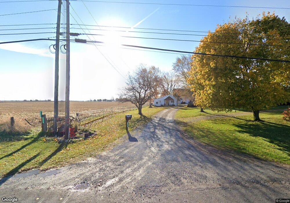
15694 State Route 67 Kenton, OH 43326
Estimated Value: $378,000 - $2,059,358
3
Beds
2
Baths
3,143
Sq Ft
$388/Sq Ft
Est. Value
About This Home
This home is located at 15694 State Route 67, Kenton, OH 43326 and is currently estimated at $1,218,679, approximately $387 per square foot. 15694 State Route 67 is a home located in Hardin County with nearby schools including Kenton Elementary School, Kenton Middle School, and Kenton High School.
Ownership History
Date
Name
Owned For
Owner Type
Purchase Details
Closed on
Apr 25, 2013
Sold by
Wyndham Berniece R
Bought by
H E Ward Farms Llc
Current Estimated Value
Purchase Details
Closed on
Jul 30, 2007
Sold by
Wydham Berniece R
Bought by
Wyndham Berniece R
Purchase Details
Closed on
Oct 8, 2001
Bought by
Wyndham Berniece R
Purchase Details
Closed on
Sep 25, 1997
Bought by
Wyndham Berniece R and Wyndham Gla
Purchase Details
Closed on
Apr 22, 1994
Bought by
Ward Gladys J
Purchase Details
Closed on
Dec 17, 1990
Create a Home Valuation Report for This Property
The Home Valuation Report is an in-depth analysis detailing your home's value as well as a comparison with similar homes in the area
Home Values in the Area
Average Home Value in this Area
Purchase History
| Date | Buyer | Sale Price | Title Company |
|---|---|---|---|
| H E Ward Farms Llc | -- | None Available | |
| Wyndham Berniece R | -- | None Available | |
| Wyndham Berniece R | -- | -- | |
| Wyndham Berniece R | -- | -- | |
| Ward Gladys J | -- | -- | |
| -- | -- | -- |
Source: Public Records
Tax History Compared to Growth
Tax History
| Year | Tax Paid | Tax Assessment Tax Assessment Total Assessment is a certain percentage of the fair market value that is determined by local assessors to be the total taxable value of land and additions on the property. | Land | Improvement |
|---|---|---|---|---|
| 2024 | $10,759 | $248,460 | $126,430 | $122,030 |
| 2023 | $10,759 | $248,460 | $126,430 | $122,030 |
| 2022 | $7,674 | $159,920 | $60,060 | $99,860 |
| 2021 | $7,755 | $161,080 | $61,220 | $99,860 |
| 2020 | $6,762 | $161,080 | $61,220 | $99,860 |
| 2019 | $7,644 | $188,960 | $106,950 | $82,010 |
| 2018 | $7,268 | $186,660 | $104,650 | $82,010 |
| 2017 | $7,076 | $186,660 | $104,650 | $82,010 |
| 2016 | $2,683 | $75,430 | $5,780 | $69,650 |
| 2015 | $2,636 | $75,430 | $5,780 | $69,650 |
| 2014 | $1,355 | $75,430 | $5,780 | $69,650 |
| 2013 | $1,315 | $78,990 | $5,780 | $73,210 |
Source: Public Records
Map
Nearby Homes
- 125 Hester St
- 460 Oriental St
- 777 Maydoll Dr
- 79 Broadway St
- 12126 Pamela Dr
- 12160 Pamela Dr
- 115 Scioto St
- 530 E Franklin St
- 618 N High St
- 513 E Franklin St
- 12535 Barbara Dr
- 215 Henry St
- 506 E Franklin St
- 324 E North St
- 416 N Cherry St
- 602 N Wayne St
- 121 S High St
- 510 Decatur St
- 233 N Main St
- 328 N Detroit St
- 15385 State Route 67
- 15385 State Route 67
- 16013 State Route 67
- 000 Sr 67 E
- 11660 Parklane Dr
- 0 Sr 67 Morningside Dr Unit 207851
- 11671 County Road 175
- 15697 Beverly Dr
- 15761 Beverly Dr
- 15799 Beverly Dr
- 15748 Beverly Dr
- 11709 County Road 175
- 11780 Lydia Ln
- 15845 Beverly Dr
- 0 Morningside Dr
- 11732 Parklane Dr
- 11797 Lydia Ln
- 11797 Lydia Ln
- 11786 Hillcrest Dr