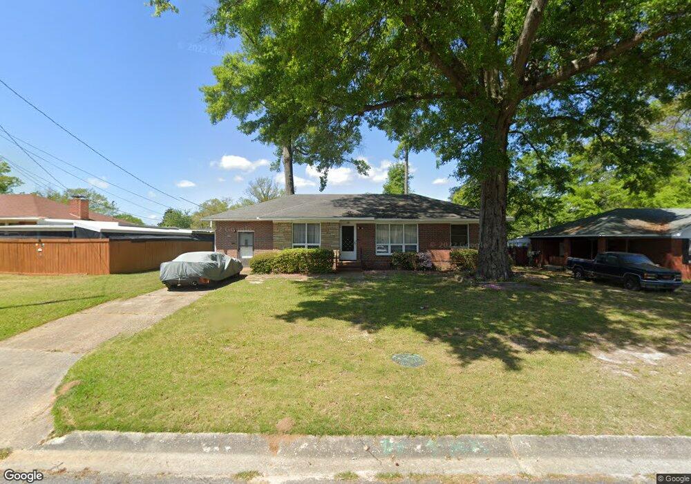
157 Bob o Link Dr Columbus, GA 31906
Eastern Columbus NeighborhoodEstimated Value: $122,000 - $144,000
3
Beds
2
Baths
1,521
Sq Ft
$88/Sq Ft
Est. Value
About This Home
This home is located at 157 Bob o Link Dr, Columbus, GA 31906 and is currently estimated at $133,479, approximately $87 per square foot. 157 Bob o Link Dr is a home located in Muscogee County with nearby schools including St. Mary's Road Magnet Academy, Baker Middle School, and Spencer High School.
Ownership History
Date
Name
Owned For
Owner Type
Purchase Details
Closed on
Aug 31, 2018
Sold by
Edwards Walter Dean
Bought by
Davis Denesha
Current Estimated Value
Home Financials for this Owner
Home Financials are based on the most recent Mortgage that was taken out on this home.
Original Mortgage
$40,499
Outstanding Balance
$35,321
Interest Rate
4.6%
Mortgage Type
New Conventional
Estimated Equity
$98,158
Purchase Details
Closed on
Aug 29, 2011
Sold by
Edwards Myrtle F
Bought by
Edwards Myrtle F and Barlow Leinda Jean
Create a Home Valuation Report for This Property
The Home Valuation Report is an in-depth analysis detailing your home's value as well as a comparison with similar homes in the area
Home Values in the Area
Average Home Value in this Area
Purchase History
| Date | Buyer | Sale Price | Title Company |
|---|---|---|---|
| Davis Denesha | $45,000 | -- | |
| Edwards Myrtle F | -- | -- |
Source: Public Records
Mortgage History
| Date | Status | Borrower | Loan Amount |
|---|---|---|---|
| Open | Davis Denesha | $40,499 |
Source: Public Records
Tax History Compared to Growth
Tax History
| Year | Tax Paid | Tax Assessment Tax Assessment Total Assessment is a certain percentage of the fair market value that is determined by local assessors to be the total taxable value of land and additions on the property. | Land | Improvement |
|---|---|---|---|---|
| 2025 | $1,733 | $44,284 | $6,320 | $37,964 |
| 2024 | $173 | $44,284 | $6,320 | $37,964 |
| 2023 | $174 | $44,284 | $6,320 | $37,964 |
| 2022 | $1,030 | $25,228 | $6,320 | $18,908 |
| 2021 | $793 | $19,424 | $6,320 | $13,104 |
| 2020 | $793 | $19,424 | $6,320 | $13,104 |
| 2019 | $737 | $18,000 | $5,840 | $12,160 |
| 2018 | $5 | $30,952 | $6,320 | $24,632 |
| 2017 | $7 | $30,952 | $6,320 | $24,632 |
| 2016 | $8 | $19,181 | $3,108 | $16,073 |
| 2015 | $4 | $19,181 | $3,108 | $16,073 |
| 2014 | $10 | $19,181 | $3,108 | $16,073 |
| 2013 | $12 | $19,181 | $3,108 | $16,073 |
Source: Public Records
Map
Nearby Homes
- 130 Sycamore Ct
- 229 N Oakley Dr
- 3589 Irwin Way
- 409 Florida Dr
- 3400 Saint Marys Rd Unit 450
- 3943 Curry St
- 3402 Montecello Dr
- 716 Benning Dr
- 4422 Pate Dr
- 4437 St Marys Rd
- 917 Fletcher Ave
- 4534 Sentry St
- 3711 Youmans St
- 810 Winston Rd
- 824 Winston Rd
- 906 Winston Rd
- 1025 Fletcher Ave
- 679 Parkchester Dr
- 4408 Ridgefield Dr
- 4516 Sims St
- 163 Bob o Link Dr
- 151 Bob o Link Dr
- 3747 Meadowlark Dr
- 164 Kingfisher Dr
- 169 Bob o Link Dr
- 168 Kingfisher Dr
- 174 Kingfisher Dr
- 3739 Meadowlark Dr
- 160 Bob o Link Dr
- 154 Bob o Link Dr
- 148 Bob o Link Dr
- 166 Bob o Link Dr
- 175 Bob o Link Dr
- 172 Bob o Link Dr
- 3752 Meadowlark Dr
- 3746 Meadowlark Dr
- 3758 Meadowlark Dr
- 180 Kingfisher Dr
- 183 Bob o Link Dr
- 3740 Meadowlark Dr