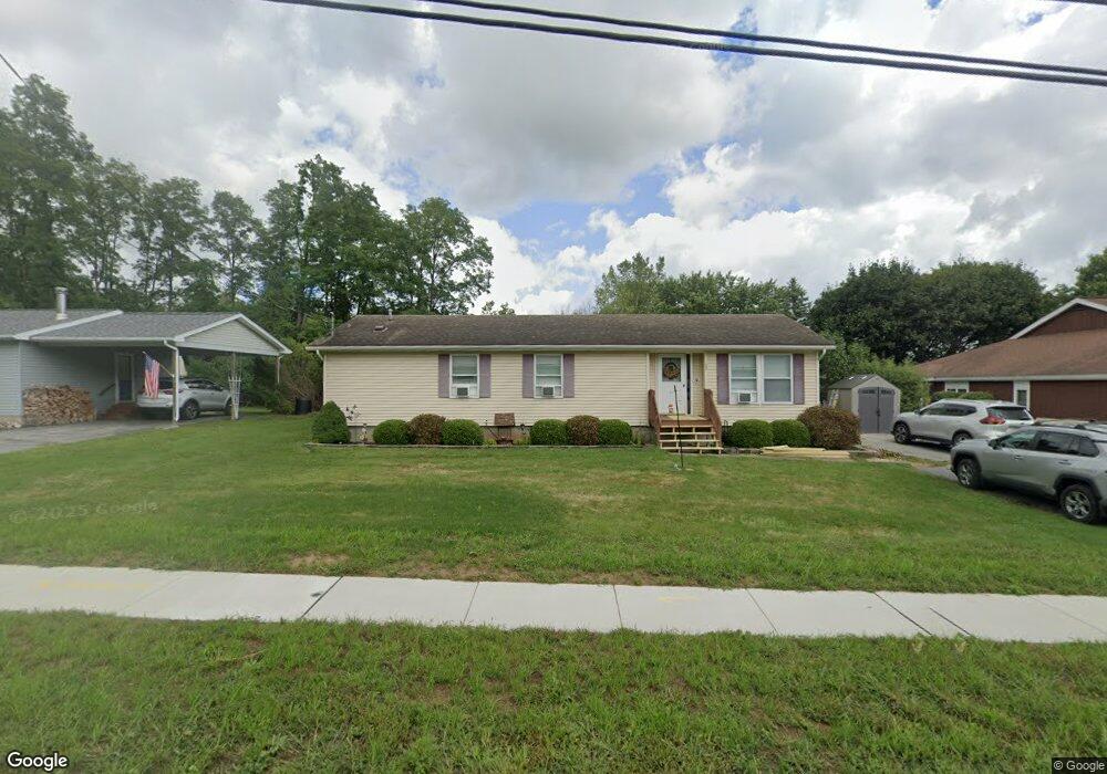
157 N Bloomfield Rd Canandaigua, NY 14424
Estimated Value: $313,000 - $356,000
3
Beds
2
Baths
1,748
Sq Ft
$192/Sq Ft
Est. Value
About This Home
This home is located at 157 N Bloomfield Rd, Canandaigua, NY 14424 and is currently estimated at $335,064, approximately $191 per square foot. 157 N Bloomfield Rd is a home located in Ontario County with nearby schools including Canandaigua Primary-Elementary School, Canandaigua Middle School, and Canandaigua Academy And Middle School.
Ownership History
Date
Name
Owned For
Owner Type
Purchase Details
Closed on
Aug 24, 2007
Current Estimated Value
Home Financials for this Owner
Home Financials are based on the most recent Mortgage that was taken out on this home.
Original Mortgage
$130,173
Outstanding Balance
$55,355
Interest Rate
6.71%
Estimated Equity
$279,709
Purchase Details
Closed on
Jun 26, 1998
Sold by
Sweet Timothy M and Dee Tracey
Bought by
Mcgovern Patricia A
Purchase Details
Closed on
Mar 1, 1995
Sold by
Andross Jay M Andross Bonnie L
Bought by
Sweet Timothy M and Sweet Tracey Dee
Create a Home Valuation Report for This Property
The Home Valuation Report is an in-depth analysis detailing your home's value as well as a comparison with similar homes in the area
Home Values in the Area
Average Home Value in this Area
Purchase History
| Date | Buyer | Sale Price | Title Company |
|---|---|---|---|
| -- | -- | -- | |
| Mcgovern Patricia A | $93,000 | -- | |
| Sweet Timothy M | $91,000 | -- |
Source: Public Records
Mortgage History
| Date | Status | Borrower | Loan Amount |
|---|---|---|---|
| Open | -- | $130,173 |
Source: Public Records
Tax History Compared to Growth
Tax History
| Year | Tax Paid | Tax Assessment Tax Assessment Total Assessment is a certain percentage of the fair market value that is determined by local assessors to be the total taxable value of land and additions on the property. | Land | Improvement |
|---|---|---|---|---|
| 2024 | $8,004 | $250,700 | $33,800 | $216,900 |
| 2023 | $3,741 | $175,000 | $28,900 | $146,100 |
| 2022 | $3,682 | $175,000 | $28,900 | $146,100 |
| 2021 | $3,788 | $175,000 | $28,900 | $146,100 |
| 2020 | $3,717 | $161,500 | $27,000 | $134,500 |
| 2019 | $4,473 | $161,500 | $27,000 | $134,500 |
| 2018 | $2,498 | $161,500 | $27,000 | $134,500 |
| 2017 | $2,523 | $161,500 | $27,000 | $134,500 |
| 2016 | $2,421 | $155,000 | $27,000 | $128,000 |
| 2015 | $2,421 | $155,000 | $27,000 | $128,000 |
| 2014 | -- | $155,000 | $27,000 | $128,000 |
Source: Public Records
Map
Nearby Homes
- 16 Keuka Ln
- 5246 Overlook Ln
- 154 W Gibson St
- 135 Deseyn Dr
- 55 Fort Hill Ave
- 104 N Main St
- 127 Park Ave
- 34 Dungan St
- 367 West Ave
- 40 Dungan St
- 0 Route 21 S Unit R1587258
- 120 Fort Hill Ave
- 182 Kennedy St
- 126 Chapin St
- 80 Chapin St
- 75 Thompson Ln
- 90 Thompson Ln
- 38 Chapin St
- 0 Cr-32 Unit R1614194
- 0 Cr-32 Unit R1614204
- 153 N Bloomfield Rd
- 163 N Bloomfield Rd
- 151 N Bloomfield Rd
- 147 N Bloomfield Rd
- 145 N Bloomfield Rd
- 168 N Bloomfield Rd
- 160 N Bloomfield Rd
- 139 N Bloomfield Rd
- 152 N Bloomfield Rd
- 182 N Bloomfield Rd
- 146 N Bloomfield Rd
- 133 N Bloomfield Rd
- 186 N Bloomfield Rd
- 2 Dorset Dr
- 6 Dorset Dr
- 132 N Bloomfield Rd
- 190 N Bloomfield Rd
- 2 Douglas Dr
- 5 Douglas Dr
- 10 Dorset Dr