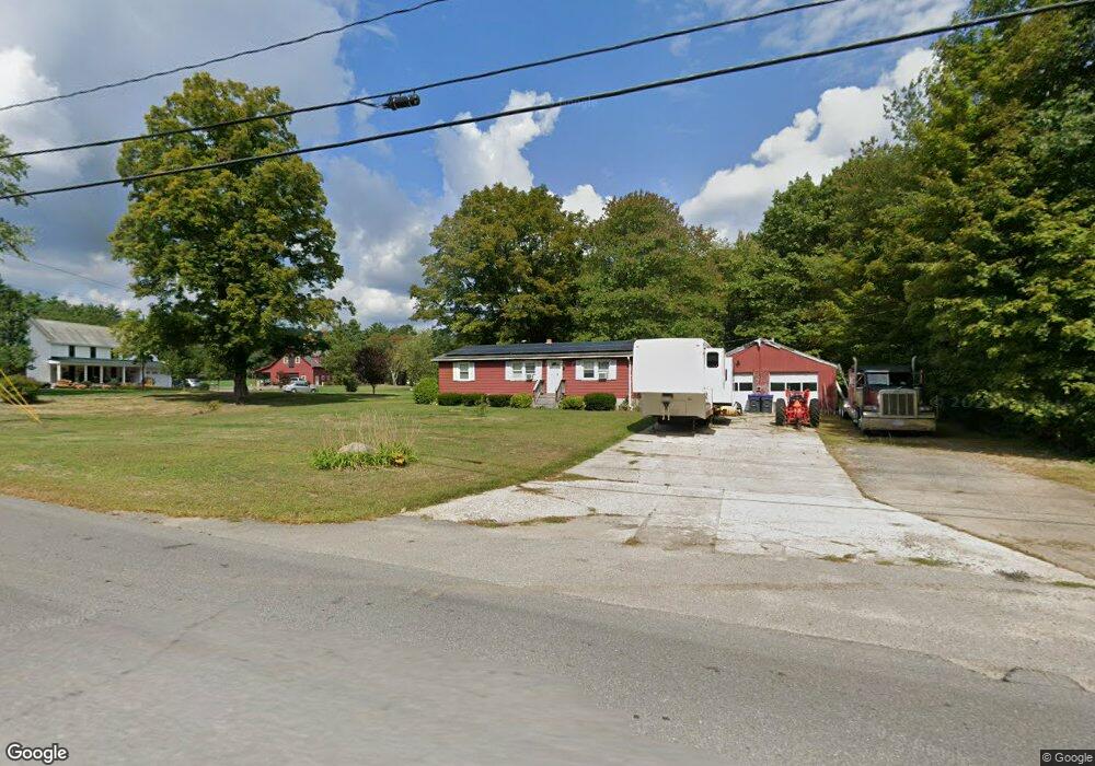
157 Page St Lunenburg, MA 01462
Estimated Value: $414,000 - $490,000
3
Beds
2
Baths
1,056
Sq Ft
$426/Sq Ft
Est. Value
About This Home
This home is located at 157 Page St, Lunenburg, MA 01462 and is currently estimated at $449,504, approximately $425 per square foot. 157 Page St is a home located in Worcester County with nearby schools including Lunenburg Primary School and Lunenburg High School.
Ownership History
Date
Name
Owned For
Owner Type
Purchase Details
Closed on
Apr 24, 2015
Sold by
Katkin Ft and Orlow Betty F
Bought by
Thompson Allyn C
Current Estimated Value
Purchase Details
Closed on
Sep 22, 2014
Sold by
Katkin Ft and Orlow Betty F
Bought by
Thompson Allyn C
Purchase Details
Closed on
Sep 6, 1996
Sold by
Katkin Thelma
Bought by
Tel New England
Purchase Details
Closed on
Feb 10, 1994
Sold by
Katkin Joseph M and Katkin Thelma
Bought by
Thompson Allyn C
Home Financials for this Owner
Home Financials are based on the most recent Mortgage that was taken out on this home.
Original Mortgage
$109,888
Interest Rate
7.08%
Mortgage Type
Purchase Money Mortgage
Purchase Details
Closed on
Feb 13, 1992
Sold by
Thompson Allyn C and Thompson Herdis
Bought by
Katkin Joseph M and Katkin Thelma M
Purchase Details
Closed on
Dec 11, 1989
Sold by
Thompson Allyn
Bought by
Beneficial Mtg Co
Create a Home Valuation Report for This Property
The Home Valuation Report is an in-depth analysis detailing your home's value as well as a comparison with similar homes in the area
Home Values in the Area
Average Home Value in this Area
Purchase History
| Date | Buyer | Sale Price | Title Company |
|---|---|---|---|
| Thompson Allyn C | -- | -- | |
| Thompson Allyn C | -- | -- | |
| Tel New England | $2,000 | -- | |
| Thompson Allyn C | $108,999 | -- | |
| Katkin Joseph M | $112,000 | -- | |
| Beneficial Mtg Co | $24,000 | -- |
Source: Public Records
Mortgage History
| Date | Status | Borrower | Loan Amount |
|---|---|---|---|
| Previous Owner | Beneficial Mtg Co | $109,888 | |
| Previous Owner | Beneficial Mtg Co | $24,000 |
Source: Public Records
Tax History Compared to Growth
Tax History
| Year | Tax Paid | Tax Assessment Tax Assessment Total Assessment is a certain percentage of the fair market value that is determined by local assessors to be the total taxable value of land and additions on the property. | Land | Improvement |
|---|---|---|---|---|
| 2025 | $5,902 | $411,000 | $162,300 | $248,700 |
| 2024 | $5,493 | $389,600 | $153,500 | $236,100 |
| 2023 | $5,415 | $370,400 | $139,300 | $231,100 |
| 2022 | $5,030 | $292,600 | $116,900 | $175,700 |
| 2020 | $4,905 | $270,700 | $116,900 | $153,800 |
| 2019 | $4,674 | $250,200 | $110,500 | $139,700 |
| 2018 | $4,427 | $224,700 | $110,100 | $114,600 |
| 2017 | $4,320 | $216,200 | $104,500 | $111,700 |
| 2016 | $4,079 | $208,000 | $99,700 | $108,300 |
| 2015 | $3,505 | $191,300 | $84,400 | $106,900 |
Source: Public Records
Map
Nearby Homes
- 330 Arbor St
- 110 Burrage St
- 166 Elmwood Rd
- 828 Lancaster Ave
- 9 Fairview Rd
- 878 Flat Hill Rd
- 35 Leominster Rd
- 29 West St
- 1790 Massachusetts Ave Unit 25
- 1790 Massachusetts Ave Unit 22
- 31 School St
- 45 Spring St
- 70 Kilburn St
- 11 Longwood Dr
- 44 Hemlock Dr
- 29 Lakeview Ave
- 659 Reservoir Rd
- 185 Hemlock Dr
- 9 Winter Hill Rd
- 6 Riley Rd Unit 6