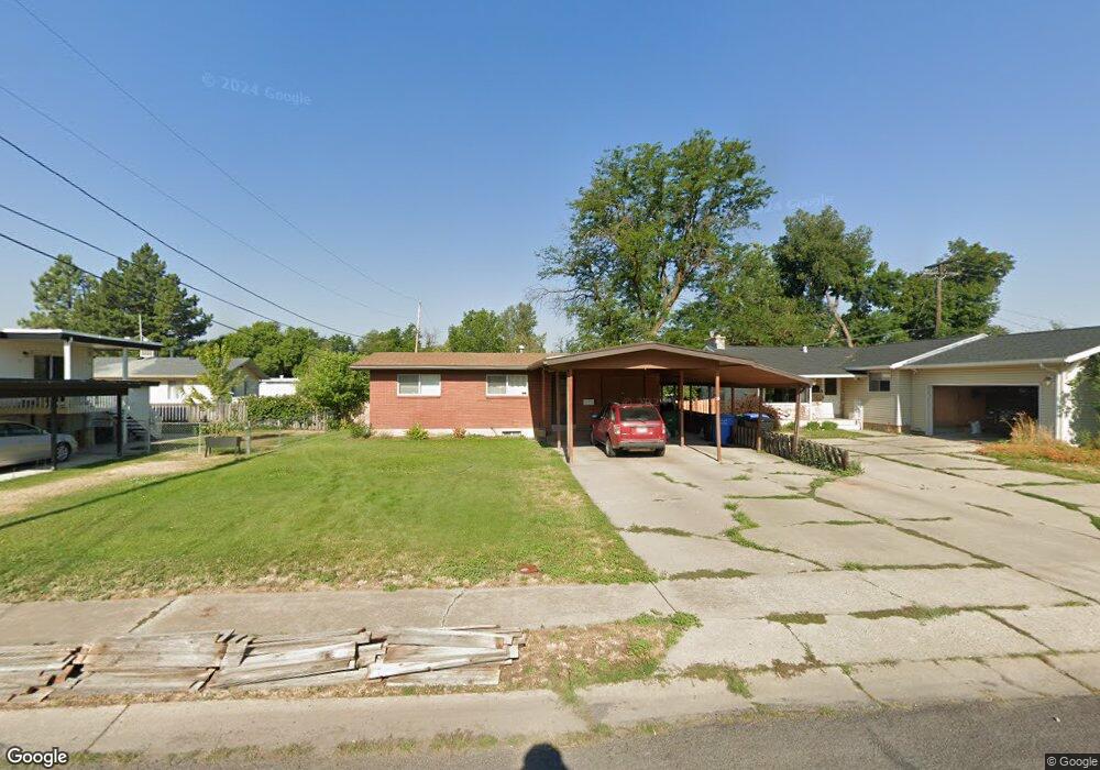
157 S 560 E Logan, UT 84321
Wilson NeighborhoodEstimated Value: $396,000 - $429,000
4
Beds
2
Baths
2,288
Sq Ft
$179/Sq Ft
Est. Value
About This Home
This home is located at 157 S 560 E, Logan, UT 84321 and is currently estimated at $409,143, approximately $178 per square foot. 157 S 560 E is a home located in Cache County with nearby schools including Wilson School, Mount Logan Middle School, and Logan High School.
Ownership History
Date
Name
Owned For
Owner Type
Purchase Details
Closed on
Mar 18, 2021
Sold by
Davis Kraig A
Bought by
Davis Kraig A and Davis Bridgette A
Current Estimated Value
Home Financials for this Owner
Home Financials are based on the most recent Mortgage that was taken out on this home.
Original Mortgage
$173,800
Outstanding Balance
$125,730
Interest Rate
2.2%
Mortgage Type
New Conventional
Estimated Equity
$283,413
Purchase Details
Closed on
Dec 14, 2017
Sold by
Kynaston Dale C
Bought by
Davis Kraig A
Home Financials for this Owner
Home Financials are based on the most recent Mortgage that was taken out on this home.
Original Mortgage
$175,750
Interest Rate
3.95%
Mortgage Type
New Conventional
Purchase Details
Closed on
Feb 12, 2016
Sold by
Fannie Mae
Bought by
Kynaston Dale C
Home Financials for this Owner
Home Financials are based on the most recent Mortgage that was taken out on this home.
Original Mortgage
$119,700
Interest Rate
3.97%
Mortgage Type
New Conventional
Purchase Details
Closed on
Nov 10, 2015
Sold by
Lauriski Robert L
Bought by
Federal National Mortgage Association
Purchase Details
Closed on
Mar 8, 2001
Sold by
Lauriski Robert L
Bought by
Lauriski Robert L
Home Financials for this Owner
Home Financials are based on the most recent Mortgage that was taken out on this home.
Original Mortgage
$64,518
Interest Rate
7.11%
Create a Home Valuation Report for This Property
The Home Valuation Report is an in-depth analysis detailing your home's value as well as a comparison with similar homes in the area
Home Values in the Area
Average Home Value in this Area
Purchase History
| Date | Buyer | Sale Price | Title Company |
|---|---|---|---|
| Davis Kraig A | -- | None Listed On Document | |
| Davis Kraig A | -- | -- | |
| Kynaston Dale C | -- | Orange Title Ins Agency | |
| Federal National Mortgage Association | $119,300 | None Available | |
| Lauriski Robert L | -- | Cache Title Company |
Source: Public Records
Mortgage History
| Date | Status | Borrower | Loan Amount |
|---|---|---|---|
| Open | Davis Kraig A | $173,800 | |
| Previous Owner | Davis Kraig A | $175,750 | |
| Previous Owner | Kynaston Dale C | $119,700 | |
| Previous Owner | Lauriski Robert L | $64,518 |
Source: Public Records
Tax History
| Year | Tax Paid | Tax Assessment Tax Assessment Total Assessment is a certain percentage of the fair market value that is determined by local assessors to be the total taxable value of land and additions on the property. | Land | Improvement |
|---|---|---|---|---|
| 2025 | $1,566 | $202,585 | $0 | $0 |
| 2024 | $1,609 | $201,595 | $0 | $0 |
| 2023 | $1,578 | $188,360 | $0 | $0 |
| 2022 | $1,689 | $188,355 | $0 | $0 |
| 2021 | $1,555 | $267,940 | $55,000 | $212,940 |
| 2020 | $1,411 | $218,800 | $55,000 | $163,800 |
| 2019 | $1,475 | $218,800 | $55,000 | $163,800 |
| 2018 | $1,098 | $148,640 | $40,000 | $108,640 |
| 2017 | $1,052 | $75,350 | $0 | $0 |
| 2016 | $1,091 | $75,350 | $0 | $0 |
| 2015 | $1,092 | $75,350 | $0 | $0 |
| 2014 | $987 | $75,350 | $0 | $0 |
| 2013 | -- | $74,005 | $0 | $0 |
Source: Public Records
Map
Nearby Homes
- 45 River Circle Dr
- 664 E Center St
- 426 E 200 S
- 381 E 300 S
- 434 River Heights Blvd
- 585 E 400 S
- 665 E 400 S
- 70 River Pointe Dr
- 28 River Pointe Dr
- 242 S 200 E
- 227 N 400 E
- 684 Apple Dr
- 1164 E Mountain Rd
- 622 Canyon Rd
- 33 N 200 E
- 141 E 200 S
- 503 750 E Unit 31
- 540 750 E Unit 41
- 550 750 E Unit 40
- 429 750 E Unit 25
Your Personal Tour Guide
Ask me questions while you tour the home.