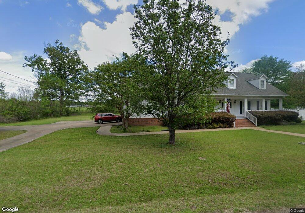
1570 Hickory Ridge Dr West Point, MS 39773
Estimated Value: $184,000 - $325,000
3
Beds
--
Bath
3,080
Sq Ft
$89/Sq Ft
Est. Value
About This Home
This home is located at 1570 Hickory Ridge Dr, West Point, MS 39773 and is currently estimated at $273,801, approximately $88 per square foot. 1570 Hickory Ridge Dr is a home located in Clay County with nearby schools including East Side Elementary School, West Clay Elementary School, and Church Hill Elementary School.
Ownership History
Date
Name
Owned For
Owner Type
Purchase Details
Closed on
Sep 28, 2017
Sold by
Secretary Housing Urban Development
Bought by
Richard Darrell D and Richard Yvonne
Current Estimated Value
Create a Home Valuation Report for This Property
The Home Valuation Report is an in-depth analysis detailing your home's value as well as a comparison with similar homes in the area
Home Values in the Area
Average Home Value in this Area
Purchase History
| Date | Buyer | Sale Price | Title Company |
|---|---|---|---|
| Richard Darrell D | -- | -- |
Source: Public Records
Tax History Compared to Growth
Tax History
| Year | Tax Paid | Tax Assessment Tax Assessment Total Assessment is a certain percentage of the fair market value that is determined by local assessors to be the total taxable value of land and additions on the property. | Land | Improvement |
|---|---|---|---|---|
| 2024 | -- | $20,382 | $1,500 | $18,882 |
| 2023 | $2,859 | $21,339 | $1,500 | $19,839 |
| 2022 | $1,013 | $21,339 | $1,500 | $19,839 |
| 2021 | $1,010 | $21,339 | $1,500 | $19,839 |
| 2020 | $1,010 | $21,339 | $1,500 | $19,839 |
| 2019 | $944 | $21,159 | $1,500 | $19,659 |
| 2018 | $898 | $21,159 | $1,500 | $19,659 |
| 2017 | $898 | $21,159 | $1,500 | $19,659 |
| 2016 | $858 | $21,159 | $1,500 | $19,659 |
| 2015 | $798 | $19,235 | $1,500 | $17,735 |
| 2014 | $722 | $19,235 | $1,500 | $17,735 |
| 2013 | $722 | $19,235 | $1,500 | $17,735 |
Source: Public Records
Map
Nearby Homes
- 164 Belvedere Ave
- 278 Converse Dr
- 27445 E Main St
- 329 Converse Dr
- 1124 N Eshman Ave
- 472 S Eshman Ave
- 44 Torbert Dr
- 1046 E Brame Ave
- 1180 E Broad St
- 27045 E Main St
- 1153 E Broad St
- 26596 E Main St
- 551 E Westbrook St
- 1104 E Broad St
- 15 David St
- 485 E Westbrook St
- 480 E Westbrook St
- 3986 E Church Hill Rd
- 479 E Westbrook St
- 389 Mapleview Rd
- 1550 Hickory Ridge Dr
- 615 Walter Wells Rd
- 536 Walter Wells Rd
- 94 Walter Wells Rd
- 153 Walter Wells Rd
- 303 Walter Wells Rd
- 1505 Hickory Ridge Dr
- 27944 E Main St
- 2073 E Main St
- 2113 E Main St
- 1762 E Main St
- 2066 E Main St
- 43 Hickory Ridge Dr
- 1500 Hickory Ridge Dr
- 1510 Hickory Ridge Dr
- 1520 Hickory Ridge Dr
- 27797 E Main St
- 122 N Jackson St
- 28122 E Main St
- 1320 E Main St