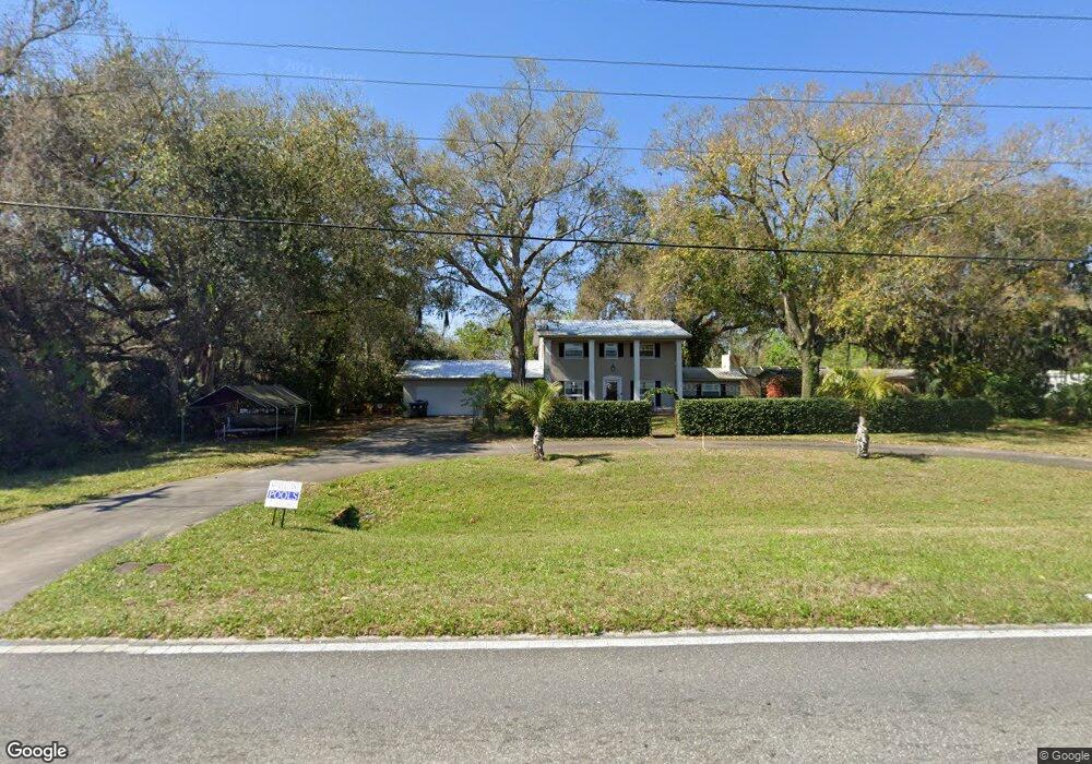
1570 N Singleton Ave Titusville, FL 32796
Estimated Value: $315,000 - $382,000
3
Beds
2
Baths
1,876
Sq Ft
$187/Sq Ft
Est. Value
About This Home
This home is located at 1570 N Singleton Ave, Titusville, FL 32796 and is currently estimated at $350,748, approximately $186 per square foot. 1570 N Singleton Ave is a home located in Brevard County with nearby schools including Oak Park Elementary School, James Madison Middle School, and Astronaut High School.
Ownership History
Date
Name
Owned For
Owner Type
Purchase Details
Closed on
Aug 30, 2002
Sold by
Ritenhouse Bernard D and Ritenhouse Jane K
Bought by
Nidy Keith and Nidy Kelly M
Current Estimated Value
Home Financials for this Owner
Home Financials are based on the most recent Mortgage that was taken out on this home.
Original Mortgage
$83,000
Outstanding Balance
$34,849
Interest Rate
6.31%
Mortgage Type
Purchase Money Mortgage
Estimated Equity
$315,899
Purchase Details
Closed on
Feb 14, 1994
Sold by
Johnson J Frank and Johnson Jeanette N
Bought by
Loud Saslow Robert E and Loud Saslow Martha
Home Financials for this Owner
Home Financials are based on the most recent Mortgage that was taken out on this home.
Original Mortgage
$87,720
Interest Rate
8.51%
Create a Home Valuation Report for This Property
The Home Valuation Report is an in-depth analysis detailing your home's value as well as a comparison with similar homes in the area
Home Values in the Area
Average Home Value in this Area
Purchase History
| Date | Buyer | Sale Price | Title Company |
|---|---|---|---|
| Nidy Keith | $103,800 | -- | |
| Loud Saslow Robert E | $86,000 | -- |
Source: Public Records
Mortgage History
| Date | Status | Borrower | Loan Amount |
|---|---|---|---|
| Open | Nidy Keith | $83,000 | |
| Previous Owner | Loud Saslow Robert E | $87,720 |
Source: Public Records
Tax History Compared to Growth
Tax History
| Year | Tax Paid | Tax Assessment Tax Assessment Total Assessment is a certain percentage of the fair market value that is determined by local assessors to be the total taxable value of land and additions on the property. | Land | Improvement |
|---|---|---|---|---|
| 2025 | $2,116 | $154,280 | -- | -- |
| 2024 | $2,066 | $149,940 | -- | -- |
| 2023 | $2,066 | $145,580 | $0 | $0 |
| 2022 | $1,920 | $141,340 | $0 | $0 |
| 2021 | $943 | $84,000 | $0 | $0 |
| 2020 | $935 | $82,850 | $0 | $0 |
| 2019 | $933 | $80,990 | $0 | $0 |
| 2018 | $922 | $79,350 | $0 | $0 |
| 2017 | $905 | $77,720 | $0 | $0 |
| 2016 | $806 | $76,130 | $18,000 | $58,130 |
| 2015 | $827 | $75,610 | $18,000 | $57,610 |
| 2014 | $818 | $75,010 | $18,000 | $57,010 |
Source: Public Records
Map
Nearby Homes
- 0000 N Singleton Ave
- 3514 Dairy Rd Unit 10
- 3538 Dairy Rd Unit 4
- 1675 Ashwood Ave
- 3105 Diamond Rd
- 1569 Liberty Tree Rd
- 0 Westwood Dr
- 1336 Wilderness Ln
- 1541 Wakefield Terrace
- 3920 Dairy Rd
- 3340 Marshall St
- 1775 Cowan Dr
- 1625 Privateer Dr
- 1155 N Singleton Ave
- 2810 Briarwood Ln
- 3669 Valley Forge Dr
- 1528 W Powder Horn Rd
- 1550 Old Dixie Hwy
- 1148 N Singleton Ave
- 3010 Kirby Dr
- 1586 N Singleton Ave
- 1590 N Singleton Ave
- 3285 Ellen Dr
- 1616 N Singleton Ave
- 3245 Ellen Dr
- 1617 N Singleton Ave
- 3235 Ellen Dr
- 1561 N Singleton Ave
- 1630 N Singleton Ave
- 1618 Rice Ave
- 1540 N Singleton Ave
- 1623 N Singleton Ave
- 3195 Ellen Dr
- 1545 N Singleton Ave
- 1624 Rice Ave
- 1629 N Singleton Ave
- 3185 Ellen Dr
- 3190 Ellen Dr
- 1630 Rice Ave
- 1640 N Singleton Ave