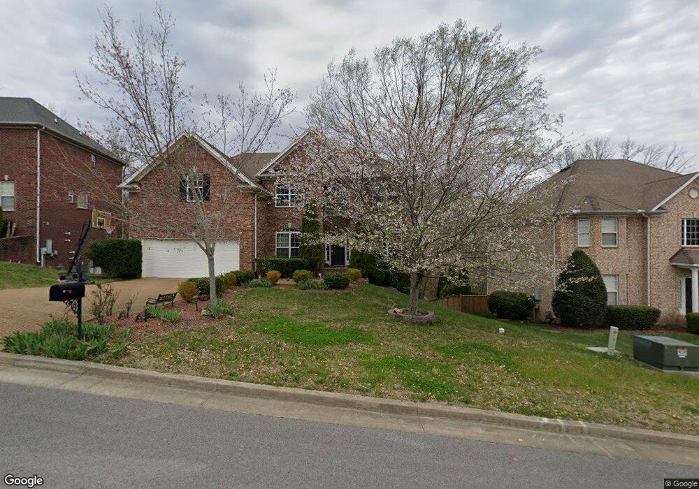
1570 Red Oak Ln Brentwood, TN 37027
Estimated Value: $923,411 - $1,104,000
--
Bed
4
Baths
3,245
Sq Ft
$318/Sq Ft
Est. Value
About This Home
This home is located at 1570 Red Oak Ln, Brentwood, TN 37027 and is currently estimated at $1,032,353, approximately $318 per square foot. 1570 Red Oak Ln is a home located in Williamson County with nearby schools including Edmondson Elementary School, Brentwood Middle School, and Brentwood High School.
Ownership History
Date
Name
Owned For
Owner Type
Purchase Details
Closed on
Oct 27, 2009
Sold by
Erskine William R and Erskine Natalie A
Bought by
Shi Yaping and Zhao Zhiguo
Current Estimated Value
Home Financials for this Owner
Home Financials are based on the most recent Mortgage that was taken out on this home.
Original Mortgage
$41,500
Interest Rate
5.25%
Mortgage Type
Credit Line Revolving
Purchase Details
Closed on
Aug 17, 2006
Sold by
Prescott Builders Llc
Bought by
Erskine William R and Erskine Natalie A
Home Financials for this Owner
Home Financials are based on the most recent Mortgage that was taken out on this home.
Original Mortgage
$48,785
Interest Rate
6.4%
Mortgage Type
Stand Alone Second
Create a Home Valuation Report for This Property
The Home Valuation Report is an in-depth analysis detailing your home's value as well as a comparison with similar homes in the area
Home Values in the Area
Average Home Value in this Area
Purchase History
| Date | Buyer | Sale Price | Title Company |
|---|---|---|---|
| Shi Yaping | $420,000 | None Available | |
| Erskine William R | $487,850 | None Available |
Source: Public Records
Mortgage History
| Date | Status | Borrower | Loan Amount |
|---|---|---|---|
| Closed | Shi Yaping | $41,500 | |
| Open | Shi Yaping | $336,000 | |
| Previous Owner | Erskine William R | $48,785 | |
| Previous Owner | Erskine William R | $390,280 |
Source: Public Records
Tax History Compared to Growth
Tax History
| Year | Tax Paid | Tax Assessment Tax Assessment Total Assessment is a certain percentage of the fair market value that is determined by local assessors to be the total taxable value of land and additions on the property. | Land | Improvement |
|---|---|---|---|---|
| 2025 | $3,526 | $263,425 | $55,000 | $208,425 |
| 2024 | $3,526 | $162,475 | $27,500 | $134,975 |
| 2023 | $3,526 | $162,475 | $27,500 | $134,975 |
| 2022 | $3,526 | $162,475 | $27,500 | $134,975 |
| 2021 | $3,526 | $162,475 | $27,500 | $134,975 |
| 2020 | $3,475 | $134,700 | $25,000 | $109,700 |
| 2019 | $3,475 | $134,700 | $25,000 | $109,700 |
| 2018 | $3,381 | $134,700 | $25,000 | $109,700 |
| 2017 | $3,354 | $134,700 | $25,000 | $109,700 |
| 2016 | $0 | $134,700 | $25,000 | $109,700 |
| 2015 | -- | $110,550 | $22,500 | $88,050 |
| 2014 | $486 | $110,550 | $22,500 | $88,050 |
Source: Public Records
Map
Nearby Homes
- 1239 Buckhead Dr
- 1542 Red Oak Ln
- 333 Shadow Creek Dr
- 602 Firefox Dr
- 415 Enclave Ct
- 1329 Chestnut Dr
- 9508 Eldwick Dr
- 1081 Sunset Rd
- 750 Sunnybrook Ct
- 6961 Stone Run Dr
- 817 Holt Grove Ct
- 821 Holt Grove Ct
- 7117 Holt Run Dr
- 1520 Simpson Ct
- 7137 Holt Run Dr
- 6948 Stone Run Dr
- 9634 Brunswick Dr
- 1308 Beech Hollow Dr
- 351 Childe Harolds Cir
- 9619 Deer Track Ct
- 1572 Red Oak Ln
- 1568 Red Oak Ln
- 1574 Red Oak Ln
- 1571 Red Oak Ln
- 1569 Red Oak Ln
- 1573 Red Oak Ln
- 1576 Red Oak Ln
- 1565 Red Oak Ln
- 1575 Red Oak Ln
- 1564 Red Oak Ln
- 1577 Red Oak Ln
- 1562 Red Oak Ln
- 1561 Red Oak Ln
- 1225 Buckhead Dr
- 1221 Buckhead Dr
- 1227 Buckhead Dr
- 1219 Buckhead Dr
- 107 Breaker Cir
- 1231 Buckhead Dr
- 1560 Red Oak Ln