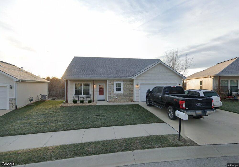
1570 S Park D Dr Tonganoxie, KS 66086
Estimated Value: $252,000 - $280,156
2
Beds
2
Baths
1,106
Sq Ft
$245/Sq Ft
Est. Value
About This Home
This home is located at 1570 S Park D Dr, Tonganoxie, KS 66086 and is currently estimated at $270,789, approximately $244 per square foot. 1570 S Park D Dr is a home located in Leavenworth County with nearby schools including Tonganoxie Elementary School, Tonganoxie Middle School, and Tonganoxie High School.
Ownership History
Date
Name
Owned For
Owner Type
Purchase Details
Closed on
Nov 14, 2024
Sold by
Houser Cynthia Gay and Houser Mark Stephen
Bought by
Shepek Lawrence M and Shepek Kathleen Ruth
Current Estimated Value
Purchase Details
Closed on
Apr 13, 2021
Sold by
Norwich Jody Anders
Bought by
Norwich Jody Anders and Schneweis Kelly
Purchase Details
Closed on
Dec 15, 2020
Sold by
Cover Property & Management Inc
Bought by
Norwich Jody
Purchase Details
Closed on
Feb 19, 2020
Sold by
Cover Development Inc
Bought by
Cover Property & Mgmt Inc
Home Financials for this Owner
Home Financials are based on the most recent Mortgage that was taken out on this home.
Original Mortgage
$182,674
Interest Rate
3.6%
Mortgage Type
Construction
Purchase Details
Closed on
Jul 29, 2011
Sold by
Himpel Holdings Llc
Bought by
Cover Development Inc
Create a Home Valuation Report for This Property
The Home Valuation Report is an in-depth analysis detailing your home's value as well as a comparison with similar homes in the area
Home Values in the Area
Average Home Value in this Area
Purchase History
| Date | Buyer | Sale Price | Title Company |
|---|---|---|---|
| Shepek Lawrence M | -- | Continental Title | |
| Shepek Lawrence M | -- | Continental Title | |
| Norwich Jody Anders | -- | None Listed On Document | |
| Norwich Jody | -- | Continental Title | |
| Cover Property & Mgmt Inc | -- | Continental Title | |
| Cover Development Inc | -- | -- |
Source: Public Records
Mortgage History
| Date | Status | Borrower | Loan Amount |
|---|---|---|---|
| Previous Owner | Cover Property & Mgmt Inc | $182,674 |
Source: Public Records
Tax History Compared to Growth
Tax History
| Year | Tax Paid | Tax Assessment Tax Assessment Total Assessment is a certain percentage of the fair market value that is determined by local assessors to be the total taxable value of land and additions on the property. | Land | Improvement |
|---|---|---|---|---|
| 2025 | $4,212 | $31,626 | $2,772 | $28,854 |
| 2024 | $4,212 | $30,475 | $2,937 | $27,538 |
| 2023 | $4,212 | $30,210 | $2,823 | $27,387 |
| 2022 | $4,015 | $28,290 | $2,533 | $25,757 |
| 2021 | $4,015 | $26,921 | $2,533 | $24,388 |
| 2020 | $363 | $2,400 | $2,400 | $0 |
| 2019 | $102 | $682 | $682 | $0 |
| 2018 | $102 | $682 | $682 | $0 |
| 2017 | $102 | $682 | $682 | $0 |
| 2016 | $102 | $682 | $682 | $0 |
| 2015 | -- | $682 | $682 | $0 |
| 2014 | -- | $606 | $606 | $0 |
Source: Public Records
Map
Nearby Homes
- 1791 S Park Dr
- 1870 Fall Creek Dr
- 118 S Village St
- 1745 Finch Dr
- 290 Rawlings Dr
- 1950 Jackson Dr
- 111 N McGee St
- 122 S McGee St
- 1940 E Finch Dr
- 2470 Woodfield Dr
- 2102 Brook Ridge Cir
- 2133 Brook Ridge Cir
- 2100 Rock Creek Dr
- RC Greenfield Plan at Stone Creek
- RC Keswick Plan at Stone Creek
- RC Mitchell Plan at Stone Creek
- RC Baltimore Plan at Stone Creek
- RC Cooper Plan at Stone Creek
- RC Armstrong Plan at Stone Creek
- RC Bridgeport Plan at Stone Creek
- 1580 S Park Dr
- 1560 S Park Dr
- 1610 S Park Dr
- 1550 Fall Creek Dr
- 1580 Fall Creek Dr
- 1620 S Park Dr
- 1540 Fall Creek Dr
- 1590 Fall Creek Dr
- 1530 Fall Creek Dr
- 1630 S Park Dr
- 1600 Fall Creek Dr
- 1561 Fall Creek Dr
- 1551 Fall Creek Dr
- 1571 Fall Creek Dr
- 1721 S Park Dr
- 1541 Fall Creek Dr
- 1581 Fall Creek Dr
- 1520 Fall Creek Dr
- 1591 Fall Creek Dr
- 1640 S Park Dr