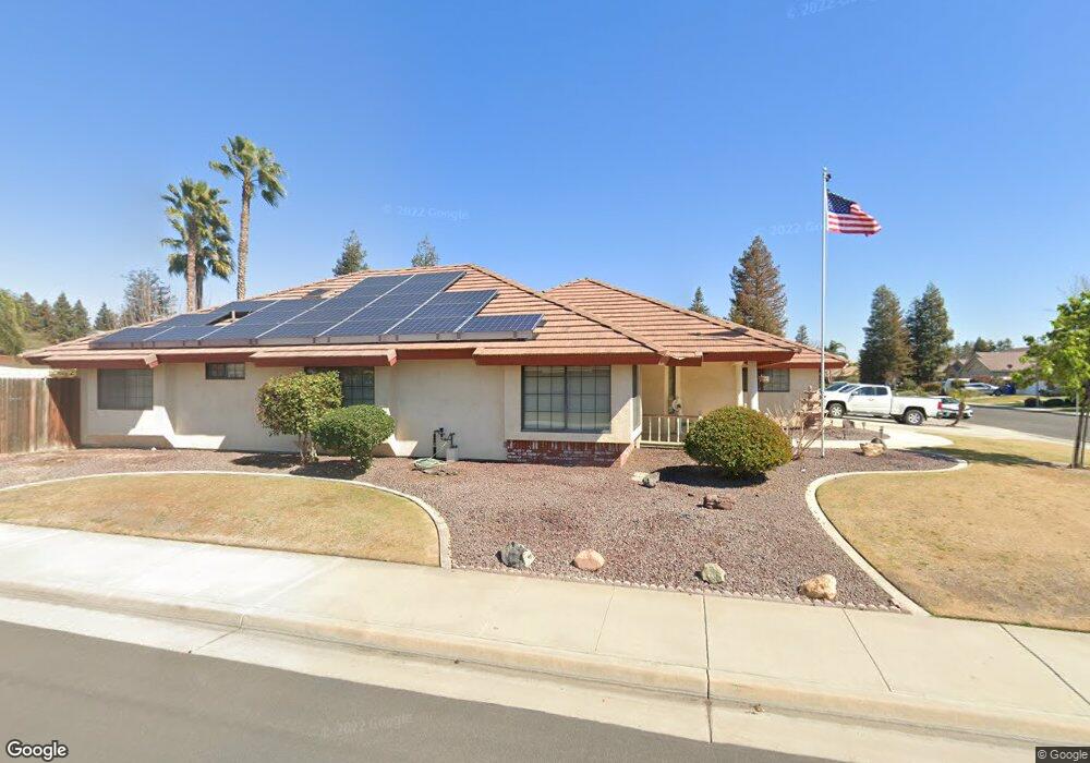
15702 Sammie Ave Unit 2 Bakersfield, CA 93314
Estimated Value: $474,000 - $508,000
3
Beds
2
Baths
2,007
Sq Ft
$244/Sq Ft
Est. Value
About This Home
This home is located at 15702 Sammie Ave Unit 2, Bakersfield, CA 93314 and is currently estimated at $489,513, approximately $243 per square foot. 15702 Sammie Ave Unit 2 is a home located in Kern County with nearby schools including Centennial Elementary School, Rosedale Middle School, and Liberty High School.
Ownership History
Date
Name
Owned For
Owner Type
Purchase Details
Closed on
Oct 6, 2011
Sold by
Childress H E and Childress L P
Bought by
Childress Harold Eugene and Childress Phyllis Louise
Current Estimated Value
Purchase Details
Closed on
Jul 18, 1995
Sold by
Rick Mclaughlin Construction Inc
Bought by
Childress H E and Childress L P
Purchase Details
Closed on
Aug 15, 1994
Sold by
Epco Ventures Ltd
Bought by
Rick Mclaughlin Construction Inc
Create a Home Valuation Report for This Property
The Home Valuation Report is an in-depth analysis detailing your home's value as well as a comparison with similar homes in the area
Home Values in the Area
Average Home Value in this Area
Purchase History
| Date | Buyer | Sale Price | Title Company |
|---|---|---|---|
| Childress Harold Eugene | -- | None Available | |
| Childress H E | $129,500 | Heritage Title | |
| Rick Mclaughlin Construction Inc | $30,000 | First American Title Ins Co |
Source: Public Records
Tax History Compared to Growth
Tax History
| Year | Tax Paid | Tax Assessment Tax Assessment Total Assessment is a certain percentage of the fair market value that is determined by local assessors to be the total taxable value of land and additions on the property. | Land | Improvement |
|---|---|---|---|---|
| 2025 | $2,041 | $77,855 | $23,901 | $53,954 |
| 2024 | $1,980 | $76,330 | $23,433 | $52,897 |
| 2023 | $1,980 | $74,834 | $22,974 | $51,860 |
| 2022 | $1,902 | $73,368 | $22,524 | $50,844 |
| 2021 | $1,802 | $71,931 | $22,083 | $49,848 |
| 2020 | $1,740 | $71,194 | $21,857 | $49,337 |
| 2019 | $1,705 | $71,194 | $21,857 | $49,337 |
| 2018 | $1,658 | $68,431 | $21,009 | $47,422 |
| 2017 | $1,620 | $67,091 | $20,598 | $46,493 |
| 2016 | $1,517 | $65,777 | $20,195 | $45,582 |
| 2015 | $1,490 | $64,790 | $19,892 | $44,898 |
| 2014 | $1,453 | $63,522 | $19,503 | $44,019 |
Source: Public Records
Map
Nearby Homes
- 15626 Sammie Ave
- 15803 Screaming Eagle Ave
- 2539 Marva Marie Ct
- 15321 Lake Berryessa Ct
- 15708 Joseph Phelps Ave
- 15733 Joseph Phelps Ave
- 15042 Championship Way
- 15027 Henderson Ave
- Plan 2029 at Northpoint
- Plan 2281 at Northpoint
- Plan 2141 at Northpoint
- Plan 1698 at Northpoint
- Plan 2998 at Northpoint
- Plan 2659 at Northpoint
- Plan 2038 at Northpoint
- 14942 Championship Way
- 14912 Henderson Ave
- 8317 Littleton St
- 15427 Chateau Montelena Dr
- 15357 Chateau Montelena Dr
- 15701 Clarisse St
- 15718 Sammie Ave
- 15627 Clarisse St
- 15616 Sammie Ave
- 15703 Sammie Ave
- 15717 Clarisse St
- 15619 Clarisse St
- 15627 Sammie Ave
- 15726 Sammie Ave Unit 2
- 15608 Sammie Ave
- 2119 Jared St
- 15619 Sammie Ave
- 15725 Clarisse St
- 15611 Clarisse St
- 15727 Sammie Ave
- 15611 Sammie Ave
- 15800 Sammie Ave
- 15602 Sammie Ave
- 15702 Stephenie St
- 15708 Clarisse St