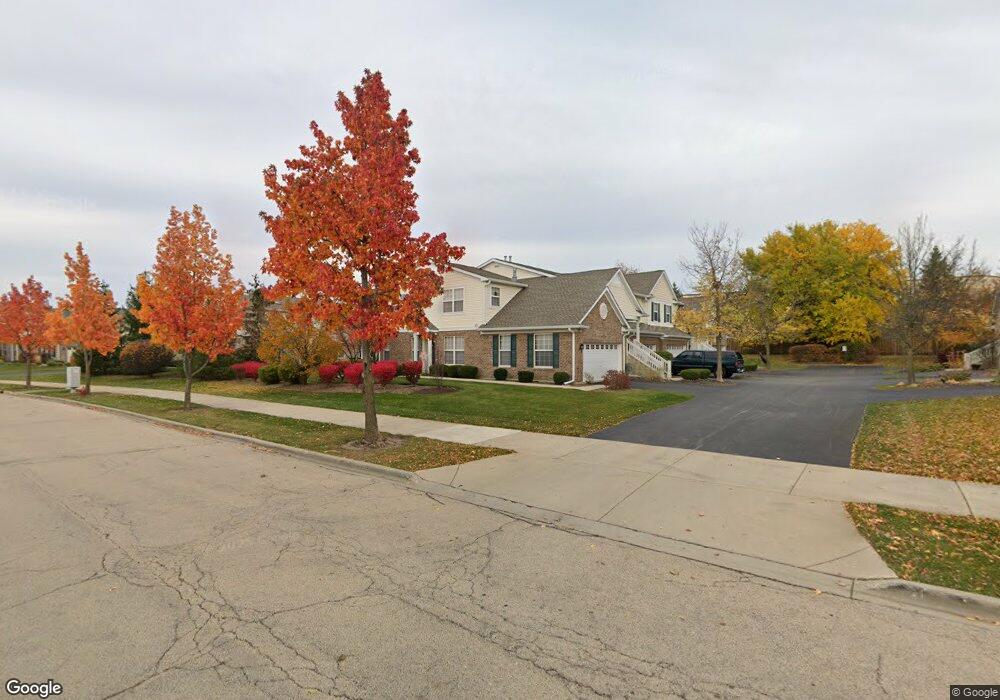
1571 Millbrook Dr Unit 1 Algonquin, IL 60102
Far West Algonquin NeighborhoodEstimated Value: $256,258 - $287,000
2
Beds
2
Baths
1,324
Sq Ft
$210/Sq Ft
Est. Value
About This Home
This home is located at 1571 Millbrook Dr Unit 1, Algonquin, IL 60102 and is currently estimated at $278,565, approximately $210 per square foot. 1571 Millbrook Dr Unit 1 is a home located in Kane County with nearby schools including Westfield Community School, Lincoln Prairie Elementary School, and Harry D Jacobs High School.
Ownership History
Date
Name
Owned For
Owner Type
Purchase Details
Closed on
Mar 12, 2009
Sold by
Irwin Union Bank & Trust Company
Bought by
Brendel Carolyn S
Current Estimated Value
Home Financials for this Owner
Home Financials are based on the most recent Mortgage that was taken out on this home.
Original Mortgage
$142,348
Outstanding Balance
$90,418
Interest Rate
5.11%
Mortgage Type
FHA
Estimated Equity
$188,147
Purchase Details
Closed on
Feb 8, 2008
Sold by
Nusseir Kami
Bought by
Irwin Union Bank & Trust Company
Purchase Details
Closed on
Jun 1, 2006
Sold by
Centex Homes
Bought by
Nusseir Rami
Home Financials for this Owner
Home Financials are based on the most recent Mortgage that was taken out on this home.
Original Mortgage
$122,655
Interest Rate
6.72%
Mortgage Type
Purchase Money Mortgage
Create a Home Valuation Report for This Property
The Home Valuation Report is an in-depth analysis detailing your home's value as well as a comparison with similar homes in the area
Home Values in the Area
Average Home Value in this Area
Purchase History
| Date | Buyer | Sale Price | Title Company |
|---|---|---|---|
| Brendel Carolyn S | $145,000 | Chicago Title Insurance Co | |
| Irwin Union Bank & Trust Company | -- | Chicago Title Insurance Co | |
| Nusseir Rami | $189,000 | Chicago Title Insurance Co |
Source: Public Records
Mortgage History
| Date | Status | Borrower | Loan Amount |
|---|---|---|---|
| Open | Brendel Carolyn S | $142,348 | |
| Previous Owner | Nusseir Rami | $122,655 |
Source: Public Records
Tax History
| Year | Tax Paid | Tax Assessment Tax Assessment Total Assessment is a certain percentage of the fair market value that is determined by local assessors to be the total taxable value of land and additions on the property. | Land | Improvement |
|---|---|---|---|---|
| 2024 | $1,659 | $73,069 | $8,371 | $64,698 |
| 2023 | $1,776 | $65,745 | $7,532 | $58,213 |
| 2022 | $2,241 | $62,640 | $7,532 | $55,108 |
| 2021 | $2,312 | $59,145 | $7,112 | $52,033 |
| 2020 | $2,323 | $57,815 | $6,952 | $50,863 |
| 2019 | $2,381 | $54,885 | $6,600 | $48,285 |
| 2018 | $3,445 | $48,367 | $6,469 | $41,898 |
| 2017 | $3,256 | $45,245 | $6,051 | $39,194 |
| 2016 | $3,313 | $43,808 | $5,859 | $37,949 |
| 2015 | -- | $38,891 | $5,490 | $33,401 |
| 2014 | -- | $37,817 | $5,338 | $32,479 |
| 2013 | -- | $38,974 | $5,501 | $33,473 |
Source: Public Records
Map
Nearby Homes
- 2612 Loren Ln Unit 293
- 0 Boyer Rd Unit MRD11328255
- 2930 Harnish Dr
- 895 Eineke Blvd
- 2069 Peach Tree Ln Unit 4116
- 1900 Waverly Ln
- 20 Peach Tree Ct Unit 4153
- 18 Peach Tree Ct Unit 4154
- 2051 Carlisle St
- 2601 Harnish Dr
- 1239 Glenmont St
- 1141 Glenmont St
- 2660 Harnish Dr
- 1020 Glenmont St
- 1262 Glenmont St
- 1264 Glenmont St
- 1221 Glenmont St
- 1256 Glenmont St
- 1090 Glenmont St
- 1247 Glenmont St
- 1571 Millbrook Dr Unit 151
- 1573 Millbrook Dr Unit 2
- 1575 Millbrook Dr Unit 3
- 1577 Millbrook Dr Unit 4
- 1563 Millbrook Dr Unit 3
- 1565 Millbrook Dr Unit 2
- 1561 Millbrook Dr Unit 164
- 1567 Millbrook Dr Unit 1
- 1567 Millbrook Dr Unit 1567
- 1583 Millbrook Dr Unit 3
- 1585 Millbrook Dr Unit 142
- 1587 Millbrook Dr Unit 1
- 1587 Millbrook Dr Unit 1587
- 1581 Millbrook Dr Unit 4
- 1562 Millbrook Dr Unit 3
- 1564 Millbrook Dr Unit 2
- 1566 Millbrook Dr Unit 1
- 1555 Millbrook Dr Unit 3
- 1593 Millbrook Dr Unit 2
- 1597 Millbrook Dr Unit 4
Your Personal Tour Guide
Ask me questions while you tour the home.