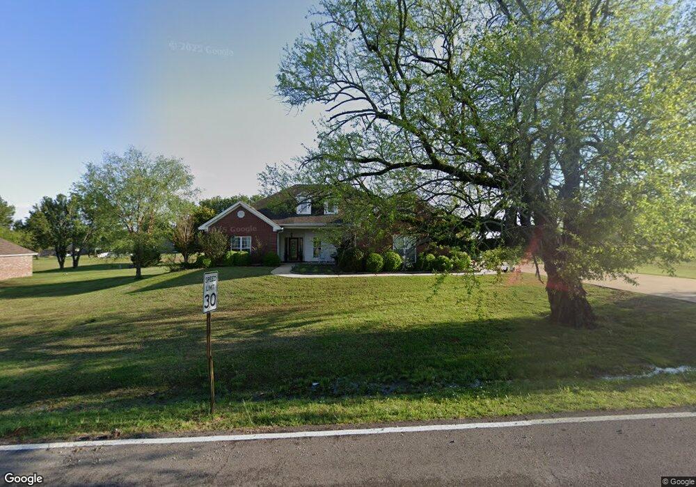
1571 Taylor Thurston Rd Columbus, MS 39701
Estimated Value: $338,000 - $428,000
--
Bed
--
Bath
2,932
Sq Ft
$124/Sq Ft
Est. Value
About This Home
This home is located at 1571 Taylor Thurston Rd, Columbus, MS 39701 and is currently estimated at $364,262, approximately $124 per square foot. 1571 Taylor Thurston Rd is a home.
Ownership History
Date
Name
Owned For
Owner Type
Purchase Details
Closed on
Dec 4, 2017
Sold by
Loyed William M and Loyed Theressa A
Bought by
Ratliff Teri Lisa and Loyed Michael Shayne
Current Estimated Value
Purchase Details
Closed on
Aug 6, 2014
Sold by
Loyed William Monroe and Loyed Theresa A
Bought by
Loyed William M and Loyed Theressa A
Purchase Details
Closed on
Jul 28, 2014
Sold by
Loyed William M and Loyed Theressa A
Bought by
Loyed William Monroe and Loyed Theressa A
Create a Home Valuation Report for This Property
The Home Valuation Report is an in-depth analysis detailing your home's value as well as a comparison with similar homes in the area
Home Values in the Area
Average Home Value in this Area
Purchase History
| Date | Buyer | Sale Price | Title Company |
|---|---|---|---|
| Ratliff Teri Lisa | -- | None Available | |
| Loyed William M | -- | None Available | |
| Loyed William M | -- | -- | |
| Loyed William Monroe | -- | -- |
Source: Public Records
Tax History Compared to Growth
Tax History
| Year | Tax Paid | Tax Assessment Tax Assessment Total Assessment is a certain percentage of the fair market value that is determined by local assessors to be the total taxable value of land and additions on the property. | Land | Improvement |
|---|---|---|---|---|
| 2025 | $1,283 | $24,111 | $0 | $0 |
| 2024 | $1,273 | $24,111 | $0 | $0 |
| 2023 | $1,267 | $21,219 | $0 | $0 |
| 2022 | $1,268 | $21,219 | $0 | $0 |
| 2021 | $1,221 | $21,219 | $0 | $0 |
| 2020 | $1,185 | $21,219 | $0 | $0 |
| 2019 | $1,194 | $20,842 | $0 | $0 |
| 2018 | $1,194 | $20,907 | $0 | $0 |
| 2017 | $1,141 | $20,907 | $0 | $0 |
| 2016 | $1,141 | $20,907 | $0 | $0 |
| 2015 | $1,182 | $21,397 | $0 | $0 |
| 2014 | $1,182 | $21,397 | $0 | $0 |
Source: Public Records
Map
Nearby Homes
- 49 Billy Casper Dr
- 1291 S Frontage Rd
- 23 Breezeway Cove
- 28 Breezeway Cove
- 100 Breezeway Cove
- 112 Breezeway Cove
- 96 Breezeway Cove
- 110 Breezeway Cove
- 0 Golden Horn Rd
- 0 S Frontage Road Lot #5 Unit 25-583
- 0 S Frontage Road Lot #3 Unit 25-581
- 0 S Frontage Road Lot #1 Unit 25-579
- 1381 S Frontage Rd
- 3267 Old West Point Rd
- 2 S Frontage Rd
- 4 S Frontage Rd
- 0 Hwy 45 N Unit 25-1761
- 541 Mount Airey Church Rd
- 5 Clisby Rd
- 13 Clisby Rd
- 1543 Taylor Thurston Rd
- 1624 Taylor Thurston Rd
- 1501 Taylor Thurston Rd
- 1562 Taylor Thurston Rd
- 9 Cobh Ln
- 17 Cobh Ln
- 27 Cobh Ln
- 37 Cobh Ln
- 41 Cobh Ln
- 1495 Taylor Thurston Rd
- 53 Cobh Ln
- 1652 Taylor Thurston Rd
- 65 Cobh Ln
- 20 Cobh Ln
- 77 Cobh Ln
- 24 Rhoades Ln
- 83 Cobh Ln
- 27 Rhoades Ln
- 28 Rhoades Ln
- 58 Cobh Ln