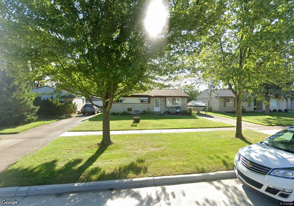
15727 Brandt St Romulus, MI 48174
Estimated Value: $178,000 - $190,000
3
Beds
3
Baths
1,000
Sq Ft
$184/Sq Ft
Est. Value
About This Home
This home is located at 15727 Brandt St, Romulus, MI 48174 and is currently estimated at $183,770, approximately $183 per square foot. 15727 Brandt St is a home located in Wayne County with nearby schools including Halecreek Elementary School, Romulus Middle School, and Romulus Senior High School.
Ownership History
Date
Name
Owned For
Owner Type
Purchase Details
Closed on
Jun 3, 2010
Sold by
Donovan Shaun and Secretary Of Housing & Urban D
Bought by
Brantley Kristen
Current Estimated Value
Purchase Details
Closed on
Oct 14, 2009
Sold by
Wells Fargo Bank Na
Bought by
The Secretary Of Housing & Urban Develop
Purchase Details
Closed on
Apr 8, 2009
Sold by
Acosta Christina and Acosta Alvaro
Bought by
Wells Fargo Bank Na
Create a Home Valuation Report for This Property
The Home Valuation Report is an in-depth analysis detailing your home's value as well as a comparison with similar homes in the area
Home Values in the Area
Average Home Value in this Area
Purchase History
| Date | Buyer | Sale Price | Title Company |
|---|---|---|---|
| Brantley Kristen | $26,100 | None Available | |
| The Secretary Of Housing & Urban Develop | -- | None Available | |
| Wells Fargo Bank Na | $119,073 | None Available |
Source: Public Records
Tax History
| Year | Tax Paid | Tax Assessment Tax Assessment Total Assessment is a certain percentage of the fair market value that is determined by local assessors to be the total taxable value of land and additions on the property. | Land | Improvement |
|---|---|---|---|---|
| 2025 | $1,806 | $82,600 | $0 | $0 |
| 2024 | $1,816 | $76,200 | $0 | $0 |
| 2023 | $1,745 | $67,800 | $0 | $0 |
| 2022 | $2,058 | $62,300 | $0 | $0 |
| 2021 | $2,000 | $50,800 | $0 | $0 |
| 2020 | $1,956 | $50,100 | $0 | $0 |
| 2019 | $1,956 | $42,600 | $0 | $0 |
| 2018 | $1,283 | $33,200 | $0 | $0 |
| 2017 | $947 | $32,700 | $0 | $0 |
| 2016 | $1,713 | $34,400 | $0 | $0 |
| 2015 | $3,330 | $33,300 | $0 | $0 |
| 2013 | $3,300 | $35,900 | $0 | $0 |
| 2012 | $1,050 | $36,100 | $5,200 | $30,900 |
Source: Public Records
Map
Nearby Homes
- 15521 Brandt St
- 15520 Brandt St
- 30058 Halecreek St
- 30455 Cherry Ave
- 30771 Halecreek St
- 15900 Sandburg St
- 16068 Middlebelt Rd
- 15715 Merriman Rd
- 16110 Farnum St
- 30620 Pennsylvania Rd
- 30930 Pennsylvania Rd Unit 8
- 00 Eureka Rd
- 00000 Pennsylvania Rd
- 15654 Isabelle St
- 29067 Cullen Dr Unit BLDG8
- 28567 Forest Dale St
- 28510 Halecreek St
- 4444 Eureka Rd
- 27597 Eureka Rd
- Lot 106 Hollywood
- 15739 Brandt St
- 15715 Brandt St
- 15751 Brandt St
- 15703 Brandt St
- 15620 Anthony St
- 15632 Anthony St
- 15608 Anthony St
- 15644 Anthony St
- 15589 Brandt St
- 15546 Anthony St
- 15763 Brandt St
- 15656 Anthony St
- 15714 Brandt St
- 15706 Anthony St
- 15726 Brandt St
- 0 Anthony Unit 4909465
- 0 Anthony Unit 211113409
- 15738 Brandt St
- 15775 Brandt St
- 15575 Brandt St
Your Personal Tour Guide
Ask me questions while you tour the home.