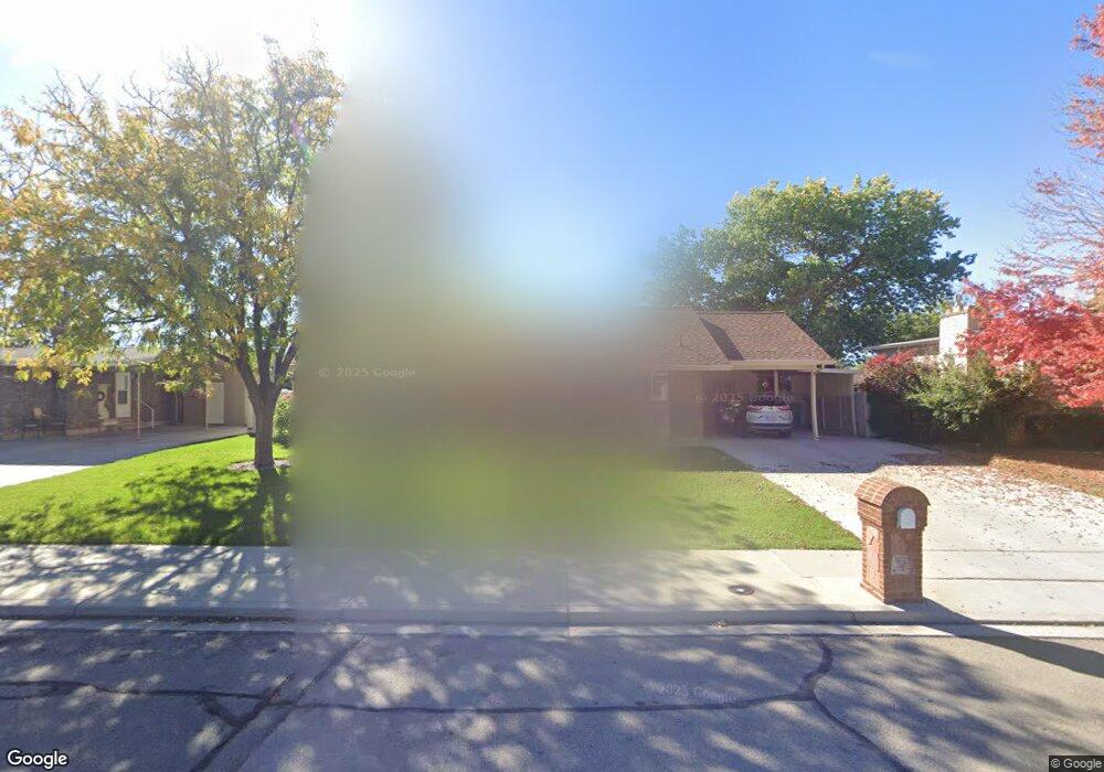
1573 W 1050 N Provo, UT 84604
Grandview South NeighborhoodEstimated Value: $515,000 - $609,000
2
Beds
3
Baths
1,542
Sq Ft
$369/Sq Ft
Est. Value
About This Home
This home is located at 1573 W 1050 N, Provo, UT 84604 and is currently estimated at $569,338, approximately $369 per square foot. 1573 W 1050 N is a home located in Utah County with nearby schools including Westridge Elementary School, Dixon Middle School, and Provo High School.
Ownership History
Date
Name
Owned For
Owner Type
Purchase Details
Closed on
May 18, 2018
Sold by
Cab Dab and Gardner Larry Earl
Bought by
Cab Dan
Current Estimated Value
Purchase Details
Closed on
Jul 22, 2015
Sold by
Gale Donald M and Gale Joyce
Bought by
Donald M Gale Family Trust and Gale Joyce
Purchase Details
Closed on
Jun 2, 2015
Sold by
Gale Joyce
Bought by
Gale Donald M and Gale Joyce
Purchase Details
Closed on
Dec 30, 2011
Sold by
Gale Donald M and Gale Joyce
Bought by
Gale Joyce
Create a Home Valuation Report for This Property
The Home Valuation Report is an in-depth analysis detailing your home's value as well as a comparison with similar homes in the area
Home Values in the Area
Average Home Value in this Area
Purchase History
| Date | Buyer | Sale Price | Title Company |
|---|---|---|---|
| Cab Dan | -- | None Available | |
| Donald M Gale Family Trust | -- | Absolute Title Agency | |
| Gale Donald M | -- | Absolute Title Agency | |
| Gale Donald M | -- | None Available | |
| Gale Joyce | -- | None Available |
Source: Public Records
Tax History Compared to Growth
Tax History
| Year | Tax Paid | Tax Assessment Tax Assessment Total Assessment is a certain percentage of the fair market value that is determined by local assessors to be the total taxable value of land and additions on the property. | Land | Improvement |
|---|---|---|---|---|
| 2025 | $2,659 | $281,930 | $172,100 | $340,500 |
| 2024 | $2,669 | $261,745 | $0 | $0 |
| 2023 | $2,798 | $258,995 | $0 | $0 |
| 2022 | $2,798 | $273,735 | $0 | $0 |
| 2021 | $2,166 | $369,700 | $109,200 | $260,500 |
| 2020 | $2,088 | $334,000 | $99,300 | $234,700 |
| 2019 | $1,997 | $332,200 | $99,300 | $232,900 |
| 2018 | $1,746 | $294,700 | $92,200 | $202,500 |
| 2017 | $1,664 | $154,275 | $0 | $0 |
| 2016 | $1,704 | $147,290 | $0 | $0 |
| 2015 | $1,686 | $151,855 | $0 | $0 |
| 2014 | $1,444 | $131,450 | $0 | $0 |
Source: Public Records
Map
Nearby Homes