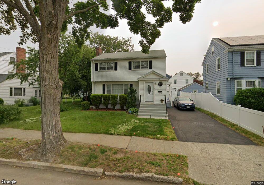
1574 Norman St Bridgeport, CT 06604
Brooklawn-Saint Vincent NeighborhoodEstimated Value: $434,000 - $481,000
3
Beds
2
Baths
1,631
Sq Ft
$282/Sq Ft
Est. Value
About This Home
This home is located at 1574 Norman St, Bridgeport, CT 06604 and is currently estimated at $460,256, approximately $282 per square foot. 1574 Norman St is a home located in Fairfield County with nearby schools including Blackham School, Central High School, and Assumption Catholic School.
Ownership History
Date
Name
Owned For
Owner Type
Purchase Details
Closed on
Apr 27, 2022
Sold by
Tahavera Edwin and Diaz Luis E
Bought by
Rodriguez Jorge and Rodriguez Kristel A
Current Estimated Value
Purchase Details
Closed on
Feb 19, 2015
Sold by
Josovitz Robert
Bought by
Diaz Luis and Hoyos Maria
Home Financials for this Owner
Home Financials are based on the most recent Mortgage that was taken out on this home.
Original Mortgage
$150,100
Interest Rate
3.74%
Mortgage Type
New Conventional
Create a Home Valuation Report for This Property
The Home Valuation Report is an in-depth analysis detailing your home's value as well as a comparison with similar homes in the area
Home Values in the Area
Average Home Value in this Area
Purchase History
| Date | Buyer | Sale Price | Title Company |
|---|---|---|---|
| Rodriguez Jorge | $385,000 | None Available | |
| Rodriguez Jorge | $385,000 | None Available | |
| Diaz Luis | $158,000 | -- | |
| Diaz Luis | $158,000 | -- |
Source: Public Records
Mortgage History
| Date | Status | Borrower | Loan Amount |
|---|---|---|---|
| Previous Owner | Diaz Luis | $150,100 |
Source: Public Records
Tax History Compared to Growth
Tax History
| Year | Tax Paid | Tax Assessment Tax Assessment Total Assessment is a certain percentage of the fair market value that is determined by local assessors to be the total taxable value of land and additions on the property. | Land | Improvement |
|---|---|---|---|---|
| 2025 | $7,679 | $176,740 | $78,430 | $98,310 |
| 2024 | $7,679 | $176,740 | $78,430 | $98,310 |
| 2023 | $7,629 | $175,570 | $78,430 | $97,140 |
| 2022 | $7,629 | $175,570 | $78,430 | $97,140 |
| 2021 | $7,207 | $165,860 | $78,430 | $87,430 |
| 2020 | $7,049 | $130,570 | $47,520 | $83,050 |
| 2019 | $7,049 | $130,570 | $47,520 | $83,050 |
| 2018 | $7,099 | $130,570 | $47,520 | $83,050 |
| 2017 | $7,099 | $130,570 | $47,520 | $83,050 |
| 2016 | $7,099 | $130,570 | $47,520 | $83,050 |
| 2015 | $7,177 | $170,070 | $52,710 | $117,360 |
| 2014 | $7,177 | $170,070 | $52,710 | $117,360 |
Source: Public Records
Map
Nearby Homes
- 97 Calvin Ave
- 412 Jackson Ave
- 1213 Wood Ave
- 53 Calvin Ave Unit 55
- 2445 Park Ave Unit 23
- 76 Suburban Ave
- 2625 Park Ave Unit 14N
- 2625 Park Ave Unit 10F
- 2625 Park Ave Unit PHB
- 201 High Ridge Dr
- 325 Suburban Ave
- 100 Lorraine St
- 2675 Park Ave Unit 3
- 2675 Park Ave Unit 22
- 65 Sedan Terrace
- 125 Alexander Dr
- 45 Sampson St
- 687 Wood Ave
- 31 Taft Ave
- 33 Jackson Ave Unit 35
- 1576 Norman St
- 1590 Norman St
- 1564 Norman St
- 556 W Mckinley Ave
- 553 W Jackson Ave
- 546 W Mckinley Ave
- 6 Pierce Ave
- 1585 Norman St
- 1540 Norman St
- 605 W Jackson Ave
- 539 W Jackson Ave
- 26 Pierce Ave
- 1620 Norman St
- 1534 Norman St
- 555 W Mckinley Ave
- 619 W Jackson Ave
- 554 W Jackson Ave
- 5 Pierce Ave
- 536 W Mckinley Ave
- 616 W Jackson Ave