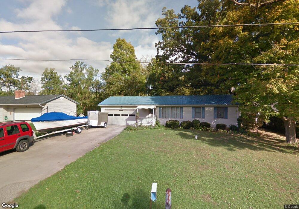
1575 Chew Rd Mansfield, OH 44903
Estimated Value: $201,217 - $242,000
3
Beds
1
Bath
1,552
Sq Ft
$144/Sq Ft
Est. Value
About This Home
This home is located at 1575 Chew Rd, Mansfield, OH 44903 and is currently estimated at $223,804, approximately $144 per square foot. 1575 Chew Rd is a home located in Richland County with nearby schools including Madison High School and Temple-Christian School.
Ownership History
Date
Name
Owned For
Owner Type
Purchase Details
Closed on
Jun 11, 2018
Sold by
Lewis Daniel C and Lewis Daniel Craig
Bought by
Mays Sondra and Brook Marcella May
Current Estimated Value
Purchase Details
Closed on
Nov 18, 2003
Sold by
Troyer Evadyne L
Bought by
Troyer Rodney L
Create a Home Valuation Report for This Property
The Home Valuation Report is an in-depth analysis detailing your home's value as well as a comparison with similar homes in the area
Home Values in the Area
Average Home Value in this Area
Purchase History
| Date | Buyer | Sale Price | Title Company |
|---|---|---|---|
| Mays Sondra | $55,000 | Southern Title | |
| Troyer Rodney L | -- | -- |
Source: Public Records
Tax History
| Year | Tax Paid | Tax Assessment Tax Assessment Total Assessment is a certain percentage of the fair market value that is determined by local assessors to be the total taxable value of land and additions on the property. | Land | Improvement |
|---|---|---|---|---|
| 2024 | $1,159 | $45,190 | $7,360 | $37,830 |
| 2023 | $1,241 | $45,190 | $7,360 | $37,830 |
| 2022 | $994 | $35,710 | $6,580 | $29,130 |
| 2021 | $994 | $35,710 | $6,580 | $29,130 |
| 2020 | $1,001 | $35,710 | $6,580 | $29,130 |
| 2019 | $791 | $30,280 | $5,580 | $24,700 |
| 2018 | $739 | $30,280 | $5,580 | $24,700 |
| 2017 | $724 | $30,280 | $5,580 | $24,700 |
| 2016 | $761 | $30,490 | $5,300 | $25,190 |
| 2015 | $726 | $30,490 | $5,300 | $25,190 |
| 2014 | $1,697 | $30,490 | $5,300 | $25,190 |
| 2012 | $844 | $32,100 | $5,580 | $26,520 |
Source: Public Records
Map
Nearby Homes
- 2011 Ohio 39
- 0 State Route 39 & I-71 Northeast Quadrant
- 0 State Route 39 & I-71 Southeast Quadrant
- 1715 Mansfield Lucas Rd
- 1851 State Route 39
- 2420 Mansfield Washington Rd
- 2130 State Route 39
- 0 Woodville Rd Unit Lot 14952, 14953
- 0 Woodville Rd Unit Lot 14954, 14955
- 0 Woodville Rd Unit Lot 14956, 14957,
- 794 Mansfield Washington Rd
- 0 Mcelroy Rd
- St Rt 603
- 0 Peterson Rd
- 27 E Main St
- 28 N Union St
- 1 E Main St
- 0 McBride Road Parcel # 1 Unit 9066028
- 1303 Park Ave E
- 744 E Hanley Rd
Your Personal Tour Guide
Ask me questions while you tour the home.