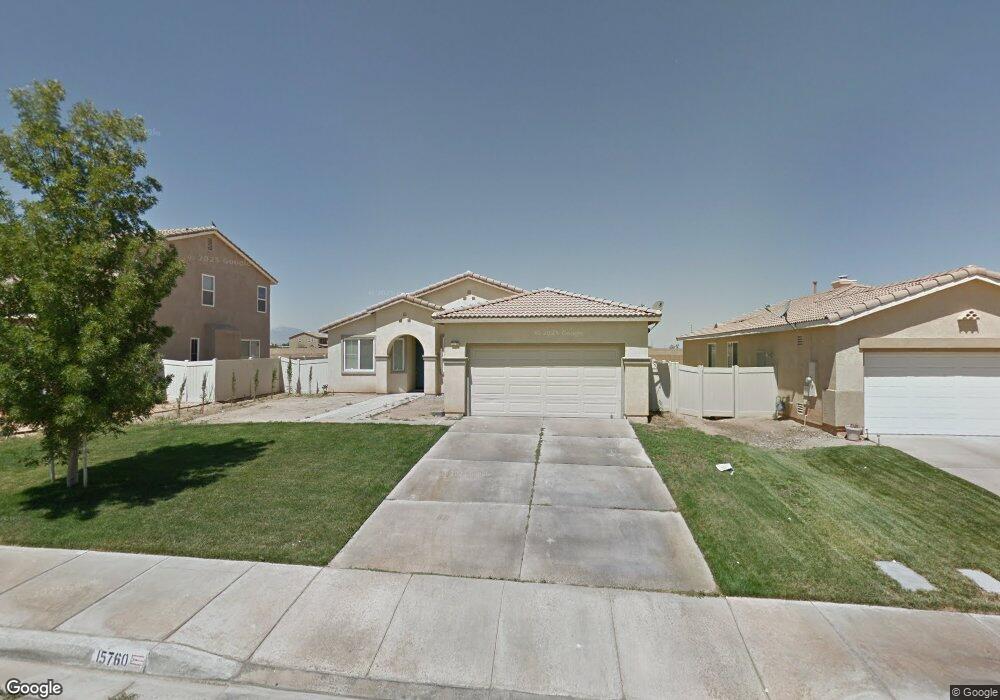
15760 Desert Rock St Adelanto, CA 92301
Mesa Linda NeighborhoodEstimated Value: $406,000 - $461,000
3
Beds
2
Baths
2,038
Sq Ft
$208/Sq Ft
Est. Value
About This Home
This home is located at 15760 Desert Rock St, Adelanto, CA 92301 and is currently estimated at $423,363, approximately $207 per square foot. 15760 Desert Rock St is a home located in San Bernardino County with nearby schools including Victoria Magathan Elementary School, Columbia Middle School, and Adelanto High School.
Ownership History
Date
Name
Owned For
Owner Type
Purchase Details
Closed on
Nov 1, 2011
Sold by
The Bank Of New York Mellon
Bought by
Gonzalez Gonzalo and Gonzalez Consuelo
Current Estimated Value
Purchase Details
Closed on
Jul 8, 2011
Sold by
Devis Eves Y
Bought by
The Bank Of New York Mellon
Purchase Details
Closed on
Jan 25, 2006
Sold by
Marcano Freddie
Bought by
Devis Eves Y
Home Financials for this Owner
Home Financials are based on the most recent Mortgage that was taken out on this home.
Original Mortgage
$57,171
Interest Rate
6.16%
Mortgage Type
Stand Alone Second
Purchase Details
Closed on
Jul 19, 2005
Sold by
Canaday Co/Adelanto Llc
Bought by
Devis Eves Y
Home Financials for this Owner
Home Financials are based on the most recent Mortgage that was taken out on this home.
Original Mortgage
$228,684
Interest Rate
7.65%
Mortgage Type
Fannie Mae Freddie Mac
Create a Home Valuation Report for This Property
The Home Valuation Report is an in-depth analysis detailing your home's value as well as a comparison with similar homes in the area
Home Values in the Area
Average Home Value in this Area
Purchase History
We collect this data history from publicly available records. To have your information removed, we recommend requesting removal directly through your county’s website.
| Date | Buyer | Sale Price | Title Company |
|---|---|---|---|
| Gonzalez Gonzalo | $79,000 | Lps Default Title & Closing | |
| The Bank Of New York Mellon | $86,400 | Accommodation | |
| Devis Eves Y | -- | First American Title Company | |
| Devis Eves Y | $286,000 | First American Title Company |
Source: Public Records
Mortgage History
We collect this data history from publicly available records. To have your information removed, we recommend requesting removal directly through your county’s website.
| Date | Status | Borrower | Loan Amount |
|---|---|---|---|
| Previous Owner | Devis Eves Y | $57,171 | |
| Previous Owner | Devis Eves Y | $228,684 |
Source: Public Records
Tax History
| Year | Tax Paid | Tax Assessment Tax Assessment Total Assessment is a certain percentage of the fair market value that is determined by local assessors to be the total taxable value of land and additions on the property. | Land | Improvement |
|---|---|---|---|---|
| 2025 | $1,818 | $119,325 | $18,839 | $100,486 |
| 2024 | $1,670 | $116,986 | $18,470 | $98,516 |
| 2023 | $1,706 | $114,692 | $18,108 | $96,584 |
| 2022 | $1,594 | $112,443 | $17,753 | $94,690 |
| 2021 | $1,663 | $110,238 | $17,405 | $92,833 |
| 2020 | $1,618 | $109,108 | $17,227 | $91,881 |
| 2019 | $1,600 | $106,968 | $16,889 | $90,079 |
| 2018 | $1,678 | $104,871 | $16,558 | $88,313 |
| 2017 | $1,623 | $102,814 | $16,233 | $86,581 |
| 2016 | $1,591 | $100,798 | $15,915 | $84,883 |
| 2015 | $1,525 | $99,284 | $15,676 | $83,608 |
| 2014 | $1,533 | $97,339 | $15,369 | $81,970 |
Source: Public Records
Map
Nearby Homes
- 15785 Horizon Way
- 15824 Desert Pass St
- 15817 Desert Pass St
- 15850 Desert Rock St
- 11767 Highgrove Ct
- 11807 Desert Glen St
- 15797 Mint St
- 11843 Desert Glen St
- 11582 Miranda Dr
- 11748 Galewood St
- 11732 Dawson Ln
- 0 Huerta Pahute Unit HD26102129
- 0 Civic #1 Dr Unit HD25143721
- 11744 Dawson Ln
- 0 Kentwood #1 Blvd Unit HD25143435
- 9 Vincent Dr
- 11747 Dawson Ln
- 11399 Baldy Mesa
- 9 Palmdale
- 0 Civic #4 Dr Unit HD25144089
- 15766 Desert Rock St
- 15754 Desert Rock St
- 15778 Desert Rock St
- 15738 Desert Rock St
- 15759 Horizon Way
- 15751 Horizon Way
- 15767 Horizon Way
- 11621 Desert Rock St
- 15757 Desert Rock St
- 15786 Desert Rock St
- 15763 Desert Rock St
- 15730 Desert Rock St
- 15745 Desert Rock St
- 15775 Desert Rock St
- 15773 Horizon Way
- 15745 Horizon Way
- 15737 Desert Rock St
- 15733 Horizon Way
- 11456 Helena St
- 11454 Helena St
Your Personal Tour Guide
Ask me questions while you tour the home.