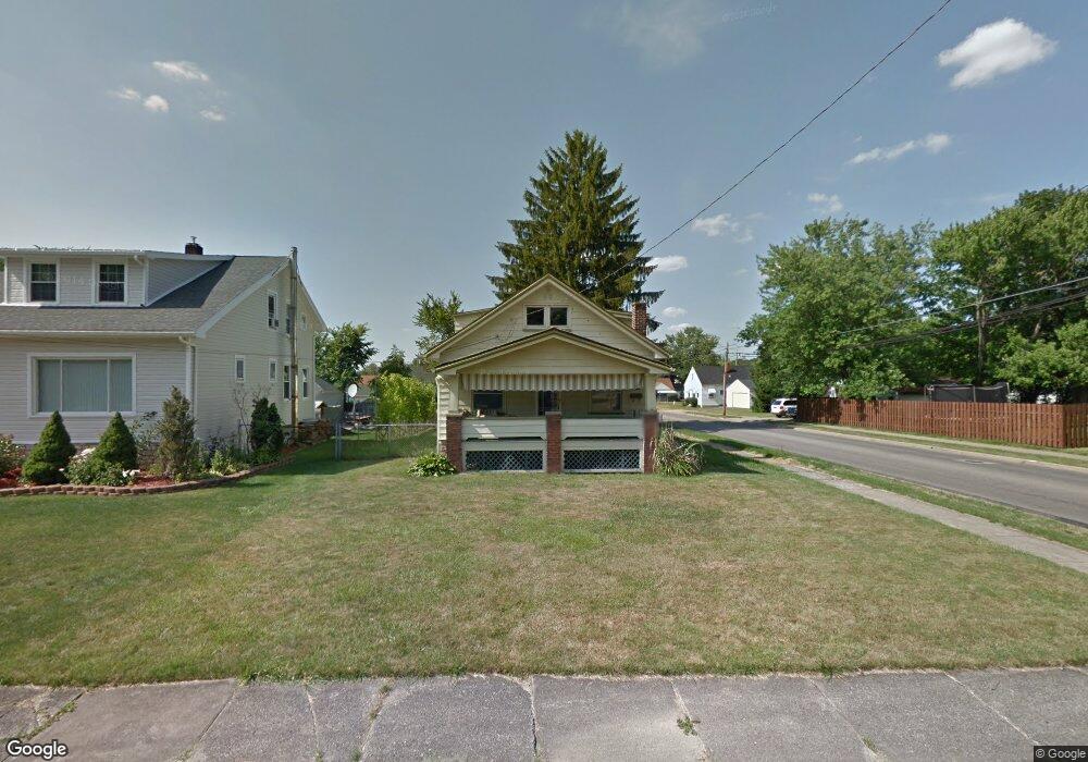
1578 Brownlee Ave Youngstown, OH 44514
Estimated Value: $347,000
3
Beds
1
Bath
1,514
Sq Ft
$229/Sq Ft
Est. Value
About This Home
This home is located at 1578 Brownlee Ave, Youngstown, OH 44514 and is currently priced at $347,000, approximately $229 per square foot. 1578 Brownlee Ave is a home located in Mahoning County with nearby schools including Paul C. Bunn Elementary School, Bayside Intermediate School, and Clear Horizons Early College High School.
Ownership History
Date
Name
Owned For
Owner Type
Purchase Details
Closed on
May 30, 2017
Sold by
Meacham Ralph T
Bought by
Mahoning County Land Reutilization Corpo
Current Estimated Value
Purchase Details
Closed on
Oct 8, 2003
Sold by
Saunders Fred
Bought by
Saunders Fred E and Saunders Verna L
Home Financials for this Owner
Home Financials are based on the most recent Mortgage that was taken out on this home.
Original Mortgage
$51,000
Interest Rate
7.63%
Mortgage Type
Purchase Money Mortgage
Purchase Details
Closed on
Jun 28, 2002
Sold by
Va
Bought by
Saunders Fred
Home Financials for this Owner
Home Financials are based on the most recent Mortgage that was taken out on this home.
Original Mortgage
$31,640
Interest Rate
6.82%
Mortgage Type
Credit Line Revolving
Purchase Details
Closed on
Dec 26, 2001
Sold by
Farrell Roland
Bought by
Va
Purchase Details
Closed on
Jun 4, 1992
Bought by
Farrell Roland
Create a Home Valuation Report for This Property
The Home Valuation Report is an in-depth analysis detailing your home's value as well as a comparison with similar homes in the area
Home Values in the Area
Average Home Value in this Area
Purchase History
| Date | Buyer | Sale Price | Title Company |
|---|---|---|---|
| Mahoning County Land Reutilization Corpo | -- | None Available | |
| Saunders Fred E | -- | -- | |
| Saunders Fred | -- | -- | |
| Va | $32,609 | -- | |
| Farrell Roland | $39,900 | -- |
Source: Public Records
Mortgage History
| Date | Status | Borrower | Loan Amount |
|---|---|---|---|
| Previous Owner | Saunders Fred E | $51,000 | |
| Previous Owner | Saunders Fred | $31,640 |
Source: Public Records
Tax History Compared to Growth
Tax History
| Year | Tax Paid | Tax Assessment Tax Assessment Total Assessment is a certain percentage of the fair market value that is determined by local assessors to be the total taxable value of land and additions on the property. | Land | Improvement |
|---|---|---|---|---|
| 2021 | -- | $0 | $0 | $0 |
| 2020 | $0 | $0 | $0 | $0 |
| 2019 | $788 | $1,900 | $1,900 | $0 |
| 2018 | $722 | $1,900 | $1,900 | $0 |
| 2017 | $453 | $14,260 | $2,230 | $12,030 |
| 2016 | $1,461 | $15,260 | $2,230 | $13,030 |
| 2015 | $1,040 | $15,260 | $2,230 | $13,030 |
| 2014 | $983 | $15,260 | $2,230 | $13,030 |
| 2013 | $970 | $15,260 | $2,230 | $13,030 |
Source: Public Records
Map
Nearby Homes
- 1579 Wakefield Ave
- 1633 Wakefield Ave
- 1513 Wakefield Ave
- 1553 Bancroft Ave
- 1661 Wakefield Ave
- 1633 Everett Ave
- 0 Weston Ave
- 1543 Lynn Ave
- 1514 Thalia Ave
- 2001 Brownlee Ave
- 2002 Bancroft Ave
- 2007 E Midlothian Blvd
- 3551 Shirley Rd
- 1913 Country Club Ave
- 1720 Sequoya Dr
- 2016 Pointview Ave
- 0 Lemoyne Ave
- 0 Crescent Dr Unit 5124984
- 3509 Lenox Ave
- 1122 Inverness Ave
- 1572 Brownlee Ave
- 1602 Brownlee Ave
- 1568 Brownlee Ave
- 1606 Brownlee Ave
- 1577 Medford Ave
- 1571 Medford Ave
- 1577 Brownlee Ave
- 1571 Brownlee Ave
- 1601 Medford Ave
- 1565 Medford Ave
- 1610 Brownlee Ave
- 1550 Brownlee Ave
- 1567 Brownlee Ave
- 1601 Brownlee Ave
- 1561 Medford Ave
- 1605 Brownlee Ave
- 1614 Brownlee Ave
- 1546 Brownlee Ave
- 1555 Medford Ave
- 1609 Medford Ave