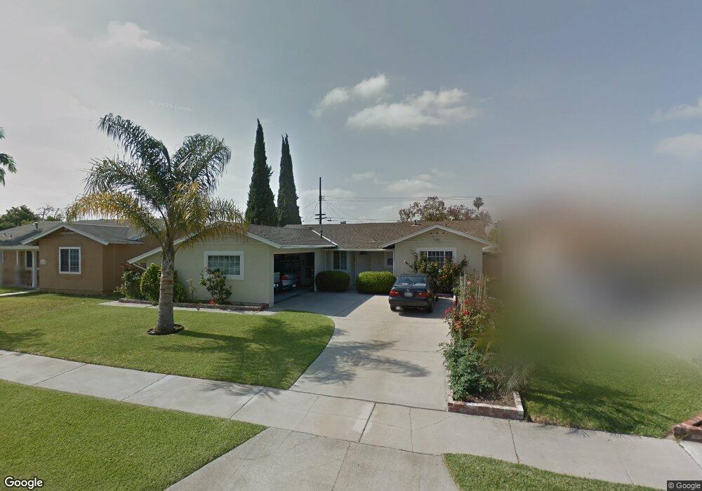
15786 Stanbrook Dr La Mirada, CA 90638
Estimated Value: $753,899 - $900,000
3
Beds
2
Baths
1,102
Sq Ft
$753/Sq Ft
Est. Value
About This Home
This home is located at 15786 Stanbrook Dr, La Mirada, CA 90638 and is currently estimated at $829,975, approximately $753 per square foot. 15786 Stanbrook Dr is a home located in Los Angeles County with nearby schools including Eastwood Elementary School, Los Coyotes Middle School, and La Mirada High School.
Ownership History
Date
Name
Owned For
Owner Type
Purchase Details
Closed on
Dec 17, 2001
Sold by
Pulera Domenic Francesco
Bought by
Pulera Domenic F and The Domenic F Pulera Living Trust
Current Estimated Value
Purchase Details
Closed on
Mar 8, 1994
Sold by
Pulera Domenic Francesco and Pulera Rita A
Bought by
Pulera Domenic Francesco
Home Financials for this Owner
Home Financials are based on the most recent Mortgage that was taken out on this home.
Original Mortgage
$123,750
Interest Rate
7%
Create a Home Valuation Report for This Property
The Home Valuation Report is an in-depth analysis detailing your home's value as well as a comparison with similar homes in the area
Home Values in the Area
Average Home Value in this Area
Purchase History
We collect this data history from publicly available records. To have your information removed, we recommend requesting removal directly through your county’s website.
| Date | Buyer | Sale Price | Title Company |
|---|---|---|---|
| Pulera Domenic F | -- | -- | |
| Pulera Domenic Francesco | -- | First American Title Company |
Source: Public Records
Mortgage History
We collect this data history from publicly available records. To have your information removed, we recommend requesting removal directly through your county’s website.
| Date | Status | Borrower | Loan Amount |
|---|---|---|---|
| Closed | Pulera Domenic Francesco | $123,750 |
Source: Public Records
Tax History
| Year | Tax Paid | Tax Assessment Tax Assessment Total Assessment is a certain percentage of the fair market value that is determined by local assessors to be the total taxable value of land and additions on the property. | Land | Improvement |
|---|---|---|---|---|
| 2025 | $1,311 | $71,031 | $39,193 | $31,838 |
| 2024 | $1,311 | $69,639 | $38,425 | $31,214 |
| 2023 | $1,277 | $68,274 | $37,672 | $30,602 |
| 2022 | $1,253 | $66,936 | $36,934 | $30,002 |
| 2021 | $1,229 | $65,624 | $36,210 | $29,414 |
| 2019 | $1,197 | $63,680 | $35,137 | $28,543 |
| 2018 | $1,098 | $62,433 | $34,449 | $27,984 |
| 2016 | $1,038 | $60,011 | $33,112 | $26,899 |
| 2015 | $1,027 | $59,110 | $32,615 | $26,495 |
| 2014 | $983 | $57,953 | $31,977 | $25,976 |
Source: Public Records
Map
Nearby Homes
- 15794 Stanbrook Dr
- 15736 Hesse Dr
- 4733 Durango Dr
- 15030 Watkins Dr
- 8221 Ginnis Green
- 4751 Saint Andrews Ave
- 8135 Keith Green
- 15026 Costa Mesa Dr
- 15213 Santa Gertrudes Ave Unit W106
- 15565 La Fortuna Dr
- 8236 Haseltine Green
- 15708 La Barca Dr
- 4980 Somerset St
- 14604 Balin Place
- 15419 Hayford St
- 5361 Humboldt Dr
- 4920 Lincolnshire Ave
- 2111 Cheyenne Way Unit 5
- 14426 Ermita Ave
- 5315 Humboldt Dr
- 15780 Stanbrook Dr
- 15309 Fairhope Dr
- 15315 Fairhope Dr
- 15303 Fairhope Dr
- 15774 Stanbrook Dr
- 15127 Stanton Ave
- 15321 Fairhope Dr
- 15785 Stanbrook Dr
- 15768 Stanbrook Dr
- 15777 Stanbrook Dr
- 4722 Stanton Ave
- 4712 Stanton Ave
- 15121 Stanton Ave
- 15327 Fairhope Dr
- 4761 Fairhope Dr
- 4692 Stanton Ave
- 15303 Stanton Ave
- 15303 S Stanton Ave
- 15115 Stanton Ave
- 15312 Fairhope Dr
Your Personal Tour Guide
Ask me questions while you tour the home.