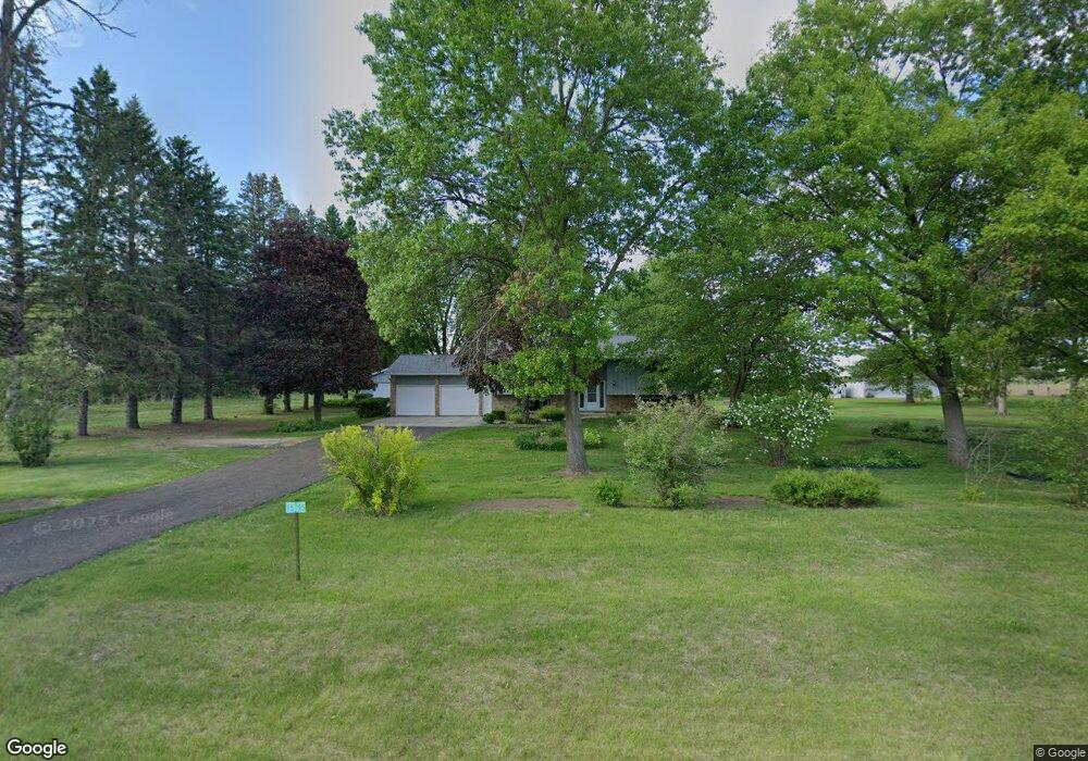
15795 190th St E Hastings, MN 55033
Ravenna NeighborhoodEstimated Value: $448,337 - $537,000
3
Beds
2
Baths
2,310
Sq Ft
$215/Sq Ft
Est. Value
About This Home
This home is located at 15795 190th St E, Hastings, MN 55033 and is currently estimated at $497,084, approximately $215 per square foot. 15795 190th St E is a home located in Dakota County with nearby schools including Kennedy Elementary School, Hastings Middle School, and Hastings High School.
Ownership History
Date
Name
Owned For
Owner Type
Purchase Details
Closed on
Aug 3, 2012
Sold by
Durand Ronald J and Durand Barbara A
Bought by
Woosley David A and Woosley Melissa J
Current Estimated Value
Home Financials for this Owner
Home Financials are based on the most recent Mortgage that was taken out on this home.
Original Mortgage
$198,050
Outstanding Balance
$85,030
Interest Rate
3.6%
Mortgage Type
New Conventional
Estimated Equity
$412,054
Create a Home Valuation Report for This Property
The Home Valuation Report is an in-depth analysis detailing your home's value as well as a comparison with similar homes in the area
Home Values in the Area
Average Home Value in this Area
Purchase History
| Date | Buyer | Sale Price | Title Company |
|---|---|---|---|
| Woosley David A | $233,000 | Dca Title |
Source: Public Records
Mortgage History
| Date | Status | Borrower | Loan Amount |
|---|---|---|---|
| Open | Woosley David A | $198,050 |
Source: Public Records
Tax History Compared to Growth
Tax History
| Year | Tax Paid | Tax Assessment Tax Assessment Total Assessment is a certain percentage of the fair market value that is determined by local assessors to be the total taxable value of land and additions on the property. | Land | Improvement |
|---|---|---|---|---|
| 2024 | $3,264 | $475,200 | $88,500 | $386,700 |
| 2023 | $3,264 | $461,200 | $85,200 | $376,000 |
| 2022 | $2,858 | $444,400 | $85,000 | $359,400 |
| 2021 | $3,214 | $378,100 | $73,900 | $304,200 |
| 2020 | $2,944 | $390,500 | $73,900 | $316,600 |
| 2019 | $3,006 | $348,700 | $70,400 | $278,300 |
| 2018 | $2,653 | $335,200 | $67,100 | $268,100 |
| 2017 | $2,464 | $287,600 | $58,500 | $229,100 |
| 2016 | $2,326 | $269,300 | $55,700 | $213,600 |
| 2015 | $2,281 | $234,606 | $50,609 | $183,997 |
| 2014 | -- | $231,009 | $50,032 | $180,977 |
| 2013 | -- | $210,735 | $44,833 | $165,902 |
Source: Public Records
Map
Nearby Homes
- Lot 3 Orlando Ave
- Lot 1 Orlando Ave
- Lot 2 Orlando Ave
- XXX Red Wing Blvd
- 20091 Red Wing Blvd
- XXX Otero Ave
- TBD Ravenna Trail
- 17994 Michael Ave
- 20430 Rhoda Ave
- 21211 Red Wing Blvd
- 13550 210th St E
- 4198 Starling Dr
- 545 Tuttle Dr
- 115 Kinglet Dr
- 182 Sandpiper Cir
- 2341 Glacier Way
- 2211 Glacier Way
- 15391 Ravenna Trail
- 2422 Rushmore Rd
- 235 Tiffany Dr
- 15795 15795 190th-Street-e
- 15855 190th St E
- 15770 190th St E
- 15677 190th St E
- 15700 190th St E
- 15885 190th St E
- 15667 190th St E
- 15840 190th St E
- 15870 190th St E
- 19116 Red Wing Blvd
- 15915 190th St E
- 15900 190th St E
- 19150 Red Wing Blvd
- 15955 190th St E
- 19137 Red Wing Blvd
- 15985 190th St E
- 15600 190th St E
- 16015 190th St E
- 15950 190th St E
- 18885 Patrick Ave