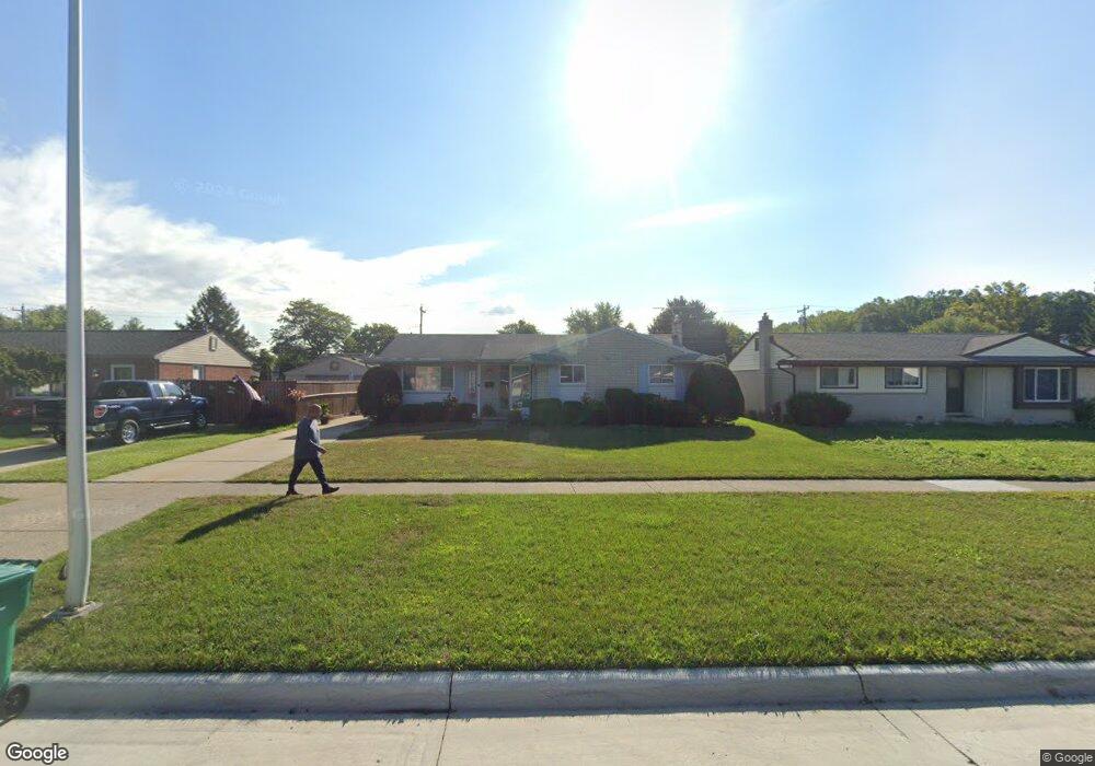
15799 Brandt St Romulus, MI 48174
Estimated Value: $185,000 - $209,000
3
Beds
2
Baths
1,148
Sq Ft
$171/Sq Ft
Est. Value
About This Home
This home is located at 15799 Brandt St, Romulus, MI 48174 and is currently estimated at $196,721, approximately $171 per square foot. 15799 Brandt St is a home located in Wayne County with nearby schools including Halecreek Elementary School, Romulus Middle School, and Romulus Senior High School.
Ownership History
Date
Name
Owned For
Owner Type
Purchase Details
Closed on
Nov 10, 2006
Sold by
Stanton Bruce L and Dufore Theresa M
Bought by
Dufore Daniel Jay
Current Estimated Value
Home Financials for this Owner
Home Financials are based on the most recent Mortgage that was taken out on this home.
Original Mortgage
$134,030
Interest Rate
6.36%
Mortgage Type
New Conventional
Purchase Details
Closed on
Nov 11, 2005
Sold by
Stanton Louise B and Stanton Bruce L
Bought by
Stanton Louise B
Purchase Details
Closed on
Mar 7, 2003
Sold by
Stanton Louise B
Bought by
Stanton Louis B
Create a Home Valuation Report for This Property
The Home Valuation Report is an in-depth analysis detailing your home's value as well as a comparison with similar homes in the area
Home Values in the Area
Average Home Value in this Area
Purchase History
| Date | Buyer | Sale Price | Title Company |
|---|---|---|---|
| Dufore Daniel Jay | -- | Complete Title Services Of S | |
| Stanton Louise B | -- | Complete Title Services | |
| Stanton Louis B | -- | -- |
Source: Public Records
Mortgage History
| Date | Status | Borrower | Loan Amount |
|---|---|---|---|
| Closed | Dufore Daniel Jay | $134,030 |
Source: Public Records
Tax History Compared to Growth
Tax History
| Year | Tax Paid | Tax Assessment Tax Assessment Total Assessment is a certain percentage of the fair market value that is determined by local assessors to be the total taxable value of land and additions on the property. | Land | Improvement |
|---|---|---|---|---|
| 2025 | $1,962 | $90,100 | $0 | $0 |
| 2024 | $1,962 | $83,500 | $0 | $0 |
| 2023 | $1,885 | $74,200 | $0 | $0 |
| 2022 | $2,224 | $68,000 | $0 | $0 |
| 2021 | $2,160 | $55,600 | $0 | $0 |
| 2020 | $2,114 | $54,900 | $0 | $0 |
| 2019 | $2,115 | $46,400 | $0 | $0 |
| 2018 | $1,383 | $36,000 | $0 | $0 |
| 2017 | $1,027 | $35,400 | $0 | $0 |
| 2016 | $1,855 | $37,400 | $0 | $0 |
| 2015 | $3,620 | $36,200 | $0 | $0 |
| 2013 | $3,610 | $39,300 | $0 | $0 |
| 2012 | $1,111 | $38,400 | $5,100 | $33,300 |
Source: Public Records
Map
Nearby Homes
- 15760 Oakbrook St
- 15795 Taft St
- 15771 Taft St
- 15900 Sandburg St
- 15415 Oakbrook St
- 15638 Sandburg St
- 30454 Dorset St
- 30455 Cherry Ave
- 30431 Cherry Ave
- 16068 Middlebelt Rd
- 16110 Farnum St
- 16971 Brandt St Unit 3
- 15701 Middlebelt Rd
- 30930 Pennsylvania Rd Unit 8
- 29054 Burning Tree Ln
- 00000 Pennsylvania Rd
- 00 Pennsylvania Rd
- 15702 Springhill St
- 28670 Zellmer St
- 28552 Halecreek St
- 15787 Brandt St
- 15811 Brandt St
- 15754 Anthony St
- 15775 Brandt St
- 15823 Brandt St
- 15730 Anthony St
- 15742 Anthony St
- 15718 Anthony St
- 15766 Anthony St
- 15763 Brandt St
- 15706 Anthony St
- 15835 Brandt St
- 15810 Brandt St
- 15786 Brandt St
- 15822 Brandt St
- 15751 Brandt St
- 15656 Anthony St
- 15774 Brandt St
- 15847 Brandt St
- 15798 Brandt St