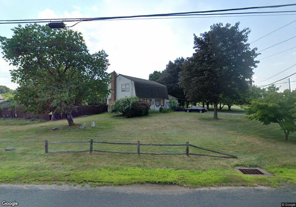
158 Depot St Broad Brook, CT 06016
Estimated Value: $378,000 - $439,000
4
Beds
2
Baths
1,734
Sq Ft
$241/Sq Ft
Est. Value
About This Home
This home is located at 158 Depot St, Broad Brook, CT 06016 and is currently estimated at $418,300, approximately $241 per square foot. 158 Depot St is a home located in Hartford County with nearby schools including Broad Brook Elementary School, East Windsor Middle School, and East Windsor High School.
Ownership History
Date
Name
Owned For
Owner Type
Purchase Details
Closed on
Nov 15, 1994
Sold by
Moody Burt and Moody Oreanna
Bought by
Downham Kevin and Downham Wendy
Current Estimated Value
Home Financials for this Owner
Home Financials are based on the most recent Mortgage that was taken out on this home.
Original Mortgage
$157,000
Interest Rate
8.78%
Mortgage Type
Unknown
Purchase Details
Closed on
Jan 6, 1987
Sold by
Tierney Edmund
Bought by
Moody Burt
Create a Home Valuation Report for This Property
The Home Valuation Report is an in-depth analysis detailing your home's value as well as a comparison with similar homes in the area
Home Values in the Area
Average Home Value in this Area
Purchase History
| Date | Buyer | Sale Price | Title Company |
|---|---|---|---|
| Downham Kevin | $154,000 | -- | |
| Moody Burt | $160,000 | -- |
Source: Public Records
Mortgage History
| Date | Status | Borrower | Loan Amount |
|---|---|---|---|
| Open | Moody Burt | $201,600 | |
| Closed | Moody Burt | $160,700 | |
| Closed | Moody Burt | $157,000 | |
| Previous Owner | Moody Burt | $235,000 |
Source: Public Records
Tax History Compared to Growth
Tax History
| Year | Tax Paid | Tax Assessment Tax Assessment Total Assessment is a certain percentage of the fair market value that is determined by local assessors to be the total taxable value of land and additions on the property. | Land | Improvement |
|---|---|---|---|---|
| 2025 | $5,963 | $225,090 | $62,280 | $162,810 |
| 2024 | $5,528 | $225,090 | $62,280 | $162,810 |
| 2023 | $4,992 | $145,620 | $49,050 | $96,570 |
| 2022 | $5,006 | $145,620 | $49,050 | $96,570 |
| 2021 | $5,024 | $145,620 | $49,050 | $96,570 |
| 2020 | $5,056 | $145,620 | $49,050 | $96,570 |
| 2019 | $4,987 | $145,620 | $49,050 | $96,570 |
| 2018 | $4,937 | $145,620 | $49,050 | $96,570 |
| 2017 | $4,768 | $145,490 | $57,330 | $88,160 |
| 2016 | $4,500 | $145,490 | $57,330 | $88,160 |
| 2015 | $4,410 | $145,490 | $57,330 | $88,160 |
| 2014 | $4,333 | $145,490 | $57,330 | $88,160 |
Source: Public Records
Map
Nearby Homes
- 159 Depot St
- 3 Eastwood Dr
- 21 Maple Ave
- 183 Chamberlain Rd
- 111 Old Ellington Rd
- 4 Rye St
- 27 Margaret Dr
- 77 Thrall Rd
- 7 East Rd
- 35 Church St
- 16 Pamela Ct
- 71 Middle Rd
- 149 Melrose Rd
- 10 Griswold Rd
- 8 Reggie Way Unit B
- 149 Tripp Rd
- 10 Hayfield Ln
- 18 Folkstone Rd Unit B
- 20 Apothecaries Hall Rd
- 0 Chamberlain Rd Unit 24129492
- 110 East Rd Unit Lot 15
- 120 East Rd
- 120 East Rd Unit Lot 11
- 122 East Rd Unit Lot 10
- 124 East Rd Unit Lot 9
- 155 Depot St Unit 4
- 155 Depot St Unit Lot 4
- 126 East Rd Unit Lot8
- 128 East Rd Unit 7
- 128 East Rd Unit Lot 7
- 156 Depot St
- 130 East Rd Unit Lot 6
- 132 East Rd Unit 5
- 132 East Rd Unit Lot 5
- 160 Depot St
- 142 East Rd
- 162 Depot St
- 152 Depot St
- 141 East Rd
- 164 Depot St