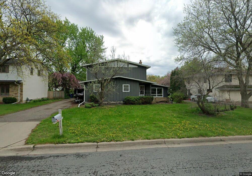
158 Myrman Ave West St. Paul, MN 55118
Estimated Value: $408,783 - $498,000
3
Beds
3
Baths
2,138
Sq Ft
$215/Sq Ft
Est. Value
About This Home
This home is located at 158 Myrman Ave, West St. Paul, MN 55118 and is currently estimated at $459,196, approximately $214 per square foot. 158 Myrman Ave is a home located in Dakota County with nearby schools including Moreland Arts & Health Sciences Magnet School, Heritage E-STEM Magnet School, and Two Rivers High School.
Ownership History
Date
Name
Owned For
Owner Type
Purchase Details
Closed on
May 18, 2010
Sold by
Link John C and Link Patricia R
Bought by
Abraham Jason K and Longbella Maren C
Current Estimated Value
Create a Home Valuation Report for This Property
The Home Valuation Report is an in-depth analysis detailing your home's value as well as a comparison with similar homes in the area
Home Values in the Area
Average Home Value in this Area
Purchase History
| Date | Buyer | Sale Price | Title Company |
|---|---|---|---|
| Abraham Jason K | $280,000 | -- |
Source: Public Records
Tax History Compared to Growth
Tax History
| Year | Tax Paid | Tax Assessment Tax Assessment Total Assessment is a certain percentage of the fair market value that is determined by local assessors to be the total taxable value of land and additions on the property. | Land | Improvement |
|---|---|---|---|---|
| 2024 | $5,026 | $389,800 | $82,800 | $307,000 |
| 2023 | $5,026 | $406,200 | $87,700 | $318,500 |
| 2022 | $4,388 | $394,000 | $87,400 | $306,600 |
| 2021 | $4,226 | $338,600 | $76,000 | $262,600 |
| 2020 | $4,080 | $324,700 | $72,400 | $252,300 |
| 2019 | $3,754 | $306,100 | $68,900 | $237,200 |
| 2018 | $3,699 | $271,500 | $64,400 | $207,100 |
| 2017 | $3,558 | $278,100 | $61,400 | $216,700 |
| 2016 | $3,347 | $258,300 | $62,900 | $195,400 |
| 2015 | $3,389 | $229,592 | $57,867 | $171,725 |
| 2014 | -- | $225,341 | $53,506 | $171,835 |
| 2013 | -- | $206,266 | $48,750 | $157,516 |
Source: Public Records
Map
Nearby Homes
- 111 Imperial Dr W Unit 102
- 100 Imperial Dr W Unit 204
- 63 Langer Cir
- 69 Langer Cir
- 158 Southwind Ln
- 1450 Bidwell St Unit 110
- 280 Edith Dr
- 1277 Hall Ave
- 1220 Stryker Ave
- 389 Edith Dr
- 69 Amelia Ave
- 1384 Smith Ave S
- 170 Wentworth Ave W Unit F
- 242 Butler Ave W
- 1620 Charlton St Unit 109
- 180 Wentworth Ave W Unit E
- 1513 Smith Ave S
- 1084 Hall Ave
- 1062 Ohio St
- 1251 Macarthur Ave
- 158 Myrman Ave
- 150 Myrman Ave
- 166 Myrman Ave
- 157 Emerson Ave W
- 1381 Bidwell St
- 165 Emerson Ave W
- 151 Emerson Ave W
- 159 Myrman Ave
- 20 Langer Cir
- 151 Emerson Ave W
- 165 Myrman Ave
- 151 Myrman Ave
- 22 Langer Cir
- 143 Emerson Ave W
- 1381 1381 Bidwell St
- 173 Emerson Ave W
- 23 Langer Cir
- 26 Langer Cir
- 183 Emerson Ave W
- 21 Langer Cir