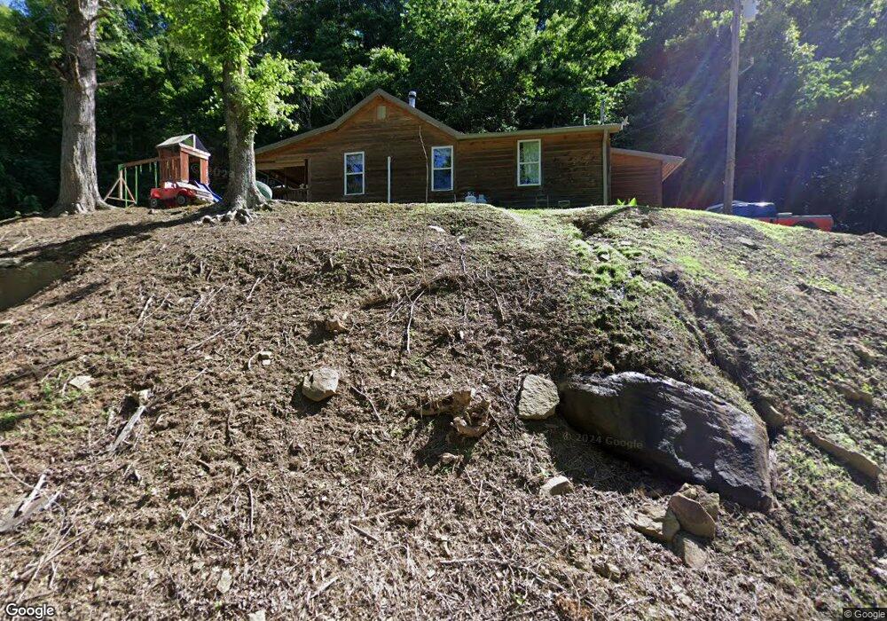
158 Sharp Creek Rd La Follette, TN 37766
Estimated Value: $131,000 - $191,000
--
Bed
1
Bath
1,404
Sq Ft
$118/Sq Ft
Est. Value
About This Home
This home is located at 158 Sharp Creek Rd, La Follette, TN 37766 and is currently estimated at $166,252, approximately $118 per square foot. 158 Sharp Creek Rd is a home located in Campbell County.
Ownership History
Date
Name
Owned For
Owner Type
Purchase Details
Closed on
Aug 31, 2015
Sold by
Wright Robbin
Bought by
Ayers Hannah and White Andrew
Current Estimated Value
Purchase Details
Closed on
Jan 15, 2014
Sold by
Bruce Ronald G
Bought by
Bolton Jimmy
Home Financials for this Owner
Home Financials are based on the most recent Mortgage that was taken out on this home.
Original Mortgage
$69,707
Interest Rate
4.48%
Mortgage Type
New Conventional
Purchase Details
Closed on
Oct 2, 2013
Sold by
Sparks Kenneth
Bought by
Wright Robbin and Wright Joyce
Purchase Details
Closed on
Aug 27, 1993
Bought by
Sparks Kenneth and Sparks Joanna
Purchase Details
Closed on
Jan 13, 1992
Bought by
Ridenour Stanley and Ridenour Debra
Purchase Details
Closed on
Sep 12, 1988
Bought by
Bolton Clevis K and Bolton Michelle
Purchase Details
Closed on
May 19, 1980
Bought by
Campbell Floyd and Campbell Louise
Create a Home Valuation Report for This Property
The Home Valuation Report is an in-depth analysis detailing your home's value as well as a comparison with similar homes in the area
Home Values in the Area
Average Home Value in this Area
Purchase History
| Date | Buyer | Sale Price | Title Company |
|---|---|---|---|
| Ayers Hannah | $38,150 | -- | |
| Bolton Jimmy | $55,000 | -- | |
| Wright Robbin | $22,600 | -- | |
| Sparks Kenneth | $26,000 | -- | |
| Ridenour Stanley | $22,000 | -- | |
| Bolton Clevis K | $28,000 | -- | |
| Campbell Floyd | -- | -- |
Source: Public Records
Mortgage History
| Date | Status | Borrower | Loan Amount |
|---|---|---|---|
| Previous Owner | Bolton Jimmy | $69,707 |
Source: Public Records
Tax History Compared to Growth
Tax History
| Year | Tax Paid | Tax Assessment Tax Assessment Total Assessment is a certain percentage of the fair market value that is determined by local assessors to be the total taxable value of land and additions on the property. | Land | Improvement |
|---|---|---|---|---|
| 2025 | $398 | $32,750 | $0 | $0 |
| 2024 | $398 | $32,750 | $4,500 | $28,250 |
| 2023 | $257 | $12,450 | $2,400 | $10,050 |
| 2022 | $257 | $12,450 | $2,400 | $10,050 |
| 2021 | $257 | $12,450 | $2,400 | $10,050 |
| 2020 | $252 | $12,450 | $2,400 | $10,050 |
| 2019 | $257 | $12,450 | $2,400 | $10,050 |
| 2018 | $266 | $11,800 | $2,075 | $9,725 |
| 2017 | $266 | $11,800 | $2,075 | $9,725 |
| 2016 | $266 | $11,800 | $2,075 | $9,725 |
| 2015 | $235 | $11,800 | $2,075 | $9,725 |
| 2014 | -- | $11,800 | $2,075 | $9,725 |
| 2013 | -- | $11,800 | $2,075 | $9,725 |
Source: Public Records
Map
Nearby Homes
- 936 Stinking Creek Rd
- 739 Rock Creek Ln
- 1055 Big 4 Rd
- 0 Melvin Hollow Rd Unit LotWP001 23933593
- 0 Melvin Hollow Rd Unit LotWP003 23933595
- 0 Melvin Hollow Rd Unit 1305423
- 0 Melvin Hollow Rd Unit 1305420
- 0 Melvin Hollow Rd Unit 1271460
- 3329 Stinking Creek Rd
- 150 Timber Oaks Ln
- 0 Hwy 90 Unit 19468896
- 3866 Highway 297
- Lot 30 Mt Clouds Tr
- Lot 31 Mt Clouds Tr
- 256 Ensley Ln
- 130 Lowwood Ln
- 1289 Highway 90
- 0 Douglas Ln
- 5273 White Oak Rd
- 0 Hickory Hill Cir
- 209 Sharp Creek Rd
- 1430 Stinking Creek Rd
- 274 Sharp Creek Rd
- 270 Sharp Creek Rd
- 0 11 40 Acres Big Four Rd
- 157 Rzr Ridge Ln
- 1649 Stinking Creek Rd
- 1124 Stinking Creek Rd
- 1555 Stinking Creek Rd
- 1546 Stinking Creek Rd
- 1098 Stinking Creek Rd
- 1078 Stinking Creek Rd
- 1068 Stinking Creek Rd
- 906 Stinking Creek Rd
- 214 Swain Ln
- 199 Rock Creek Ln
- 148 Rock Creek Ln
- 114 Fire Hill Ln
- 182 Fire Hill Ln
- 180 Rock Creek Ln