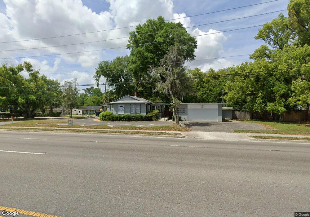
1580 Blanding Blvd Jacksonville, FL 32210
Lakeshore NeighborhoodEstimated Value: $241,000 - $253,403
--
Bed
3
Baths
1,495
Sq Ft
$164/Sq Ft
Est. Value
About This Home
This home is located at 1580 Blanding Blvd, Jacksonville, FL 32210 and is currently estimated at $245,134, approximately $163 per square foot. 1580 Blanding Blvd is a home located in Duval County with nearby schools including Andros Karperos, Hyde Park Elementary School, and Lake Shore Middle School.
Ownership History
Date
Name
Owned For
Owner Type
Purchase Details
Closed on
Feb 1, 2024
Sold by
Robert L Phillips Od Pa
Bought by
1580 Blanding Blvd Llc
Current Estimated Value
Home Financials for this Owner
Home Financials are based on the most recent Mortgage that was taken out on this home.
Original Mortgage
$208,250
Outstanding Balance
$204,570
Interest Rate
6.61%
Mortgage Type
New Conventional
Estimated Equity
$40,564
Purchase Details
Closed on
Jan 17, 2020
Sold by
Phillips Robert L and Phillips Carole E
Bought by
Robert L Phillips O D P A
Create a Home Valuation Report for This Property
The Home Valuation Report is an in-depth analysis detailing your home's value as well as a comparison with similar homes in the area
Home Values in the Area
Average Home Value in this Area
Purchase History
| Date | Buyer | Sale Price | Title Company |
|---|---|---|---|
| 1580 Blanding Blvd Llc | $245,000 | Landmark Title | |
| Robert L Phillips O D P A | -- | Attorney |
Source: Public Records
Mortgage History
| Date | Status | Borrower | Loan Amount |
|---|---|---|---|
| Open | 1580 Blanding Blvd Llc | $208,250 |
Source: Public Records
Tax History Compared to Growth
Tax History
| Year | Tax Paid | Tax Assessment Tax Assessment Total Assessment is a certain percentage of the fair market value that is determined by local assessors to be the total taxable value of land and additions on the property. | Land | Improvement |
|---|---|---|---|---|
| 2025 | $2,952 | $190,413 | $59,546 | $130,867 |
| 2024 | $2,424 | $191,111 | $55,280 | $135,831 |
| 2023 | $2,424 | $127,466 | $30,153 | $97,313 |
| 2022 | $2,859 | $160,083 | $30,153 | $129,930 |
| 2021 | $2,679 | $145,313 | $30,153 | $115,160 |
| 2020 | $2,642 | $140,844 | $30,153 | $110,691 |
| 2019 | $2,676 | $140,741 | $30,153 | $110,588 |
| 2018 | $2,699 | $140,767 | $32,400 | $108,367 |
| 2017 | $2,687 | $138,523 | $32,400 | $106,123 |
| 2016 | $2,694 | $136,414 | $0 | $0 |
| 2015 | $2,780 | $138,551 | $0 | $0 |
| 2014 | $2,797 | $137,963 | $0 | $0 |
Source: Public Records
Map
Nearby Homes
- 4649 Shelby Ave
- 4563 Shelby Ave
- 1580 Hamilton St
- 4571 Park St
- 4762 Wheeler Ave
- 4735 Park St
- 4778 Park St
- 4744 Glenwood Ave
- 4453 Woodmere St
- 4822 Merrimac Ave
- 4625 Irvington Ave
- 1480 Stimson St
- 4768 Beverly Cir
- 4436 Melrose Ave
- 4409 Saint Johns Ave
- 4440 Beverly Ave
- 4737 Shirley Ave
- 4341 Woodmere St
- 4766 Irvington Ave
- 1550 Parrish Place
- 4615 Merrimac Ave
- 4619 Merrimac Ave
- 4608 Wheeler Ave
- 000 Merrimac Ave
- 4618 Wheeler Ave
- 4623 Merrimac Ave
- 1585 Blanding Blvd Unit 1
- 1585 Blanding Blvd
- 4612 Merrimac Ave
- 4629 Merrimac Ave
- 1567 Blanding Blvd
- 4595 Merrimac Ave
- 4618 Merrimac Ave
- 4594 Wheeler Ave
- 4622 Merrimac Ave
- 4622 Wheeler Ave
- 1607 Blanding Blvd
- 4626 Merrimac Ave
- 4591 Merrimac Ave
- 4647 Merrimac Ave