Estimated Value: $1,102,000 - $2,119,000
3
Beds
2
Baths
1,337
Sq Ft
$1,189/Sq Ft
Est. Value
About This Home
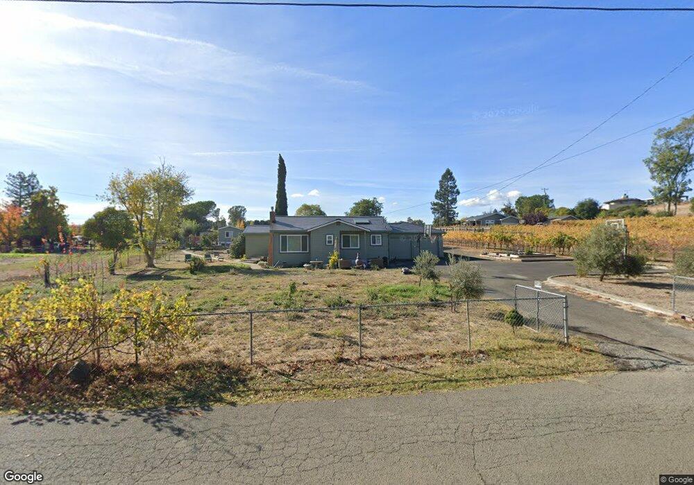
This home is located at 1581 Estee Ave, Napa, CA 94558 and is currently estimated at $1,589,933, approximately $1,189 per square foot. 1581 Estee Ave is a home located in Napa County with nearby schools including Vichy Elementary School, Silverado Middle School, and Vintage High School.
Ownership History
Date
Name
Owned For
Owner Type
Purchase Details
Closed on
May 13, 2014
Sold by
Jinks Joann M
Bought by
The Stanley 2009 Living Trust
Current Estimated Value
Home Financials for this Owner
Home Financials are based on the most recent Mortgage that was taken out on this home.
Original Mortgage
$692,000
Outstanding Balance
$528,370
Interest Rate
4.38%
Mortgage Type
New Conventional
Estimated Equity
$1,061,563
Purchase Details
Closed on
Feb 17, 2004
Sold by
Barloggi Helen
Bought by
Barloggi Helen M
Create a Home Valuation Report for This Property
The Home Valuation Report is an in-depth analysis detailing your home's value as well as a comparison with similar homes in the area
Purchase History
| Date | Buyer | Sale Price | Title Company |
|---|---|---|---|
| The Stanley 2009 Living Trust | $865,000 | Old Republic Title Company | |
| Barloggi Helen M | -- | -- |
Source: Public Records
Mortgage History
| Date | Status | Borrower | Loan Amount |
|---|---|---|---|
| Open | The Stanley 2009 Living Trust | $692,000 |
Source: Public Records
Tax History
| Year | Tax Paid | Tax Assessment Tax Assessment Total Assessment is a certain percentage of the fair market value that is determined by local assessors to be the total taxable value of land and additions on the property. | Land | Improvement |
|---|---|---|---|---|
| 2025 | $12,102 | $1,082,802 | $858,100 | $224,702 |
| 2024 | $11,674 | $1,061,572 | $841,275 | $220,297 |
| 2023 | $11,674 | $1,041,189 | $824,780 | $216,409 |
| 2022 | $11,303 | $1,021,206 | $808,608 | $212,598 |
| 2021 | $11,138 | $1,001,614 | $792,753 | $208,861 |
| 2020 | $11,054 | $991,570 | $784,625 | $206,945 |
| 2019 | $10,853 | $972,560 | $769,241 | $203,319 |
| 2018 | $10,755 | $953,922 | $754,158 | $199,764 |
| 2017 | $10,341 | $913,650 | $739,371 | $174,279 |
| 2016 | $10,248 | $895,736 | $724,874 | $170,862 |
| 2015 | $9,647 | $882,282 | $713,986 | $168,296 |
| 2014 | $926 | $88,032 | $44,993 | $43,039 |
Source: Public Records
Map
Nearby Homes
- 1597 Estee Ave
- 1095 Hardman Ave
- 1860 Mckinley Rd
- 1777 Mckinley Rd
- 209 Kaanapali Dr
- 1079 Hedgeside Ave
- 1590 Mckinley Rd
- 1776 Monticello Rd
- 2015 Monticello Rd
- 1180 Monticello Rd
- 416 Troon Dr
- 2134 Monticello Rd
- 808 Augusta Cir
- 833 Augusta Cir Unit 34
- 350 Deer Hollow Dr
- 346 Deer Hollow Dr
- 162 Bonnie Brook Dr
- 2186 Monticello Rd
- 2350 Big Ranch Rd
- 152 Bonnie Brook Dr
Your Personal Tour Guide
Ask me questions while you tour the home.