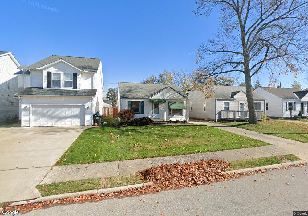
1581 Woodhurst Ave Cleveland, OH 44124
Estimated Value: $148,000 - $193,000
2
Beds
1
Bath
754
Sq Ft
$236/Sq Ft
Est. Value
About This Home
This home is located at 1581 Woodhurst Ave, Cleveland, OH 44124 and is currently estimated at $177,609, approximately $235 per square foot. 1581 Woodhurst Ave is a home located in Cuyahoga County with nearby schools including Mayfield High School, Corpus Christi Academy, and Gilmour Academy.
Ownership History
Date
Name
Owned For
Owner Type
Purchase Details
Closed on
Jul 21, 1994
Sold by
Takacs Cynthia Kay
Bought by
Domke Karen
Current Estimated Value
Home Financials for this Owner
Home Financials are based on the most recent Mortgage that was taken out on this home.
Original Mortgage
$58,000
Interest Rate
8.38%
Mortgage Type
New Conventional
Purchase Details
Closed on
Jan 15, 1987
Sold by
Hall Olga N
Bought by
Takacs Cynthia K
Purchase Details
Closed on
Jan 1, 1975
Bought by
Hall Olga N
Create a Home Valuation Report for This Property
The Home Valuation Report is an in-depth analysis detailing your home's value as well as a comparison with similar homes in the area
Home Values in the Area
Average Home Value in this Area
Purchase History
| Date | Buyer | Sale Price | Title Company |
|---|---|---|---|
| Domke Karen | $77,900 | -- | |
| Takacs Cynthia K | $47,000 | -- | |
| Hall Olga N | -- | -- |
Source: Public Records
Mortgage History
| Date | Status | Borrower | Loan Amount |
|---|---|---|---|
| Closed | Domke Karen | $58,000 |
Source: Public Records
Tax History Compared to Growth
Tax History
| Year | Tax Paid | Tax Assessment Tax Assessment Total Assessment is a certain percentage of the fair market value that is determined by local assessors to be the total taxable value of land and additions on the property. | Land | Improvement |
|---|---|---|---|---|
| 2024 | $3,196 | $48,755 | $9,835 | $38,920 |
| 2023 | $2,974 | $41,830 | $9,100 | $32,730 |
| 2022 | $3,056 | $41,830 | $9,100 | $32,730 |
| 2021 | $3,024 | $41,830 | $9,100 | $32,730 |
| 2020 | $2,820 | $35,740 | $7,770 | $27,970 |
| 2019 | $2,733 | $102,100 | $22,200 | $79,900 |
| 2018 | $2,573 | $35,740 | $7,770 | $27,970 |
| 2017 | $2,689 | $33,080 | $8,510 | $24,570 |
| 2016 | $2,647 | $32,800 | $8,510 | $24,290 |
| 2015 | $2,401 | $32,800 | $8,510 | $24,290 |
| 2014 | $2,401 | $32,170 | $8,330 | $23,840 |
Source: Public Records
Map
Nearby Homes
- 1593 Woodhurst Ave
- 1604 Fruitland Ave
- 1542 Woodhurst Ave
- 1520 Fruitland Ave
- 1572 Crestwood Rd
- 210 Teal Trace Unit 210
- 1400 Orchard Heights Dr
- 1402 Golden Gate Blvd Unit G102
- 6132 Westerham Rd
- 1575 Lander Rd
- 1637 Lander Rd
- 200 Fox Hollow Dr Unit 100
- 200 Fox Hollow Dr Unit 104
- 0 Maplewood Rd
- 180 Fox Hollow Dr Unit 105
- 1336 Genesee Ave
- 220 Fox Hollow Dr Unit 308
- 140 Fox Hollow Dr Unit 201A
- 1355 Washington Blvd
- 1297 E Miner Rd
- 1577 Woodhurst Ave
- 1585 Woodhurst Ave
- 1573 Woodhurst Ave
- 1589 Woodhurst Ave
- 1580 Fruitland Ave
- 1567 Woodhurst Ave
- 1576 Fruitland Ave
- 1588 Fruitland Ave
- 1572 Fruitland Ave
- 1580 Woodhurst Ave
- 1597 Woodhurst Ave
- 1565 Woodhurst Ave
- 1584 Woodhurst Ave
- 1590 Fruitland Ave
- 1568 Fruitland Ave
- 1588 Woodhurst Ave
- 1560 Fruitland Ave
- 1560 Fruitland Ave
- 1568 Woodhurst Ave
- 1594 Fruitland Ave