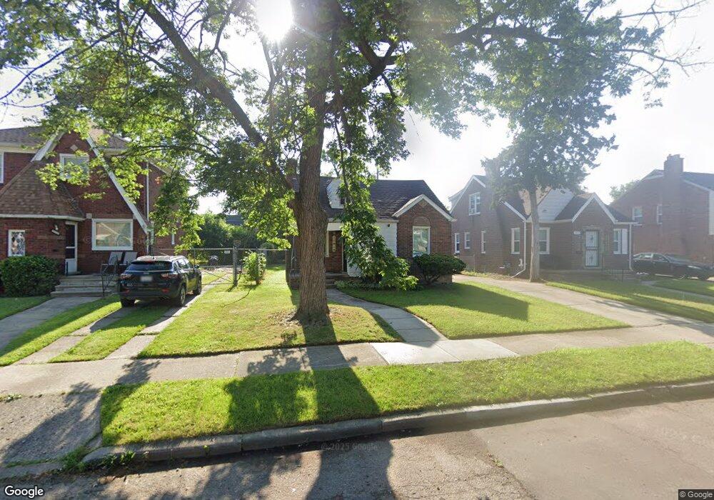
15826 Biltmore St Detroit, MI 48227
Crary-Saint Marys NeighborhoodEstimated Value: $102,625 - $118,000
--
Bed
1
Bath
989
Sq Ft
$111/Sq Ft
Est. Value
About This Home
This home is located at 15826 Biltmore St, Detroit, MI 48227 and is currently estimated at $110,156, approximately $111 per square foot. 15826 Biltmore St is a home located in Wayne County with nearby schools including Young Coleman A. Elementary School, John R. King Academic And Performing Arts Academy, and Charles L. Spain Elementary-Middle School.
Ownership History
Date
Name
Owned For
Owner Type
Purchase Details
Closed on
Jun 15, 2013
Sold by
Donaldson Carla
Bought by
Donaldson Elston
Current Estimated Value
Purchase Details
Closed on
Nov 3, 2007
Sold by
Donaldson Carla and Donaldson Elston
Bought by
Donaldson Elston
Home Financials for this Owner
Home Financials are based on the most recent Mortgage that was taken out on this home.
Original Mortgage
$72,000
Interest Rate
6.31%
Mortgage Type
New Conventional
Create a Home Valuation Report for This Property
The Home Valuation Report is an in-depth analysis detailing your home's value as well as a comparison with similar homes in the area
Home Values in the Area
Average Home Value in this Area
Purchase History
| Date | Buyer | Sale Price | Title Company |
|---|---|---|---|
| Donaldson Elston | -- | None Available | |
| Donaldson Elston | -- | None Available |
Source: Public Records
Mortgage History
| Date | Status | Borrower | Loan Amount |
|---|---|---|---|
| Closed | Donaldson Elston | $72,000 |
Source: Public Records
Tax History Compared to Growth
Tax History
| Year | Tax Paid | Tax Assessment Tax Assessment Total Assessment is a certain percentage of the fair market value that is determined by local assessors to be the total taxable value of land and additions on the property. | Land | Improvement |
|---|---|---|---|---|
| 2025 | $1,222 | $44,000 | $0 | $0 |
| 2024 | $1,222 | $37,300 | $0 | $0 |
| 2023 | $1,186 | $29,700 | $0 | $0 |
| 2022 | $1,263 | $24,100 | $0 | $0 |
| 2021 | $1,229 | $19,000 | $0 | $0 |
| 2020 | $1,229 | $18,900 | $0 | $0 |
| 2019 | $1,211 | $14,900 | $0 | $0 |
| 2018 | $1,065 | $12,800 | $0 | $0 |
| 2017 | $199 | $12,500 | $0 | $0 |
| 2016 | $1,165 | $11,600 | $0 | $0 |
| 2015 | $1,160 | $11,600 | $0 | $0 |
| 2013 | $1,629 | $16,286 | $0 | $0 |
| 2010 | -- | $23,878 | $1,022 | $22,856 |
Source: Public Records
Map
Nearby Homes
- 15791 Asbury Park
- 15762 Ferguson St
- 15744 Ferguson St
- 15872 Asbury Park
- 15745 Biltmore St
- 15710 Biltmore St
- 15900 Murray Hill St
- 16111 Gilchrist St
- 15480 Asbury Park
- 15717 Lindsay St
- 15449 Ferguson St
- 15454 Gilchrist St
- 15763 Mansfield St
- 15454 Asbury Park
- 15465 Murray Hill St
- 15786 Mansfield St
- 16521 Biltmore St
- 15455 Lindsay St
- 15835 Rutherford St
- 15785 Rutherford St
- 15836 Biltmore St
- 15818 Biltmore St
- 15821 Ferguson St
- 15846 Biltmore St
- 15810 Biltmore St
- 15829 Ferguson St
- 15837 Ferguson St
- 15800 Biltmore St
- 15800 Biltmore St
- 15854 Biltmore St
- 15845 Ferguson St
- 15811 Ferguson St
- 15827 Biltmore St
- 15821 Biltmore St
- 15837 Biltmore St
- 15803 Ferguson St Unit Bldg-Unit
- 15803 Ferguson St
- 15855 Ferguson St
- 15855 Ferguson St
- 15864 Biltmore St