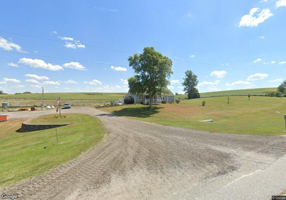
1584 Us Highway 71 Villisca, IA 50864
Estimated Value: $197,000 - $483,000
4
Beds
2
Baths
1,935
Sq Ft
$190/Sq Ft
Est. Value
About This Home
This home is located at 1584 Us Highway 71, Villisca, IA 50864 and is currently estimated at $368,532, approximately $190 per square foot. 1584 Us Highway 71 is a home located in Montgomery County.
Ownership History
Date
Name
Owned For
Owner Type
Purchase Details
Closed on
Dec 13, 2016
Sold by
Bashaw Thomas C
Bought by
Focht Andrew M and Focht Karla M
Current Estimated Value
Home Financials for this Owner
Home Financials are based on the most recent Mortgage that was taken out on this home.
Original Mortgage
$246,637
Outstanding Balance
$202,988
Interest Rate
4.16%
Mortgage Type
New Conventional
Estimated Equity
$165,544
Create a Home Valuation Report for This Property
The Home Valuation Report is an in-depth analysis detailing your home's value as well as a comparison with similar homes in the area
Home Values in the Area
Average Home Value in this Area
Purchase History
| Date | Buyer | Sale Price | Title Company |
|---|---|---|---|
| Focht Andrew M | $266,000 | None Available |
Source: Public Records
Mortgage History
| Date | Status | Borrower | Loan Amount |
|---|---|---|---|
| Open | Focht Andrew M | $246,637 |
Source: Public Records
Tax History Compared to Growth
Tax History
| Year | Tax Paid | Tax Assessment Tax Assessment Total Assessment is a certain percentage of the fair market value that is determined by local assessors to be the total taxable value of land and additions on the property. | Land | Improvement |
|---|---|---|---|---|
| 2025 | $4,208 | $313,540 | $56,240 | $257,300 |
| 2024 | $4,208 | $272,790 | $61,530 | $211,260 |
| 2023 | $3,250 | $272,790 | $61,530 | $211,260 |
| 2022 | $3,056 | $183,090 | $35,150 | $147,940 |
| 2021 | $3,324 | $183,090 | $35,150 | $147,940 |
| 2020 | $3,324 | $183,090 | $35,150 | $147,940 |
| 2019 | $3,432 | $183,090 | $35,150 | $147,940 |
| 2018 | $3,040 | $183,090 | $0 | $0 |
| 2017 | $3,040 | $183,090 | $0 | $0 |
| 2015 | $3,372 | $183,090 | $0 | $0 |
| 2014 | $3,364 | $178,980 | $0 | $0 |
Source: Public Records
Map
Nearby Homes
- 308 U Ave
- 120th Street
- 00 120th St
- 64919 Yankton Rd
- 59708 Yankton Rd
- 620 Halland Ave
- 706 Frankfort St
- 00 Wichita Rd
- 216 Prospect St
- 515 Harvard Ave
- 1308 235th St
- 133 W High St
- 116 N 3rd Ave
- 105 E 6th St
- 3080 265 St
- 701 3rd St
- 000 Holly Ln
- 1303 Summit St Unit Parcel A
- 1303 Summit St
- 1303 Summit St Unit Parcel B